Los Peñasquitos Lagoon facts for kids
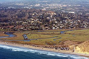
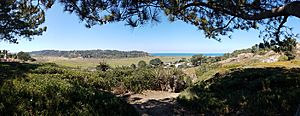
The Los Peñasquitos Marsh Natural Preserve and Lagoon is a special coastal wetland in San Diego County, California. It's right at the northern edge of the City of San Diego, next to Del Mar, California. This lagoon, once called The Soledad Lagoon, separates a group of rare Torrey pine trees that are an endangered species. The name "Los Peñasquitos" means "The Little Cliffs" in Spanish.
Contents
How Humans Have Changed the Lagoon
For many years, the Los Peñasquitos Lagoon changed from a natural tidal area to a lagoon that was often blocked off from the ocean. But since it became part of the State Park System, many things have been done to help the ocean tides flow into the lagoon more easily.
Railroad Tracks Across the Lagoon
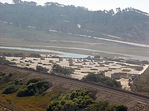
Originally, the railroad tracks ran around the lagoon. But in 1925, the Santa Fe Railroad built a raised path, called a causeway, right through the middle of the lagoon. This path is still used daily by trains like the San Diego Coaster and Pacific Surfliner, as well as freight trains.
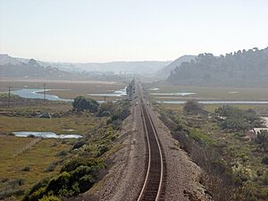
This causeway greatly changed how water flowed in the lagoon. The original wooden bridges were replaced with new concrete ones between 2015 and 2017 to make train travel better.
Highway 101 and the Lagoon Mouth
When Pacific Coast Highway (also known as U.S. Route 101 in California) was made bigger in the 1930s, the road along the beach was raised. A bridge was built over the lagoon's opening to the ocean. This bridge had many wooden poles that would easily get blocked by sand and trash. This made it hard for water to move between the ocean and the lagoon.
Old Wastewater in the Lagoon
In the past, several wastewater treatment plants released their treated water into the lagoon. This happened from the 1950s to the 1970s.
North Beach Parking Lot
The North Beach Parking Lot was built in 1968. It's a paved area that significantly changed how water moved in the lagoon. Before it was built, there were some tourist beach houses in the area.
Too Much Sediment in the Water
The Los Peñasquitos Lagoon has a problem with too much sediment (like dirt and sand) building up. This is mainly because of sedimentation in the lagoon and the rivers that flow into it. This extra sediment can harm the plants and animals living in the lagoon. It can also make it harder for flood control channels to work properly.
Protecting and Restoring the Lagoon
California State Preserve Status
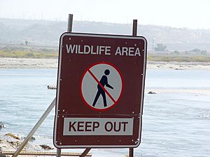
The California Division of Parks and Recreation has given Los Peñasquitos Lagoon a special status as a State Preserve. This means it's one of the rarest and most fragile lands owned by the state. Because of this, public access is very limited in most areas, and many signs say "Do Not Enter."
The State Preserve covers over 630 acres of saltwater lagoon area next to Torrey Pines State Beach and Torrey Pines State Reserve. In 1987, another 240 acres of marshland were added.
Los Peñasquitos Lagoon Enhancement Plan
In 1985, a plan was created to fix many of the problems caused by humans. Now, a special program watches the water quality, helps remove sand when the lagoon mouth closes, and works with other groups to protect and restore the lagoon. The Los Peñasquitos Lagoon Foundation, started in 1983, helps manage this plan. You can find more information at lospenasquitos.org.
New Bridge Over the Lagoon Mouth
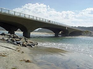
In 2005, a new bridge was built over the lagoon's opening to the ocean. This new bridge has only four supports instead of 72 wooden poles, allowing for a much wider opening. This helps water flow better between the ocean and the lagoon. This bridge cost over $9.6 million to build.
Improved Wastewater Pump Stations
The City of San Diego has improved its wastewater treatment and pumping stations so they no longer release treated water directly into the lagoon.
Pump Station 64
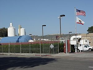
Pump Station 64 is located at the far end of the lagoon, near the Sorrento Valley Coaster Station. In the past, this station sometimes broke down, releasing millions of gallons of untreated wastewater into the lagoon. After many improvements, including a new $23 million facility in 1988, the lagoon became much cleaner. However, spills can still happen, like a large one in 2011 due to a power outage.
Pump Station 65
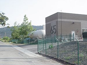
Pump Station 65 was rebuilt in 1996 and is located near the lagoon. It pumps a large amount of wastewater each day to Pump Station 64. There are plans to move Pump Station 65 out of the lagoon area and upgrade the sewer lines.
Closing Sorrento Valley Road
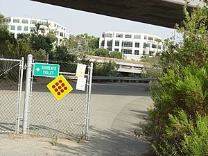
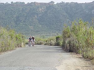
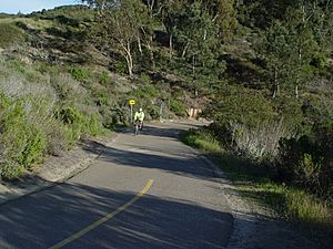
In 1996, the northern part of Sorrento Valley Road, which ran along the edge of the lagoon, was closed. This was done to build Pump Station 65. The road stayed closed during other construction projects, and in 2003, the San Diego City Council voted to close it permanently. This area is now a bike path and multi-use trail. Closing the road has helped create a wildlife path for animals like deer, fox, coyote, bobcat, and skunk to move safely in and out of the Preserve.
Staying Safe Near the Lagoon
West Nile Virus
The Los Peñasquitos Lagoon is a place where mosquitoes carrying the West Nile virus (WNV) can breed. This virus arrived in California in 2003. WNV can be deadly to birds, and sometimes affects horses and humans. About one in five infected humans will get flu-like symptoms, and some might need to go to the hospital. Trucks sometimes spray for mosquitoes around the lagoon to help prevent the spread of WNV.
Tick Diseases
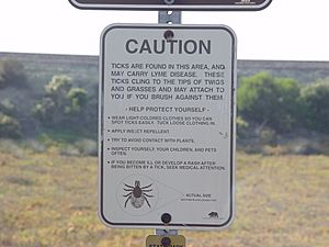
Deer live in the marsh area and can carry ticks. Ticks can fall off onto plants, and then transfer to hikers who brush against them. Ticks can carry diseases like Lyme disease or Tularemia. While Lyme disease is rare in San Diego County and usually treatable, it's important to be careful. Signs in the area warn hikers about ticks.
Rattlesnakes
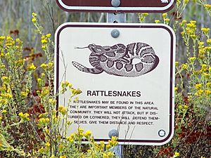
Rattlesnakes live throughout San Diego County, including the marsh area. A warning sign on the Marsh Trail reminds hikers to be aware of them.
Mountain Lions
While mountain lions are rare near the lagoon now, their tracks have been seen. Mountain lions are more common in Los Peñasquitos Canyon Preserve, which is connected to the lagoon by a creek. Mountain lion attacks on pets and people have happened in San Diego County, so it's important to be aware.
Trails to Explore
Even though you can't go into the central parts of the lagoon and marsh, there are several trails nearby that you can use.
Marsh Trail
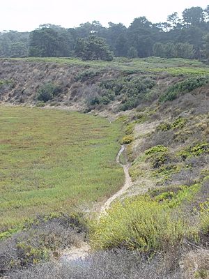
This trail is partly unpaved and partly paved. It runs along the southern edge of the wetland for about 1.5 miles. Dogs and bicycles are not allowed on this trail.
Closed Section of Sorrento Valley Road
This paved section of Sorrento Valley Road is closed to cars but is great for bicycles and pedestrians. It runs along the eastern edge of the wetland.
Del Mar Trail
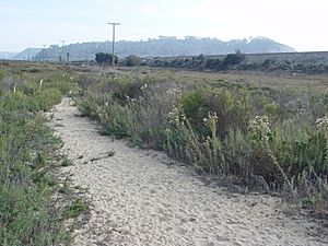
This trail is unpaved, and dogs are not allowed. It's a shorter trail that generally follows the railroad causeway.
SR-56 Bike Route
This is a paved bike route that follows Carmel Creek and California State Route 56. Bicycles, horses, and pedestrians are allowed, but not cars. It's a very popular spot for biking.
 | Madam C. J. Walker |
 | Janet Emerson Bashen |
 | Annie Turnbo Malone |
 | Maggie L. Walker |


