Lynd River facts for kids
Quick facts for kids Lynd |
|
|---|---|
|
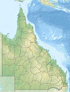
Location of Lynd River mouth in Queensland
|
|
| Country | Australia |
| State | Queensland |
| Region | Far North Queensland |
| Physical characteristics | |
| Main source | Great Dividing Range below Mount Poole 742 m (2,434 ft) |
| River mouth | confluence with the Mitchell River Highbury 96 m (315 ft) 16°27′50″S 143°18′28″E / 16.46389°S 143.30778°E |
| Length | 323 km (201 mi) |
| Basin features | |
| River system | Mitchell River catchment |
| Tributaries |
|
| National park | Forty Mile Scrub National Park |
The Lynd River is an important river in Far North Queensland, Australia. It flows through the Cape York Peninsula, a large area in the northern part of Queensland. This river is a key part of the local environment and history.
Contents
Journey of the Lynd River
The Lynd River starts its journey in the Great Dividing Range. This is a large mountain range in eastern Australia. The river begins specifically within the Forty Mile Scrub National Park.
From Mountains to Plains
As the river flows, it moves from the mountains down to the flat lands. These flat areas are part of the Gulf Country. Along its way, the river passes by large cattle stations. These include places like Torwood and Bulimba.
Meeting the Mitchell River
The Lynd River continues flowing north. It eventually joins the Mitchell River. This meeting point is close to the Staaten River National Park. The Lynd River travels 323-kilometre (201 mi) from where it starts to where it meets the Mitchell River. During this journey, it drops about 647 metres (2,123 ft) in height.
River Connections
The Lynd River has many smaller streams that flow into it. These are called tributaries. There are twenty tributaries in total, including the Tate River. The Kennedy Highway crosses the Lynd River in its upper parts.
Wetland Area
The Lynd River also helps feed a large freshwater wetland area. This area is called the Mitchell River Fan Aggregation. It covers a huge space of about 7,149-square-kilometre (2,760 sq mi). This wetland is also fed by the Mitchell and Palmer Rivers. It is located southeast of Kowanyama.
Plants Along the River
The areas along the river banks are called riparian zones. Many different types of plants grow here. These plants help protect the river banks and provide shade.
Common River Plants
Some common plants found along the Lynd River include Melaleuca fluviatilis. You might also see Casuarina cunninghamiana, which is a type of river oak. Other plants are Pandanus spiralis and Ficus racemosa, also known as the cluster fig. These plants create most of the natural cover along the river.
People of the Land
The traditional owners of the land where the Lynd River begins are the Kunjen peoples. They have lived in this area for a very long time.
How the River Got its Name
The Lynd River was named a long time ago, in 1844. It was named by an explorer named Ludwig Leichhardt.
Honoring Robert Lynd
Leichhardt named the river after Lieutenant Robert Lynd. Robert Lynd was a British Army officer. He helped Leichhardt a lot, both socially and by giving him money. Leichhardt was on an expedition from Queensland to Port Essington when he named the river.
Other Explorers
Another explorer, William Hann, also traveled through this area. This happened in 1872. Hann and his team camped along the Lynd River before moving on to the Palmer River.
 | George Robert Carruthers |
 | Patricia Bath |
 | Jan Ernst Matzeliger |
 | Alexander Miles |


