Gulf Country facts for kids
Quick facts for kids Gulf CountryQueensland |
|
|---|---|
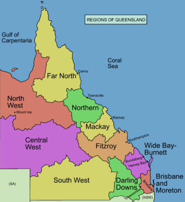
North West Queensland is also referred to as the Gulf Country
|
|
| Area | 186,000 |
| LGA(s) | Burke, Carpentaria, Cloncurry, Croydon, Flinders, McKinlay, Mount Isa, Richmond |
| State electorate(s) | Traeger, Cook |
| Federal Division(s) | Kennedy |
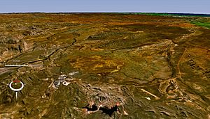
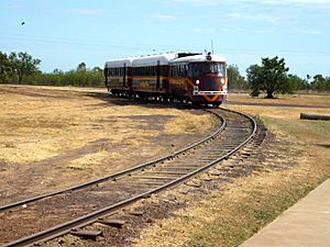
The Gulf Country is a large area in north western Queensland and eastern Northern Territory, Australia. It's also known as North West Queensland or the Gulf Savannah. This region is mostly made up of woodlands and savanna grasslands. It surrounds the Gulf of Carpentaria on Australia's northern coast.
This flat, grassy land has a dry season and a wet season. It has the biggest areas of natural grassland in Australia. People use the land for raising cattle and for mining. The area has large amounts of valuable minerals like zinc, lead, and silver. Many rivers flow through the Gulf Country, and it is home to several animals that are in danger of extinction. The first European explorer known to visit this region was Willem Janszoon.
Contents
Where is the Gulf Country?
The Gulf Country is a dry savanna area. It sits between the wetter lands of Arnhem Land and the Top End in the Northern Territory to the west. To the east is the Cape York Peninsula in Far North Queensland. South and east of it are plains with Mitchell grasses and the Einasleigh Uplands.
The Northern Territory part of this area is called the Gulf Fall. It has sandstone slopes and gorges that drain water from the inland uplands into the gulf. The main ways people use the land here are for beef cattle farming and mining.
The region covers about 186,000 square kilometres (71,800 square miles). The land is mostly flat and low-lying. It's a tropical savannah with rivers that carry monsoon rains to the gulf. These rivers also create coastal mudflats and small areas of rainforest. The Sir Edward Pellew Group of Islands and the Wellesley Islands are located off the gulf coast.
The main towns and cities in the Gulf Country include Mount Isa, Doomadgee, Cloncurry, Camooweal, Kowanyama, Karumba, Normanton, and Burketown. The port at Karumba is important for exporting live cattle from Australia. The oldest building in the region is the Burketown Hotel.
Climate and Weather
The Gulf Country has a hot climate with two main seasons: a dry season and a monsoon (wet) season. The dry season usually lasts from April to November. During this time, dry winds blow from the southeast to the east.
The wet season is from December to March. It brings humid air from the north, causing heavy rains. The amount of rain can change a lot each year. For example, in Burketown, the wet season rain has been as low as 150 mm (6 inches) and as high as 2,000 mm (79 inches). If there's a lot of rain, low-lying areas can flood, and even paved roads might be cut off. The Gulf is also a place where cyclones can form between November and April.
In September and October, a special cloud formation called the Morning Glory Cloud can be seen in the Southern Gulf. The best place to see this amazing sight is near Burketown, just after the sun rises.
History of the Gulf Country
Many Australian Aboriginal languages are spoken in the Gulf Country. These include Jirandali (around Hughenden), Waanyi (in the western parts near Lawn Hill Creek and Nicholson River, including Doomadgee), Wanamarra (around Flinders River, Kynuna, and Richmond), and Yukulta (including the Aboriginal Shire of Doomadgee and Shire of Mornington).
The first known European explorer to visit the Gulf Country was the Dutch sailor Willem Janszoon in 1605–1606. Another Dutchman, Jan Carstenszoon, visited in 1623. He named the gulf after Pieter de Carpentier, who was a governor at the time. Abel Tasman also explored the coast in 1644. Later, Matthew Flinders explored and mapped the coast in 1802 and 1803.
The first European explorer to travel across the land was Ludwig Leichhardt in 1844 and 1845. Other explorers followed, including Augustus Gregory in 1856, and Burke and Wills in 1861. After Burke and Wills went missing, search parties led by John McKinlay, Frederick Walker, and William Landsborough explored the Gulf region in 1861 and 1862.
When pastoralists (people who raise livestock) started settling in the area, there were serious conflicts with the local Aboriginal people. These events were part of the Australian frontier wars. A historian named Tony Roberts wrote a book about the violence that occurred in the Gulf Country during this time.
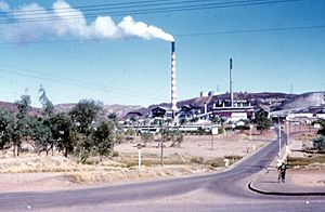
The 1964 Mount Isa Mines Strike was a long disagreement between the miners and the management at Mount Isa Mines.
Mining in the Gulf Country
The Gulf Country is rich in valuable minerals like copper, zinc, lead, and silver. Mount Isa Mines has several mines in Mount Isa that produce these minerals. Production started there in 1931. Century Mine, which was Australia's largest zinc mine, began operating near Mount Isa in 1997. Other mines in the region include George Fisher mine, Cannington Mine, and Hilton Mine.
Air Quality and Health
Because of lead production in Mount Isa, the town has a very good system for checking air quality. There have been discussions about how mining activities might affect the air and the health of children in the area.
Nature and Wildlife
Plants of the Gulf Country
In the Gulf Country, there are no mountains to block rainfall near the coast. This means the change from coastal mangroves to Acacia stenophylla woodlands and then to the dry central Australian scrubs happens slowly. Along the gulf coast, there are about nineteen important areas for birds that migrate, especially around river mouths like the Gregory River-Nicholson River estuary and the Roper River.
Small patches of rainforest grow in places that are protected from grassland fires. In the savanna, tall dicanthium bluegrass grows after the monsoon rains. The Gulf Country has one of the largest areas of natural grassland in Australia. The sandstone gorges in the Gulf Fall are home to unique wildlife. The Pellew Islands also have their original mangroves and thick woodlands.
Animals of the Gulf Country
The Gulf Country is home to several animals that are in danger of extinction. These include a special rodent called the Carpentarian rock rat (Zyzomys palatalis) and unique reptiles like the Carpentarian lerista skink. The mudflats and saltpans along the coast are home to waterbirds, such as the magpie goose.
One bird that lives only in the grasslands, the Carpentarian grasswren, is struggling. This is because changes in how fires are managed are reducing their habitat. The region is a great place for birdwatching.
Protecting the Environment
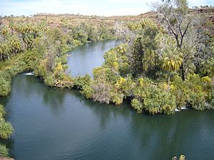
Most of the Gulf Country still has its natural vegetation. However, too many cattle grazing and the introduction of new types of grass are changing the grasslands and wetlands. The woodlands are also affected by changes in how fires are managed. Some introduced weeds, like the rubber vine, are also a problem.
Several areas are protected, including Staaten River National Park, Boodjamulla National Park (which used to be called Lawn Hill), and the World Heritage fossil sites at Riversleigh. Other protected areas are Camooweal Caves National Park and Mitchell-Alice Rivers National Park in Queensland. However, the coastal wetlands are not as well protected. The Lawn Hill crater, which is an impact crater surrounded by limestone hills, is also in the Gulf Country. Finally, Barranyi (North Island) National Park is one of the Pellew Islands.
Major Rivers of the Region
Here are some of the main rivers found in and around the Gulf Country:
- Top End
- Roper River
- Wilton River
- Gulf Country
- Cox River
- Calvert River
- Gilbert River
- Flinders River
- Leichhardt River
- McArthur River
- Norman River
- Cape York Peninsula
- Archer River
- Mission River
- Mitchell River
- Alice River
- Smithburne River
- Staaten River
- Wenlock River
 | Frances Mary Albrier |
 | Whitney Young |
 | Muhammad Ali |


