
Flinders River facts for kids
Quick facts for kids Flinders |
|
|---|---|

Flooding of the Flinders River at Hughenden, January 1917
|
|

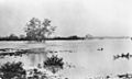
Location of Flinders River mouth in Queensland
|
|
| Country | Australia |
| State | Queensland |
| Region | North West Queensland, Gulf Country |
| Settlements | McKinlay, Hughenden, Richmond, Julia Creek, Cloncurry, Burke and Wills Junction |
| Physical characteristics | |
| Main source | Burra Range, Great Dividing Range Reedy Springs 816 m (2,677 ft) |
| River mouth | Gulf of Carpentaria west of Karumba 0 m (0 ft) 17°35′59″S 140°35′44″E / 17.59972°S 140.59556°E |
| Length | 1,004 km (624 mi) |
| Depth |
|
| Basin features | |
| Basin size | 109,000 km2 (42,000 sq mi) |
| Tributaries |
|
The Flinders River is the longest river in Queensland, Australia. It stretches for about 1,004 kilometres (624 mi)! This amazing river was named after a famous explorer, Matthew Flinders. The land around the river, called its catchment, doesn't have many people living there and is mostly untouched. The Flinders River starts high up on the western side of the Great Dividing Range in North West Queensland. It then flows mostly north-west through the Gulf Country, crosses a big, flat area of clay, and finally empties into the Gulf of Carpentaria.
Contents
Exploring the Flinders River's Journey
The Flinders River begins its journey in the Burra Range. This area is part of the Great Dividing Range, about 110 kilometres (68 mi) north-east of Hughenden. From there, it flows west past towns like Hughenden, Richmond, and Julia Creek. Then, it turns north-west towards the Gulf of Carpentaria, ending its long trip about 25 km (16 mi) west of Karumba. The Selwyn Range forms the southern border of the river's catchment area.
At 1,004 kilometres (624 mi) long, the Flinders River is the eighth-longest river in all of Australia. Its catchment area, which is all the land that drains water into the river, covers a huge 109,000 square kilometres (42,000 sq mi). Most of this land is used for grazing animals and other farming activities. This river system covers about 1.5% of the entire Australian continent!
River Branches and Water Sources
Many smaller rivers and creeks flow into the Flinders River. There are 36 of these "tributaries" in total! The most important ones are the Cloncurry, Saxby, and Corella rivers. Another cool tributary is Porcupine Creek. It has carved out an amazing deep gorge, which you can see in the Porcupine Gorge National Park.
The Flinders River also has two dams: the Flinders River Dam and Corella Dam. Other smaller creeks that join the river include Range Creek, Morepork Creek, and Dutton River. The river flows through one permanent waterhole called Flagstone waterhole.
Towns Along the River
Several towns are located within the Flinders River's catchment area. These include McKinlay, Burke and Wills Junction, Hughenden, Richmond, Julia Creek, and Cloncurry. These towns rely on the river for various activities.
River Flow and Bed
The Flinders River has an average yearly water flow of 3,857 gigalitres (8.48×10¹¹ imp gal; 1.02×10¹² US gal). The highest flow ever recorded was an incredible 18,000 gigalitres (3.96×10¹² imp gal; 4.76×10¹² US gal)!
The riverbed itself is made up of different materials. You'll find silt, clay, sand, gravel, and even cobble stones. Near where the Flinders River, Gregory River, and Leichhardt Rivers meet the Gulf, there's a large, flat area of clay. The very end of the river, where it meets the sea, is part of a special area called the Gulf Plains Important Bird Area. This means it's a significant place for many different kinds of birds. In 2015, about 6,600 people lived in the river's catchment area.
Plants Along the River
The plants growing along the Flinders River, especially in its upper parts, are mostly riparian woodlands. This means they are trees and plants that thrive near water. You'll see paperbark trees like Melaleuca argentea and Melaleuca fluviatilis. There are also eucalypts such as River Red Gum and Coolabah. You might also spot Bauhinia and wattle trees.
Unfortunately, some unwanted plants, called weeds, have also grown here. These include Prickly acacia, Noogoora burr, and Rubber vine. The ground beneath the trees is often covered with grasses, including native couch grass, especially on the sandy soil next to the river.
A Look at the Flinders River's Past

The land around the Flinders River has been home to many different Aboriginal peoples for thousands of years. These include the Kalkadoon, Mitakoodi, Kukatj, Guthaarn, Mayi-Yapi, Mayi-Kulan, Mayi-Thakurti, Ngawun, Wanamara, Mbara, Yirandali, and Gugu-Badhun peoples.
Traditional Languages of the Area
Several Aboriginal languages were spoken in the Flinders River region.
- Jirandali (also known as Yirandali) was spoken in the Shire of Flinders area, including Hughenden and the Flinders River itself.
- Wanamarra (also known as Maykulan) was spoken in parts of the Shire of Mckinlay, Shire of Cloncurry, and Shire of Richmond, including the Flinders River area.
- Dalleburra (also known as Dalebura) was another language of North-West Queensland, particularly around Lammermoor Station near Hughenden.
Naming the River
The Flinders River got its name in 1841. Captain Wickham and Lieutenant John Lort Stokes from the ship HMS Beagle named it. They chose the name to honor the famous explorer Matthew Flinders. Stokes also mapped and surveyed the river's mouth and named other nearby places.
Famous Explorers and Early Settlers
In 1861, explorers Robert O'Hara Burke, William John Wills, and Charles Gray reached the river's delta. This was a big achievement, as it meant they had successfully crossed the Australian continent from south to north. Sadly, Gray died on the way back, and Burke and Wills also passed away after returning to Cooper Creek to find their supply depot empty.
The first pastoralist (someone who raises livestock) to settle along the Flinders River was James Gibson. He started Prairie Station in 1861. By 1864, Gibson had set up more cattle stations, including Millungera and Taldora Stations.
Flooding Events
The Flinders River has experienced massive floods many times throughout history.
- In July 1870, huge floods caused one station to lose over 4,000 sheep, and roads were cut off.
- Even bigger floods happened in 1917, when Hughenden was completely underwater, and several people drowned.
- More heavy flooding was recorded in 1955, 1960, 1974, 1991, and 2000.
- In early 2019, very heavy rainfall in Queensland led to major flooding along the Flinders. This was considered the worst flood in 50 years! The wide flood plain allowed the river to spread out as much as 60 Kilometre[convert: unknown unit]. These rising waters also caused huge losses for farmers, especially their cattle herds.
Water Use and Irrigation
In 2003, people were first given permission to take water from the river for farming. A pastoralist named Corbett Tritton got a license to irrigate his land. He successfully grew crops like sorghum and cotton on his cattle station. Soon, other graziers (ranchers) became interested in doing the same. A temporary halt was put on issuing new licenses, but this was lifted in 2013.
Images for kids
-
Flooding of the Flinders River at Hughenden, January 1917
See also
 In Spanish: Río Flinders para niños
