Lyra, Queensland facts for kids
Quick facts for kids LyraQueensland |
|||||||||||||||
|---|---|---|---|---|---|---|---|---|---|---|---|---|---|---|---|

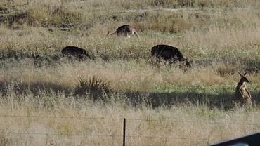
Rural views (cows and wallabies), Lyra, 2015
|
|||||||||||||||
| Population | 35 (2021 census) | ||||||||||||||
| • Density | 2.73/km2 (7.1/sq mi) | ||||||||||||||
| Postcode(s) | 4382 | ||||||||||||||
| Area | 12.8 km2 (4.9 sq mi) | ||||||||||||||
| Time zone | AEST (UTC+10:00) | ||||||||||||||
| Location |
|
||||||||||||||
| LGA(s) | Southern Downs Region | ||||||||||||||
| State electorate(s) | Southern Downs | ||||||||||||||
| Federal Division(s) | Maranoa | ||||||||||||||
|
|||||||||||||||
Lyra is a small, quiet place in the countryside of Queensland, Australia. It's part of the Southern Downs Region. In 2021, only 35 people lived there!
Contents
Lyra's Location and Landscape
Lyra is a rural area, meaning it's mostly farmland and natural spaces. The western and central parts of Lyra are quite flat. However, if you head east, you'll find small hills. These hills are part of the huge Great Dividing Range, a mountain range that stretches along Australia's east coast.
Creeks and Rivers in Lyra
Several creeks flow through Lyra. Accommodation Creek starts in the south-east and flows towards the north-west. Bald Rock Creek comes from the north-east and joins Accommodation Creek. Doctors Creek flows from the west and also joins Bald Rock Creek. These creeks are important for the local environment and farms.
Roads and Railways
The New England Highway passes through Lyra, entering from the north-west and leaving towards the south. This highway is a major road connecting different towns. Right next to the highway, you'll find the Southern railway line. Even though the train line runs through Lyra, there isn't a train station there anymore.
What the Land is Used For
The land in Lyra is used for a mix of farming. Some areas are used for horticulture, which means growing fruits, vegetables, or flowers. Other parts are used for grazing, where animals like cattle or sheep eat the natural grass. You'll also find several vineyards in Lyra, where grapes are grown to make wine. One well-known vineyard is Sirromet Wines. Lyra is also very close to Girraween National Park, a beautiful natural area.
Lyra's Past: A Look Back
Lyra has an interesting history, especially with its railway and school.
The Railway Arrives
The railway line was extended to Lyra on 14 February 1887. A railway station was built, and it was named Lyra. The name "Lyra" comes from a group of stars, or a constellation, called Lyra. The whole area then took its name from this railway station.
Lyra State School
Lyra State School opened its doors on 7 November 1929. It started with just 10 students and its first teacher was Kathleen May O'Donohue. The land for the school was kindly given by Evan Hindmarsh. The school building itself was moved from another old school called Applevale State School, and the furniture came from Somme State School. The school served the community for many years but eventually closed on 19 June 1966. After it closed, the students went to Ballandean State School instead.
People Living in Lyra
The number of people living in Lyra is quite small. In 2016, there were 53 people. By 2021, the population had changed to 35 people.
 | Jessica Watkins |
 | Robert Henry Lawrence Jr. |
 | Mae Jemison |
 | Sian Proctor |
 | Guion Bluford |


