Lào Cai province facts for kids
Quick facts for kids
Lào Cai province
Tỉnh Lào Cai
|
|
|---|---|
|
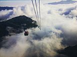
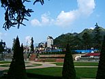
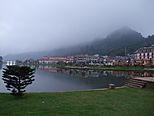
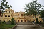
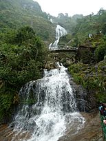
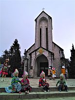
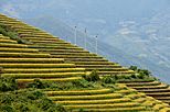
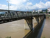
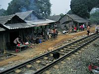
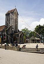
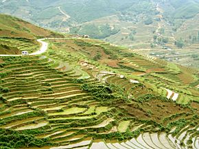
Fansipan aerial tramway • Phan Xi Păng • Topas tourist area • Bảo An Temple • Lào Cai Mountain • Lào Cai City • Hoàng A Tưởng House • Sa Pa Terrace • Sa Pa Mountain • Stone church in Sa Pa • Bạc Waterfall • snowfall at Sa Pa
|
|
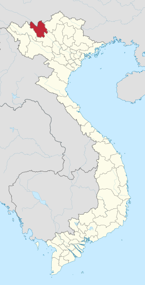
Location of Lào Cai within Vietnam
|
|
| Country | |
| Region | Northwest |
| Capital | Lào Cai |
| Subdivision | 1 city, 7 rural districts and one town |
| Government | |
| • Type | Province |
| • Body | Lào Cai Provincial People's Council |
| Area | |
| • Province | 6,364.03 km2 (2,457.17 sq mi) |
| Population
(2021)
|
|
| • Province | 743,401 |
| • Density | 116.81293/km2 (302.5441/sq mi) |
| • Urban | 181,019 |
| Ethnic groups | |
| • Vietnamese | 33.78% |
| • Mông | 25.08% |
| • Tày | 14.83% |
| • Dao | 14.24% |
| • Giáy | 4.53% |
| • Others | 7.54% |
| Time zone | UTC+7 (ICT) |
| Area codes | 214 |
| ISO 3166 code | VN-02 |
Lào Cai is a province in the mountains of northwest Vietnam. It shares a border with the Yunnan province in China. The province covers about 6,384 square kilometers. In 2008, it had a population of around 602,300 people.
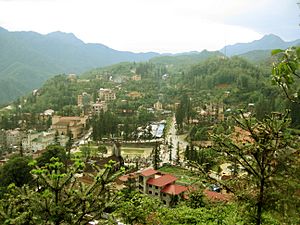
Lào Cai City and Sa Pa are two important places in the province. Lào Cai City is a key trading spot near the Chinese border. Sa Pa is a famous mountain town known for tourism. It is often called the "queen of mountains." This is because it is located near Phan Xi Păng, Vietnam's highest mountain.
Lào Cai province has many old historical sites and natural caves. It also grows special fruits like Bắc Hà plums. In 1929, a French biologist named Jean Théodore Delacour studied the plants and animals here. He found many unique species in northern Vietnam.
Contents
What's in a Name?
The name "Lao-Kay" was first used by the French during their time in Vietnam. The Vietnamese pronounce it as "Lào Cai." This became the official spelling in November 1950.
The exact origin of the name is not fully clear. One idea is that it comes from an old trading area called Cốc Lếu. This area grew into a market town. It was called Lão Nhai (老街), which means "Old Town" in Chinese. In the Hmong language, this sounded like "Lao Cai."
Another idea is that the name "Lao Kai" appeared on a map in 1879. This map was made by Jean Dupuis, who explored the Red River. The map marked the spot as "Lao-kai, residence du Chef des Pavilions noirs." This meant "residence of the Head of the Black Flag Army."
Professor Đào Duy Anh believes the name comes from "Lão Nhai." When the French made maps, they wrote it as "Lao-Kay." The Vietnamese then pronounced this as Lào Cai, and the name has stuck ever since.
Land, Water, and Weather
Lào Cai province is in the northern part of Vietnam. It covers about 6,384 square kilometers. It borders other Vietnamese provinces like Hà Giang and Yên Bái. It also borders the Yunnan province in China.
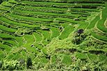
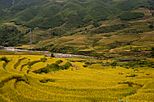
The province has many different types of soil. For example, the land along the Red River is good for growing food. Other areas have reddish-brown soil, which is great for growing crops and trees. Some parts, like Sa Pa, have rich soil perfect for medicinal plants and fruits. You can also see beautiful terraced fields, especially in Bắc Hà and Sa Pa.
- Climate
Since Lào Cai is mostly mountainous, it has a dry, cold season from October to March. The rainy season, called the tropical monsoon, lasts from April to September. The average temperature for the year is about 23°C (73°F).
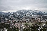
In the lower areas, temperatures usually range from 18°C (64°F) to 28°C (82°F). In the highlands, it's a bit cooler, between 20°C (68°F) and 22°C (72°F). However, in Sa Pa town, it can get very cold, sometimes below 0°C (32°F), with snow! Fog and frost are also common here.
| Climate data for Lào Cai | |||||||||||||
|---|---|---|---|---|---|---|---|---|---|---|---|---|---|
| Month | Jan | Feb | Mar | Apr | May | Jun | Jul | Aug | Sep | Oct | Nov | Dec | Year |
| Record high °C (°F) | 31.4 (88.5) |
34.6 (94.3) |
38.0 (100.4) |
39.0 (102.2) |
42.8 (109.0) |
40.1 (104.2) |
39.7 (103.5) |
40.0 (104.0) |
36.8 (98.2) |
37.2 (99.0) |
33.2 (91.8) |
32.8 (91.0) |
42.8 (109.0) |
| Mean daily maximum °C (°F) | 20.1 (68.2) |
21.3 (70.3) |
25.3 (77.5) |
28.8 (83.8) |
32.1 (89.8) |
32.7 (90.9) |
32.7 (90.9) |
32.4 (90.3) |
31.3 (88.3) |
28.7 (83.7) |
25.1 (77.2) |
21.9 (71.4) |
27.7 (81.9) |
| Daily mean °C (°F) | 15.7 (60.3) |
17.0 (62.6) |
20.7 (69.3) |
24.2 (75.6) |
27.0 (80.6) |
27.9 (82.2) |
27.9 (82.2) |
27.5 (81.5) |
26.3 (79.3) |
24.0 (75.2) |
20.2 (68.4) |
17.0 (62.6) |
23.0 (73.4) |
| Mean daily minimum °C (°F) | 13.3 (55.9) |
14.5 (58.1) |
17.9 (64.2) |
21.1 (70.0) |
23.6 (74.5) |
24.7 (76.5) |
24.9 (76.8) |
24.4 (75.9) |
23.3 (73.9) |
21.2 (70.2) |
17.5 (63.5) |
14.3 (57.7) |
20.0 (68.0) |
| Record low °C (°F) | 1.4 (34.5) |
5.6 (42.1) |
6.8 (44.2) |
10.0 (50.0) |
14.8 (58.6) |
18.7 (65.7) |
20.0 (68.0) |
17.3 (63.1) |
15.8 (60.4) |
8.8 (47.8) |
5.8 (42.4) |
2.8 (37.0) |
1.4 (34.5) |
| Average precipitation mm (inches) | 22 (0.9) |
33 (1.3) |
58 (2.3) |
129 (5.1) |
171 (6.7) |
239 (9.4) |
302 (11.9) |
355 (14.0) |
222 (8.7) |
153 (6.0) |
54 (2.1) |
27 (1.1) |
1,764 (69.4) |
| Average rainy days | 7.8 | 8.8 | 11.5 | 15.8 | 16.8 | 18.7 | 20.9 | 21.1 | 15.8 | 14.8 | 10.2 | 7.7 | 169.8 |
| Average relative humidity (%) | 84.8 | 84.0 | 82.5 | 83.1 | 81.4 | 84.4 | 85.8 | 86.0 | 85.5 | 85.8 | 86.3 | 85.8 | 84.6 |
| Mean monthly sunshine hours | 80.4 | 76.9 | 105.0 | 144.9 | 189.2 | 148.9 | 166.6 | 168.1 | 162.5 | 129.9 | 105.4 | 110.6 | 1,588.4 |
| Source 1: Vietnam Institute for Building Science and Technology | |||||||||||||
| Source 2: The Yearbook of Indochina | |||||||||||||
| Climate data for Sa Pa | |||||||||||||
|---|---|---|---|---|---|---|---|---|---|---|---|---|---|
| Month | Jan | Feb | Mar | Apr | May | Jun | Jul | Aug | Sep | Oct | Nov | Dec | Year |
| Record high °C (°F) | 23.2 (73.8) |
25.8 (78.4) |
28.1 (82.6) |
29.8 (85.6) |
30.0 (86.0) |
29.4 (84.9) |
29.1 (84.4) |
29.6 (85.3) |
28.2 (82.8) |
26.4 (79.5) |
24.5 (76.1) |
24.0 (75.2) |
30.0 (86.0) |
| Mean daily maximum °C (°F) | 12.3 (54.1) |
14.3 (57.7) |
18.2 (64.8) |
21.3 (70.3) |
22.4 (72.3) |
22.9 (73.2) |
23.0 (73.4) |
23.0 (73.4) |
21.7 (71.1) |
19.0 (66.2) |
16.1 (61.0) |
13.2 (55.8) |
18.9 (66.0) |
| Daily mean °C (°F) | 8.6 (47.5) |
10.4 (50.7) |
13.9 (57.0) |
17.1 (62.8) |
18.9 (66.0) |
19.8 (67.6) |
19.8 (67.6) |
19.5 (67.1) |
18.2 (64.8) |
15.7 (60.3) |
12.5 (54.5) |
9.4 (48.9) |
15.3 (59.5) |
| Mean daily minimum °C (°F) | 6.2 (43.2) |
7.8 (46.0) |
10.8 (51.4) |
14.0 (57.2) |
16.3 (61.3) |
17.6 (63.7) |
17.7 (63.9) |
17.4 (63.3) |
15.9 (60.6) |
13.7 (56.7) |
10.2 (50.4) |
7.0 (44.6) |
12.9 (55.2) |
| Record low °C (°F) | −6.1 (21.0) |
−1.3 (29.7) |
−3.5 (25.7) |
3.4 (38.1) |
8.3 (46.9) |
10.8 (51.4) |
7.0 (44.6) |
10.4 (50.7) |
8.7 (47.7) |
5.6 (42.1) |
1.0 (33.8) |
−3.2 (26.2) |
−6.1 (21.0) |
| Average precipitation mm (inches) | 70.2 (2.76) |
73.5 (2.89) |
104.5 (4.11) |
213.4 (8.40) |
340.6 (13.41) |
381.4 (15.02) |
461.0 (18.15) |
451.9 (17.79) |
303.1 (11.93) |
201.3 (7.93) |
106.3 (4.19) |
65.7 (2.59) |
2,779.6 (109.43) |
| Average rainy days | 16.3 | 16.3 | 15.7 | 17.9 | 22.2 | 24.4 | 25.6 | 23.4 | 19.8 | 18.6 | 13.8 | 13.5 | 228.1 |
| Average relative humidity (%) | 87.8 | 85.5 | 82.1 | 82.3 | 84.8 | 86.9 | 88.3 | 88.8 | 90.0 | 90.8 | 80.5 | 80.3 | 87.2 |
| Mean monthly sunshine hours | 113.3 | 115.6 | 151.2 | 167.8 | 148.1 | 98.9 | 104.1 | 114.2 | 101.7 | 94.0 | 112.5 | 121.0 | 1,435.9 |
| Source 1: Vietnam Institute for Building Science and Technology | |||||||||||||
| Source 2: The Yearbook of Indochina | |||||||||||||
- Water Resources
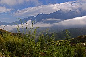
Lào Cai is a mountainous area. In the northwest, you'll find Phan Xi Păng (Fansipan), Vietnam's tallest mountain at 3,143 meters (10,312 feet). It can even be covered in snow during winter! The Sa Pa Mountains are in the western part of the province.
Over 100 rivers flow through Lào Cai. The most important one is the Red River (Sông Hồng). It flows from China through the province for about 130 kilometers (81 miles) towards Hanoi. Other important rivers include the Chay and Nam Ti Rivers. Much of the province is covered in thick forests.
There are also underground water sources. Plus, the province has four natural mineral water springs.
- Mineral Resources
Lào Cai is rich in minerals. About 30 different types have been found here. Some of the most valuable minerals are:
- Copper (53 million tons)
- Molybdenum (15 million tons)
- Apatite and iron (2.5 billion tons)
There are 150 mines in the province that dig for these minerals.
Animals and Plants
Forests cover about 43.87% of Lào Cai province. Most of these are natural forests, while some are planted. These forests are home to 442 different species, including many birds, insects, and frogs. The province is known for its rare timber trees, like po mu and lat hoa. Many medicinal herbs also grow here.
In the Phan Xi Păng mountain range, the plants change with how high up you go. Above 1,500 meters (4,900 feet), you still find forests. Between 2,500 and 2,800 meters (8,200-9,200 feet), you'll see "elfin forests." These are small, twisted trees less than 8 meters (26 feet) tall, covered in moss. Even higher, above 2,800 meters (9,200 feet), the plants are smaller. You'll find lots of bamboo and rhododendrons.
The Hoàng Liên National Park has a rich variety of plants and animals. However, only about 12 square kilometers (4.6 square miles) of forest remain due to farming and other human activities. Grass, bushes, and small trees grow where forests have been cleared. Many areas are used for farming, especially ginger.
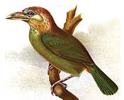
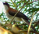
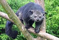
In 1929, biologist Delacour studied the animals here. He found mammals like the clouded leopard, leopard, tiger, binturong, and Asiatic black bear. In the forests of Sa Pa, 150 bird species were recorded. These include the red-vented barbet and chestnut bulbul. Many of these species are unique to northern Vietnam.
History of Lào Cai
Lào Cai has been an important trading post for a very long time. Different groups, including the Chinese, Vietnamese, and local ethnic minorities, often fought for control of this area. In 1463, the Viet Kings made Lào Cai the capital of their northern region, then called Hưng Hóa.
In 1889, the French took control of Lào Cai. It became their administrative center and a military base. In the early 1900s, the first railway line was built from Hanoi to this region. It took seven years to complete. Sadly, 25,000 Vietnamese workers died during its construction.
In 1979, the city of Lào Cai was heavily damaged during a border conflict. After this, the border with China was closed for several years. Today, there are still reports of land mines along the border, which can be dangerous.
Since then, Lào Cai City has grown a lot because of trade with China. It is now a busy city and an important center for the region. In 2006, Lào Cai officially became a city. There are also plans to build an airport here by 2020.
Local Government Divisions
Lào Cai province is divided into 9 main areas. These include one city, one town, and seven rural districts.
- Lào Cai City
- Bắc Hà District
- Bảo Thắng District
- Bảo Yên District
- Bát Xát District
- Mường Khương District
- Sa Pa Town
- Si Ma Cai District
- Văn Bàn District
These areas are further divided into smaller towns, communes (like villages), and wards.
Economy and Resources
Traditional jobs like agriculture (farming) and forestry (working with forests) are still very important in Lào Cai. However, the province is also trying to attract foreign businesses. Trading goods across the border with China is a growing source of money. Tourism is also very popular, especially for people who want to hike up Phan Xi Păng, Vietnam's highest mountain. Ecotourism, which focuses on enjoying nature responsibly, is also becoming more common.
Most of the economic activity (about 78%) comes from farming and forestry. Other important areas include mining, manufacturing, and construction. Services like hospitality (hotels and restaurants), communication, and education also play a role.
In 2008, the province produced about 199,800 tons of cereals (like rice). This was a good amount for the number of people living there.
Lào Cai has many mines, with 30 different types of minerals. Some of the largest mines in Vietnam are here. These include:
- The apatite mine at Cam Đường (2.5 billion tons)
- The iron mine at Quý Xa (124 million tons)
- The copper mine at Sin Quyền (53 million tons)
In recent years, the Vietnamese government has encouraged planting more trees in the province. This is important for the environment and for providing wood. Tree planting has been especially encouraged in Sa Pa.
People and Cultures
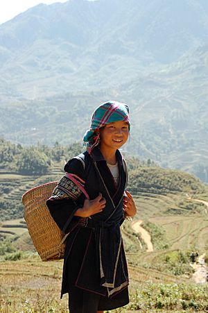
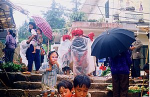
Lào Cai is home to more than 20 different ethnic groups, making it a rich mix of cultures and history. The largest group is the ethnic Vietnamese (Kinh people). Since the 1960s, the government has encouraged people from lowland areas to move to the highlands.
According to 2008 figures, Lào Cai province had a population of 602,300 people. About 94 people lived per square kilometer. Most of the population (about 79%) lived in rural areas.
The province has 25 of Vietnam's ethnic minority groups. These groups make up about 64% of the population. The main ethnic groups are:
- Kinh - 35.9%
- Hmong - 22.21%
- Tay - 15.84%
- Dao - 14.05%
- Giay - 4.7%
- Nùng - 4.4%
- Other groups like Phu La, San Chay, Ha Nhi, and La Chi.
Besides Vietnamese, other languages spoken in Lào Cai province include:
- Hmong and Kim Mun (from the Hmong–Mien language family)
- Nùng, Tày, and Giáy (from the Tai language family)
- Phula and Laghuu (from the Tibeto-Burman language family)
Hoàng Liên National Park
The Hoàng Liên National Park is located in Lào Cai province. It was made a national park in 2006. It covers an area of about 24.66 square kilometers (9.5 square miles). The park includes the peak of Phan Xi Păng, which is the highest mountain in Vietnam.
The park has dense forests and a wide variety of plants and animals. However, due to farming (like ginger plantations), only about 12 square kilometers (4.6 square miles) of the park are still forested. Many migrating birds of prey have been seen in the park, which is quite rare.
In 1929, French biologist Jean Théodore Delacour explored this area. He collected 48 different mammal species for a museum. The rocks in the park are very old, dating back millions of years. The northwestern edge of the park has rugged areas of marble and other changed rocks.
Getting Around Lào Cai
Lào Cai is one of the few mountainous provinces with good transportation. It has roads, railways, and waterways. An airport is also planned for Bao Yen District.
Lào Cai City is connected to Hanoi (about 340 kilometers or 211 miles away) by road, rail, and river. It also connects to the Yunnan province in China. Within the province, roads lead to Sa Pa and Bắc Hà. The railway line from Haiphong to Yunnan is very important for trade.
There are four national highways in the province, totaling 400 kilometers (250 miles). There are also 300 kilometers (190 miles) of provincial roads and 1,000 kilometers (620 miles) of village roads.
The Hanoi–Lào Cai railway is 296 kilometers (184 miles) long. About 62 kilometers (39 miles) of it are in Lào Cai province. This railway connects to Chinese railways at the border. It can carry a lot of goods and many people each year. There are plans for a high-speed rail link between Hanoi and Lào Cai. This would create a fast train route from Kunming (China) to Lào Cai, Hanoi, and Haiphong.
The Red River also allows for water transport, though its capacity is limited. The planned Sapa Airport Project was approved by the government and is expected to be built in this province in late 2021.
Places to Visit
Lào Cai province is mountainous and still developing, so its natural environment is very beautiful and unspoiled. This makes it a great place for ecotourism. It has become a popular spot for both Chinese and Vietnamese tourists.
Special travel packages allow tourists to visit certain places in Northern Vietnam, especially Lào Cai City. Lào Cai is the last stop before crossing into China on the way to Kunming. The number of Chinese tourists visiting Lào Cai has grown a lot. For example, it went from 4,200 in 1995 to 176,310 in 2002.
A popular route for motorbiking tourists covers the mountainous region known as the "Tonkinese Alps." This route starts from villages like White Thai villages, goes through Sơn La and the historic site of Dien Bien Phu, and ends in Sa Pa.
Sa Pa is one of Vietnam's 21 national tourism areas. It is located at an altitude of 1,200 to 1,800 meters (3,900-5,900 feet). Sa Pa has a mild climate all year round, with lush forests, mountains, and waterfalls. It's also a center for the cultural activities of various ethnic minorities, like the Hmong and Dao people. They used to gather at the weekly market for a special "Love Market." Sa Pa is 38 kilometers (24 miles) from Lào Cai City.
Sa Pa is very popular with visitors from Western countries because of its ethnic tribal culture. The French even set up a Travel Bureau here in 1917. Sa Pa was a popular mountain resort during French rule. However, Sa Pa was damaged several times between 1947 and 1979 due to wars. It has been partly rebuilt and has become a tourist hub since 1993.
A great time to visit Sa Pa is in the fall (September to November) when the rice fields are being harvested. The fields show different shades of green, indicating when various plots are ready. The women of the ethnic minority tribes, who harvest the crops, wear colorful red and indigo dresses. These outfits make the beautiful green fields even more striking.
Lào Cai also has many historic sites, natural caves, and produces special fruits like Bắc Hà plums.
See also
 In Spanish: Provincia de Lào Cai para niños
 | May Edward Chinn |
 | Rebecca Cole |
 | Alexa Canady |
 | Dorothy Lavinia Brown |


