
Yên Bái province facts for kids
Quick facts for kids
Yên Bái province
Tỉnh Yên Bái
|
|
|---|---|
    .jpeg) .jpg)     Mù Cang Chải • Thác Bà Lake • Tà Chì Nhù Mountain
|
|
| Nickname(s):
Tranquillity
|
|

Location of Yên Bái within Vietnam
|
|
| Country | |
| Region | Northeast |
| Capital | Yên Bái |
| Subdivision | 1 city, 7 rural districts and one town |
| Government | |
| • Type | Province |
| • Body | Yên Bái Provincial People's Council |
| Area | |
| • Province | 6,887.7 km2 (2,659.4 sq mi) |
| Population
(2021)
|
|
| • Province | 890,041 |
| • Density | 129.2218/km2 (334.6829/sq mi) |
| • Urban | 168,774 |
| Ethnic groups | |
| • Vietnamese | 42.71% |
| • Tày | 18.28% |
| • Mông | 13.04% |
| • Dao | 12.33% |
| • Thái | 7.58% |
| • Others | 6.06% |
| Time zone | UTC+7 (ICT) |
| Area codes | 216 |
| ISO 3166 code | VN-06 |
Yên Bái is a province in the northern part of Vietnam. It shares its borders with six other provinces. These are Hà Giang province, Lào Cai province, Lai Châu province, Sơn La province, Phú Thọ province, and Tuyên Quang province. The province covers about 6,887 square kilometers. In 2019, it had a population of over 821,000 people.
Yên Bái has an important history. It was a key location during the time when Vietnam was a French colony. A famous event called the "Yên Bái mutiny" happened here on February 10, 1930. This was an uprising by Vietnamese soldiers in the French army. They worked with local people who were part of the Việt Nam Quốc Dân Đảng (Vietnamese Nationalist Party).
The main ways people make a living in Yên Bái are through forestry (working with forests) and farming. Thác Bà Lake is a beautiful natural spot in the province. It is also home to the Thác Bà Hydroelectric Plant, which produces electricity. The Dong Cuong Festival is a big celebration in the province.
Contents
People and Cultures in Yên Bái
In 2019, Yên Bái province had a population of 821,030 people. This means there were about 119 people living in each square kilometer. There were slightly more males than females.
Many different ethnic groups live in Yên Bái province. The Kinh people, who are the largest group in Vietnam, settled here a long time ago. They worked with local minority groups to develop farming methods.
There are four main branches of the Dao (Yao) ethnic group in Yên Bái province:
- Dao Đỏ (Red Yao)
- Dao Quần Chẹt (Tight-trouser Yao)
- Dao Quần Trắng (White-trouser Yao)
- Dao Làn Tuyển (Indigo Yao)
History of Yên Bái
The area around Yên Bái has been lived in for a very long time. This is because the Hong and Chay Rivers made it easy to travel. Old temples and tools made of stone have been found here. Some stone tools were found in Mù Cang Chải District.
Vietnam became a French colony between 1859 and 1883. At first, some groups tried to fight against French rule. One important group was the Việt Nam Quốc Dân Đảng (VNQDĐ), or Vietnamese Nationalist Party. They tried to secretly work against the French.
On February 10, 1930, the VNQDĐ worked with Vietnamese soldiers in the French army to start the Yên Bái mutiny. This was an uprising in Yên Bái. It was one of the first battles during the First Indochina War. Yên Bái was an important military spot for the Việt Minh, who received weapons from China to fight the French.
The French quickly stopped the uprising. Many Vietnamese soldiers and leaders were executed. After this, there were more protests and strikes against French rule across the country. The French kept control until World War II.
Many old items have been found in Yên Bái. In 1961, a large bronze jar with carvings was discovered. In 1964, an 80,000-year-old skeleton was found in Hum Cave in Lục Yên District. In 1996, another bronze jar and the 2,000-year-old remains of a 6-year-old girl were found on Choi Mountain.
Geography and Climate

Yên Bái covers about 6,899 square kilometers. The Red River flows through the province. Yên Bái is a mountainous province with rugged mountains and green rice fields in the valleys. The Hoàng Liên Sơn mountain range also runs through the province.
The Red River and Chay River both start in China and flow through Yên Bái. The valleys created by these rivers are very fertile. The Muong Lo plain is known as the "rice bowl" of the province.
The land in Yên Bái is steep, rising from east to west and south to north. The average height is about 600 meters above sea level. The province has about 200 canals, small streams, and large lakes.

Thác Bà Lake is an artificial lake in the province. It covers about 23,400 hectares and has 1,331 islands and hills. It was built to power the Thác Bà hydroelectric plant, one of Vietnam's first large hydropower projects. The lake's clear blue water reflects the green forests around it. Many caves, like Hum, Cau Cuoi, and Bach Xa, are found among the islands. There is also a Thác Bà Temple near the lake. The lake has made the climate in the western parts of the province more moderate.
The main natural areas in Yên Bái are rainforests and mountainous zones. The province has a tropical monsoon season. The Mu Cang Chai Species / Habitat Conservation Area was set up in 2004. It protects endangered mountain wildlife in the Cang Chai district.
The average temperature in the mountains above 1,500 meters is about 20 degrees Celsius. It can drop to 0 degrees Celsius with frost and snow in some areas. December and January are dry winter months. From April to December, it is summer and the rainy season. Yên Bái is sometimes called the "drizzle center of the country" because of frequent light rain in late winter.
Archaeological Finds
Many archaeological findings have been discovered in Yên Bái province. These findings show that people have lived here for a very long time, from 8,000 years ago to 2,000 years ago. These items are kept in the Archaeological Museum in Yên Bái City.
Some of the ancient items found include:
- A large cylindrical jar in Dao Thinh Commune showing scenes of people living together.
- A skeleton of an ancient Viet person.
- Another bronze jar with the remains of a six-year-old girl, found in Hum Cave in Luc Yen.
Administrative Divisions
Yên Bái province is divided into 9 main areas. These include 1 city, 1 district-level town, and 7 rural districts. These areas are further divided into 173 smaller communities.
| Administrative divisions of Yên Bái | ||||||||||||||||||||||||||||||||||||||
|---|---|---|---|---|---|---|---|---|---|---|---|---|---|---|---|---|---|---|---|---|---|---|---|---|---|---|---|---|---|---|---|---|---|---|---|---|---|---|
|
|
Economy and Resources
The total area of Yên Bái province is about 689,900 hectares. A large part of this land, about 453,600 hectares, is covered by forests. Farming land makes up about 78,600 hectares.
Yên Bái has 281 cooperatives. These are groups of people who work together to achieve common goals. They help create jobs for thousands of workers. These cooperatives are involved in many areas like farming services, building, trade, and transportation. They also help with things like making black tea, growing crops, and providing electricity in rural areas.
A study in 2006 showed that living standards in Yên Bái had improved a lot. The Gross Domestic Product (GDP), which measures the value of goods and services produced, tripled between 1990 and 2004. This means the province's economy grew by about 7.5% each year. The number of people living in poverty also went down significantly.
Farming in Yên Bái

Farming is a very important part of the economy in Yên Bái. It helps improve life in rural areas. The province plans to organize farming better to increase income for rural families. They want to improve land value and farming income through special services.
Main crops grown in the province include tea, cinnamon, glutinous rice, grapefruit, oranges, taro, and fish. About 700 farms grow trees for paper production, tea, and cinnamon. They also raise chickens, cattle, and pigs.
In the mountainous northern region, there is a plan to replant forests over a large area. This includes planting about 40,000 hectares of cinnamon trees.
Farming Support Services
The Centre for Agricultural and Forestry Extension in Yên Bái province helps farmers. They work in over 1,000 villages to share new farming knowledge and technologies. They teach farmers how to grow different plants and animals. They also show them how to use new methods for growing rice and other crops.
They have developed 25 main farming programs for different types of land. More than 50 new farming models have been adopted. These models focus on growing food, industrial plants, and raising animals for trade. Farmers are learning how to grow winter corn, hybrid rice, and high-quality chickens. They are also learning about planting forests.
Mining for Minerals

Yên Bái province is rich in minerals. In Lục Yên District, 33 different ores and minerals are mined. These include 23 valuable minerals and gemstones. Some of these minerals are apatite, graphite, quartz, and tourmaline. Lục Yên is especially famous for its beautiful rubies.
Water Resources

The Chay River is the second largest branch of the Lo River. It starts in the Tay Con Linh mountain range and flows through Yên Bái. The Chay River's water is used for many things. It helps produce hydropower, provides water for irrigation, supports fish farming, and allows for river travel.
Thác Bà Hydropower Plant
The Thác Bà Hydropower Plant is a big project in Yên Bái province. It is built on the Chay River. Construction started in 1964 with help from the Soviet Union. The first part of the power plant began working in 1971.
This power plant can produce 120 megawatts of electricity. It can generate 400 million kilowatt-hours of energy each year. The project includes a dam that is 48 meters high and 657 meters long. This dam created a large reservoir on the Chay River. The reservoir is 60 kilometers long and covers 235 square kilometers.
Every year, the Yên Bái Provincial People's Committee organizes the Thác Bà Discovery Festival. This festival is held near the Thác Bà Hydroelectric Power Plant. People visit the lake and take part in a boat race. There are also village festivals, trade fairs, costume shows, and sports competitions.
Thác Bà Lake
Thác Bà Lake is an artificial lake created for hydropower. It covers about 23,400 hectares and has 1,331 islands. The area around the lake is very beautiful, with thousands of hills and islands. Many caves, like Hum, Cau Cuoi, and Bach Xa, are found here. There is also a temple called Thác Bà Temple on the lake's banks.
The lake area was a historic site in 1285 AD during the Thu Vat Battle. This battle was led by Trần Nhật Duật against Mongolian invaders. Today, Thác Bà Lake is a popular place for ecological tourism. People can enjoy entertainment, mountain climbing, and hiking. The Mong Son Grotto, which was used by the Yên Bái Party Committee during the anti-American resistance, is located in the middle of this lake.
Transportation

Yên Bái city is an important transportation center in Northern Vietnam.
Railways
Yên Bái is on the railway line that goes from Hanoi, the capital, northwest to Lào Cai. This railway continues into Yunnan in China. The railway also passes through the towns of Mau A and Co Phuc. It has been a major route for goods between China and Vietnam since it was built. It generally follows the Red River.
Roads
National Route 70 is a highway that goes from Lào Cai southeast into Yên Bái province. It passes through Yên Bình and joins National Road 2 (which leads to Hanoi) at Đoan Hùng.
Running next to National Road 70 is National Road 32. This road goes from Hanoi northwest to Yên Bái city. It passes through Sơn Tây, Lâm Thao, and Phú Thọ province. National Road 37 connects Yên Bái city to Nong Truong Tran Phu to the south. National Road 32 also goes northwest through Nghĩa Lộ and into the mountainous areas of the province.
Air Travel
Yên Bái Airbase (VVYB) is about 5 kilometers north of Yên Bái city. It is currently used to train fighter pilots for the Vietnam People's Air Force.
Culture and Festivals
Dong Cuong and Dai Cai are two temples in the province. Dai Cai Temple is built among green surroundings and can be reached by riverside roads. Old items from the Son Vi culture have been found in the Dong Cuong Temple area.
Festivals and Celebrations
Many festivals are celebrated in Yên Bái province. Some of the important ones include:
Dong Cuong Temple Festival
The Dong Cuong Temple Festival is held in the Dong Cuong commune. It includes events like inviting spirits, making royal offerings, and a procession of the Tutelary God and Holy Mother. The festival also features traditional cultural activities. These include xoe dance, con throwing, and traditional opera singing.
Muong Lo Cultural Week
The Muong Lo Cultural Week is held in October in Nghia Lo town. It celebrates the liberation of Nghia Lo. The week-long festivities include sports, a Tây Bắc (North West) Fair, and a food and drink competition.
Suoi Giang Panpines Festival
The Suoi Giang Panpines Festival takes place in June in Suoi Giang commune. It features dances and visits to the Suoi Giang tea tree. There is also a tea ceremony by the Mong ethnic minority people. Visits to traditional villages and Tap Plang Waterfall are also part of the festival.
Grapefruit Flower Festival
The Grapefruit Flower Festival is held in September at the Kha Linh communal house. It includes offerings of grapefruit flowers and tours to the Ngoi Tu cultural village. Traditional sports are also part of the celebration.
Nam Cuong Temple Festival
The Nam Cuong Temple Festival is held in March in Nam Cường commune, Yên Bái city. Villagers release pigeons to wish for peace. A boat race in Nam Cuong lake and a tug-of-war competition are also part of the festival.
Mong Ethnic Cultural Festival
This festival celebrates the Hmong people and an ancient tea tree in Suot Giang. This tree helped the Hmong people improve their lives. During the festival, a special ritual is performed at the ancient tree. This ritual represents the history and culture of the land. Khen dancing, Pao throwing, and tug-of-war are also held.
Other interesting places to visit include the Mu Cang Chai species and bio-landscape reserve. You can also see the white Bauhilia flower in the western region and the Giang Spring.
Images for kids
-
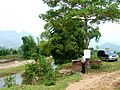
Suoi Khoang, Văn Chấn District
-
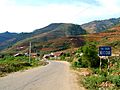
Mu Cang Chai town
-
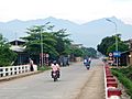
Nghĩa Lộ


See also
 In Spanish: Provincia de Yên Bái para niños
