Tuyên Quang province facts for kids
Quick facts for kids
Tuyên Quang province
Tỉnh Tuyên Quang
|
|
|---|---|
|
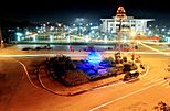
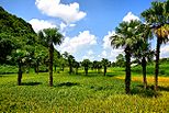
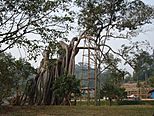
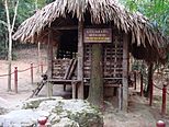
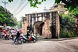
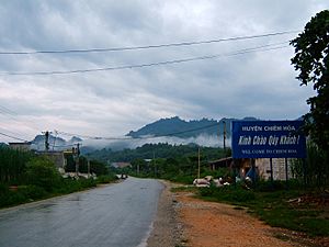
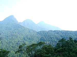
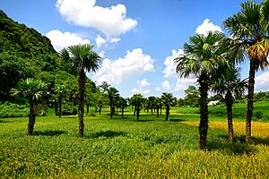
Tuyên Quang City • Tuyên Quang Field • Banyan in Tân Trào • Lan Na Lua • Tân Trào Temple • Mạc dynasty Temple • Mơ Waterfall • Tuyên Quang Dam
|
|
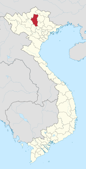
Location of Tuyên Quang within Vietnam
|
|
| Country | |
| Region | Northeast |
| Capital | Tuyên Quang |
| Subdivision | 1 city, 6 rural districts |
| Government | |
| • Type | Province |
| • Body | Tuyên Quang Provincial People's Council |
| Area | |
| • Province | 5,867.90 km2 (2,265.61 sq mi) |
| Population
(2021)
|
|
| • Province | 790,862 |
| • Density | 134.77769/km2 (349.0726/sq mi) |
| • Urban | 141,949 |
| Ethnic groups | |
| • Vietnamese | 43.23% |
| • Tày | 26.20% |
| • Dao | 13.42% |
| • Sán Chay | 9.00% |
| • Mông | 2.72% |
| • Others | 5.43% |
| Time zone | UTC+7 (ICT) |
| Area codes | 207 |
| ISO 3166 code | VN-07 |
Tuyên Quang (Vietnamese: [twiən˧˧ kwaːŋ˧˧]) is a province in Vietnam. It is located in the northeastern part of the country. Tuyên Quang is northwest of Hanoi, in the middle of the Lô River valley. The Lô River is a branch of the Red River.
The capital city of the province is also called Tuyên Quang. In 2019, about 784,811 people lived here. The province covers an area of about 5,867.3 square kilometres (2,265.4 sq mi).
Tuyên Quang province shares borders with several other provinces. To the north is Hà Giang. To the northeast is Cao Bằng. Bắc Kạn and Thái Nguyên are to the east. To the south is Vĩnh Phúc. Phú Thọ is to the southwest, and Yên Bái is to the west.
Contents
History of Tuyên Quang Province
Tuyên Quang has a long and interesting history, especially with many battles. It was an important place during the First Indochina War. French soldiers were stationed there. A famous event was the Siege of Tuyên Quang in 1884–1885. French soldiers defended the town for four months. They fought against 12,000 troops from the Yunnan Army and the Black Flag Army.
Long ago, Thai people lived all over Tuyên Quang. By the 13th century, it became part of the Trần dynasty. It was first called Quốc Oai, then Châu Tuyên Quang. Later, under Emperor Trần Hiến Tông, it became a trấn. When the Ming dynasty of China took over Vietnam for a short time, it was called thành phủ.
After Lê Lợi drove out the Chinese, he started the Lê dynasty. Tuyên Hóa became part of Tây Đạo. Under Emperor Lê Thánh Tông, Tuyên Quang had one phủ and five districts. It then became the province of Minh Quang. Later, it was renamed An Tại, and the Vũ family, who were ethnic Thai, took control.
By the late 1600s, the Lê dynasty sent Vietnamese officials to oversee the Thai people. When Gia Long started the Nguyễn dynasty, he changed the region to the trấn of Tuyên Quang. It became a province under Emperor Minh Mạng. When the French took over, people from different ethnic groups fought against them. These groups included the Thái, Mường, Mèo, Thổ, and Nùng. The Black Flag Army was also involved. The French finally took control in 1894.
Geography and Climate
Tuyên Quang province has many different types of land. It has high mountains and deep valleys. Most of the province is between 200–600 metres (660–1,970 ft) high. It is in the foothills of the Northern Highlands. The southern part has narrow river valleys and mountains under 300 metres (980 ft). The northern part has steep hills over 1,400 metres (4,600 ft) high. The highest mountain is Cham Chu at 1,589 metres (5,213 ft). The Tam Dao mountain range is also in this province.
The capital city, Tuyên Quang, is about 100 kilometres (62 mi) from Hanoi. It is less than 100 metres (330 ft) high. The city is on the right bank of the Lô River. This river flows from Hà Giang, near the Chinese border. The Gâm River is a major branch of the Lô River. The province has a total land area of about 5,900 square kilometres (2,300 sq mi). Only 7.2% of this land is natural forest.
Water Resources
Tuyên Quang has many rivers and streams. The three main rivers are the Lô, Gâm, and Pho Day. The Lô River starts in China and flows through Hà Giang into Tuyên Quang. It flows for 145 kilometres (90 mi) in the province. This river is used for boats to carry goods.
The Gâm River also starts in China. It flows through Cao Bằng and Hà Giang before reaching Tuyên Quang. The Gâm River joins the Lô River at Tu Hiep. The Pho Day River starts in the Tam Dao Mountains. It flows for 84 kilometres (52 mi) through Tuyên Quang. Besides these, there are many small rivers, lakes, and ponds. The water from these sources is clean and safe to drink. The province also has three mineral water springs.
Climate and Weather
Tuyên Quang has two main seasons: the monsoon (rainy) season and the dry season. Most rain falls from May to October, which is also summer. The amount of rain can change a lot depending on the area. The province gets about 1,500 millimetres (59 in) of rain each year, over 150 rainy days. About 94% of the rain happens during the monsoon season.
Wind direction changes with the seasons. Thunderstorms are common from April to August. Sometimes, strong storms can bring 100 millimetres (3.9 in) of rain in one go. Cyclones can happen every year in April and May. Mist is common in early winter, lasting 25 to 80 days. Frost can occur about once every two years in January or November.
The climate helps many different plants and animals grow. The northern part of the province has a long, cold winter but gets more rain in summer. The southern part has a short winter and a hot summer with monsoons. Heavy rainstorms can sometimes cause floods, which may damage homes and property. The average temperature in the province is 22.4 °C (72.3 °F).
Natural Resources
Tuyên Quang province has many valuable natural resources.
Mineral Resources
The province has a lot of metal and non-metal minerals:
- Iron ore: There are 10 iron mines with large amounts of iron.
- Lead-zinc ore: There are 24 mines and sites with lead and zinc.
- Tin ore: Found in several areas, with an estimated 50,000 tonnes.
- Tungsten ore: Also known as Vonfram, found with reserves of 674 tonnes.
- Manganese: Found in six places in Chiêm Hoá.
- Antimony: With large reserves of 1,191,000 tonnes.
Other minerals like Barite, Kaolin, felspar, and Limestone are also found in large amounts. Clay is common in many areas. Smaller amounts of pyrite, gold, and pebble sand are also present.
Transport Network
Tuyên Quang province does not have railways or an airport. However, it has National Highway No. 2 and 37 for road travel. The Lô, Gâm, and Pho Day Rivers are important water routes. They connect Tuyên Quang with nearby provinces. Tuyên Quang city is about 165 kilometres (103 mi) by road from Hanoi.
Administrative Divisions
Tuyên Quang province is divided into seven main areas:
- One provincial city:
- Tuyên Quang (This is the capital city)
- Six districts:
- Chiêm Hoá
- Hàm Yên
- Lâm Bình
- Na Hang
- Sơn Dương
- Yên Sơn
These areas are further divided into smaller towns, communes, and wards.
Local Government Divisions
| Name | Division type | Population (2003) | Area (km2) | Towns (huyện lỵ or thị trấn) (bold) and communes (xã) |
|---|---|---|---|---|
| Tuyên Quang | City (thành phố) | 139,000 | 119.17 | Wards (phường): Hưng Thành, Nông Tiến, Ỷ La, Minh Xuân, Phan Thiết, Tân Quang, Tân Hà. Communes (xã): Tràng Đà, An Tường, Lưỡng Vượng, An Khang, Thái Long, Đội Cấn. |
| Chiêm Hoá District | District (huyện) | 124,337 | 1280.379 | Vĩnh Lộc Town, Minh Quang, Trung Hà, Hà Lang, Phúc Sơn, Tân Mỹ, Hùng Mỹ, Tân An, Hòa An, Trung Hòa, Nhân Lý, Bình Nhân, Vinh Quang, Kim Bình, Tri Phú, Linh Phú, Ngọc Hội, Phú Bình, Bình Phú, Kiên Đài, Yên Lập, Xuân Quang, Phúc Thịnh, Tân Thịnh, Yên Nguyên, Hòa Phú. |
| Hàm Yên District | District (huyện) | 104,648 | 346.7 | Tân Yên Town, Hùng Đức, Bằng Cốc, Thành Long, Thái Hòa, Đức Ninh, Thái Sơn, Bình Xa, Nhân Mục, Yên Phú, Tân Thành, Minh Hương, Phù Lưu, Minh Dân, Yên Lâm, Minh Khương, Bạch Xa, Yên Thuận. |
| Lâm Bình District | District (huyện) | 29,459 | 781.522 | Lăng Can, Thượng Lâm, Khuôn Hà, Phúc Yên, Xuân Lập, Bình An, Thổ Bình, Hồng Quang. |
| Na Hang District | District (huyện) | 41,868 | 865.497 | Na Hang Town, Năng Khả, Thanh Tương, Sơn Phú, Đà Vị, Yên Hoa, Côn Lôn, Sinh Long, Khâu Tinh, Thượng Giáp, Thượng Nông, Hồng Thái. |
| Sơn Dương District | District (huyện) | 174,118 | 789 | Sơn Dương Town, Bình Yên, Cấp Tiến, Chi Thiết, Đại Phú, Đông Lợi, Đồng Quý, Đông Thọ, Hào Phú, Hồng Lạc, Hợp Hòa, Hợp Thành, Kháng Nhật, Lâm Xuyên, Lương Thiện, Minh Thanh, Ninh Lai, Phú Lương, Phú Ứng, Quyết Thắng, Sầm Dương, Sơn Nam, Tam Đa, Tân Trào, Thanh Phát, Thiện Kế, Thương Ấm, Trung Yên, Tú Thịnh, Tuân Lộ, Văn Phú, Vân Sơn, Vĩnh Lợi. |
| Yên Sơn District | District (huyện) | 175,917 | 1210 | Tân Bình Town, Đội Bình, Nhữ Khê, Nhữ Hán, Mỹ Bằng, Phú Lâm, Kim Phú, Hoàng Khai, Chân Sơn, Trung Môn, Lang Quán, Thắng Quân, Tứ Quận, Phúc Ninh, Chiêu Yên, Lực Hành, Quý Quân, Xuân Vân, Tân Long, Tân Tiến, Trung Trực, Kiến Thiết, Đạo Viện, Phú Thịnh, Thái Bình, Tiến Bộ, Công Đa, Kim Quan, Trung Sơn, Hùng Lợi, Trung Minh. |
People and Languages
In 2019, Tuyên Quang province had a population of 784,811 people. About 395,146 were male and 389,665 were female. Most people lived in rural areas (676,524), while 108,287 lived in cities.
Many different ethnic groups live in Tuyên Quang. The main groups are Vietnamese, Tày, Dao, Sán Chay, and Mông. Each group has its own culture and traditions.
Several languages are spoken in the province:
- Hmong-Mien languages: Hmong, Iu Mien, Kim Mun, Pa-Hng, Na-Meo
- Tai languages: Tày, Nùng, Cao Lan
- Kam-Sui languages: Kam, Sui
- Chinese languages: San Diu (like Cantonese), Ngái (like Hakka), San Chay (like Pinghua)
Economy and Development
Tuyên Quang's economy mostly relies on its main industries. In 2005, the economy was divided like this: 30.7% from construction, 33.6% from services, and 35.7% from agriculture, forestry, and fishing.
Rice is the main food grown here. Farmers also grow maize, cassava, potato, tea, lemongrass, citrus fruits, and beans. Animals raised include buffalo, pigs, and poultry. The most important minerals found are zinc, manganese, tin, and antimony. The province also makes paper, cement, and limestone.
About 20% of the province's land is used for farming. This has sometimes led to forests being cut down. However, traditional farming methods like "swidden agriculture" (also called shifting cultivation) are becoming less common. Projects are helping farmers learn new ways to grow crops and raise animals. This includes better farming techniques, managing money, and storing food.
The forestry industry is important because of the Bai Bang pulp and paper mill. This is one of Vietnam's largest paper mills. It uses wood from the province's forests to make pulp.
Tuyên Quang Hydroelectric Plant
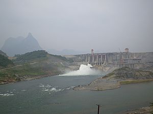
The Tuyên Quang Hydropower Plant is a big project that creates electricity from water. It is located on the Gâm River, near Pac Ta Mountain. Building started in 2002. The first part of the plant began working in March 2008, and all parts were ready by the end of 2008.
This power plant can produce 342 megawatts of electricity. It is the second largest in northern Vietnam. It can generate 1200 gigawatt-hours of energy each year. The project cost about US$490 million. The plant has a 92 metres (302 ft) tall rock dam, called the Na Hang Dam. This dam can hold 2.3 billion cubic metres of water.
Nature and Wildlife
Tuyên Quang province has a rich variety of plants and animals.
Forests
Most of the cultivated land is in the south of the province. Large, dense forests are common in the northern districts, covering about 12% of the area. Bamboo forests can be found in almost all districts. Some forest areas have been turned into farmland or have become barren.
Flora and Fauna
The province has many different types of plants. Scientists have found 597 plant species from 90 families. Many of these plants are rare or endangered. The Vietnamese Red Book lists 18 precious plants in Tuyên Quang.
There are 293 animal species in the province. This includes 51 types of mammals, 175 types of birds, 5 types of reptiles, and 17 types of amphibians. Many animal species are abundant, but 39 are considered rare and precious. Some animals in danger of disappearing include 18 mammal species, 12 bird species, and 12 reptile species.
Some mammals found here are the tiger, Asian black bear, clouded leopard, Indian muntjac (a small deer), black gibbon, apricot panther, sambar (another small deer), and Sumatran serow (a small goat-like animal). Primates like the Tonkin snub-nosed monkey have been seen. Sadly, the Phayre's leaf monkey is thought to be extinct here. The places where these animals live are getting smaller because of deforestation and farming.
Culture and Festivals
Tuyên Quang has many interesting historical sites and cultural events.
Historical Places
Important historical places in the province include the Cave Pagoda at Yên Sơn. There are also the Dat Nong Tien and the Thuong Temple in Tuyên Quang city. The province is also known for its beautiful mountains, some over 2,000 metres (6,600 ft) high. The My Lam Mineral Spring is another natural attraction.
The province has 26 registered historical monuments. There are also eight cultural centers and 42 communal cultural houses. The main Christian churches in the province are seven Roman Catholic churches. About 60% of the province's population is believed to be Catholic.
Festivals
Two popular festivals celebrated in the province are the Gieng Tanh village festival and the Qua Tang festival of the Dao people. These festivals are important cultural events for the local communities.
See also
 In Spanish: Provincia de Tuyên Quang para niños
 | Kyle Baker |
 | Joseph Yoakum |
 | Laura Wheeler Waring |
 | Henry Ossawa Tanner |


