Magueyes, Ponce, Puerto Rico facts for kids
Quick facts for kids
Magueyes
|
|
|---|---|

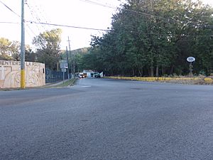
Scene in Barrio Magueyes
|
|

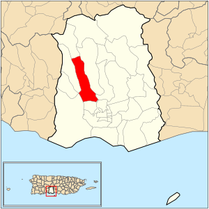
Location of barrio Magueyes within the municipality of Ponce shown in red
|
|
| Commonwealth | |
| Municipality | |
| Area | |
| • Total | 4.55 sq mi (11.8 km2) |
| • Land | 4.55 sq mi (11.8 km2) |
| • Water | 0 sq mi (0 km2) |
| Elevation | 344 ft (105 m) |
| Population
(2010)
|
|
| • Total | 5,947 |
| • Density | 1,307/sq mi (505/km2) |
| Source: 2010 Census | |
| Time zone | UTC−4 (AST) |
Magueyes is one of the 31 barrios (which are like neighborhoods or districts) in the city of Ponce, Puerto Rico. It's one of the eight barrios located inland, away from the coast.
The name "Magueyes" comes from the native Taíno language. It refers to the maguey plant, which is a type of agave. This barrio was first established way back in 1831.
Contents
Magueyes: A Look Back in Time
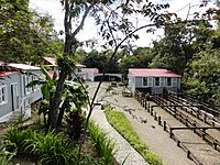
Magueyes is one of the oldest barrios in Ponce. It's home to a very old place called Hacienda Buena Vista. This historic farm dates all the way back to 1833.
The word Magueyes is the plural form of Maguey. This word comes from the Taíno language, spoken by the native people of the Caribbean.
Where is Magueyes Located?
Magueyes has clear boundaries that help you find it on a map. To the north, it's bordered by hills near Tierras Buenas Road. To the south, you'll find Ruth Fernandez Boulevard.
On the west side, there are hills near PR-123. To the east, it's bordered by more hills near PR-123 and also by Ruth Fernandez Boulevard.
When looking at other barrios, Magueyes is next to Guaraguao in the north. To the south, it borders Magueyes Urbano and Portugues Urbano. On its west side are Marueño and Canas. Finally, to the east, you'll find Tibes and Portugués.

What's Magueyes Like?
Magueyes covers about 4.56 square miles of land. It doesn't have any large bodies of water within its area.
In 2010, about 5,947 people lived in Magueyes. This means there were about 1,307 people living in each square mile. It's one of the more populated barrios in Ponce.
The Rio Canas (Canas River) flows right through Magueyes. It actually splits the barrio into two nearly equal parts! Several communities are part of Magueyes, including Corral Viejo, Las Delicias, and Granada Hills.
The main road that goes through Barrio Magueyes is PR-123. Another road, PR-501, also passes through a small part of the barrio.
The highest point in Magueyes is a hill that stands 2,066 feet tall. You can find this tall point at the very northeast tip of the barrio.
Cool Places to See
The famous Hacienda Buena Vista is located right here in Magueyes. It's a great place to learn about the history of coffee and sugar production in Puerto Rico.
See also
 In Spanish: Magueyes (Ponce) para niños
- List of communities in Puerto Rico


