Maintop Mountain facts for kids
Quick facts for kids Maintop Mountain |
|
|---|---|
| Highest point | |
| Elevation | 1,235 meters (4,050 ft) |
| Prominence | 180 m (600 ft) |
| Geography | |
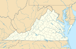
| Location | Nelson County, Virginia, U.S. |
| Parent range | Blue Ridge Mountains |
| Topo map | USGS Massies Mill |
Maintop Mountain is a cool mountain located in Nelson County, Virginia. It's part of the famous Blue Ridge Mountains. This mountain stands tall in the beautiful George Washington National Forest.
Contents
About Maintop Mountain
Maintop Mountain is a peak that branches off the main Blue Ridge Mountains. It's about 2 miles (3 km) east of Elk Pond Mountain. You can also find it about 3.5 miles (5.5 km) west of another mountain called The Priest.
Where the Water Goes
The rain and snow that fall on Maintop Mountain eventually flow into the Tye River. The Tye River then joins the larger James River.
- The northwest side of Maintop Mountain sends its water into Mill Creek. This creek then flows into the South Fork of the Tye River.
- Water from the northeast side goes into the Maidenhead Branch. This also joins the South Fork of the Tye River.
- The southeast side drains into Shoe Creek. This creek flows into the Piney River, which then joins the Tye River.
- Finally, the southwest side's water goes into the Louisa Spring Branch. This branch flows into the North Fork of the Piney River.
The Appalachian Trail
The famous Appalachian Trail (AT) currently crosses the very top of Maintop Mountain. The AT is a super long National Scenic Trail. It stretches for about 2,170 miles (3,500 km)! It starts all the way in Georgia and ends in Maine.
In May 2009, the Appalachian Trail was planned to be moved. The new path would be less steep. It would also pass just below the mountain's summit instead of over it.
Spy Rock: A Great Viewpoint
Maintop Mountain is a popular spot for people to visit. One big reason is the amazing view from a place called Spy Rock. Spy Rock is a rocky spur located about a quarter mile from the mountain's summit.
You can reach Spy Rock by hiking. It's a steep hike, about one and a half miles long. The trail starts from a state fish hatchery in Montebello, Virginia. It's a challenging but rewarding climb!
 | Claudette Colvin |
 | Myrlie Evers-Williams |
 | Alberta Odell Jones |


