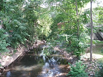
Mamaroneck River facts for kids
Quick facts for kids Mamaroneck River |
|
|---|---|

Halstead Avenue, Mamaroneck
|
|
| Other name(s) | Bonnie Brook, Merrimack River |
| Country | United States |
| State | New York |
| District | Westchester County |
| Physical characteristics | |
| Main source | White Plains, New York 41°02′34″N 73°45′08″W / 41.04288°N 73.75236°W |
| River mouth | Long Island Sound Mamaroneck, New York 40°56′23″N 73°43′15″W / 40.9398209°N 73.7209638°W |
The Mamaroneck River is a freshwater stream in Westchester County, New York. It starts in White Plains and Harrison. The river flows south for about 7.3 miles (11.7 km).
It passes through Mamaroneck Town and Mamaroneck Village. Finally, it flows into Mamaroneck Harbor and Long Island Sound. The name "Mamaroneck" comes from a local Native American word. It means "where the fresh water meets the salt water."
The area around the Mamaroneck River is called its watershed. This area covers about 17.4 square miles (45 square km). Most of this land has suburban homes and shopping areas. Many homes are built close together, especially near the middle and lower parts of the river.
Contents
Where the Mamaroneck River Begins
The Mamaroneck River starts in a small wetlands area. This spot is in Harrison, about 430 feet (131 meters) above sea level. From there, it flows south along the edge of White Plains.
East and West Branches of the River
The river first meets the 'East Branch' near Anderson Hill Road and Westchester Avenue. The Mamaroneck River then flows for another 2.5 miles (4 km). Here, it joins the 'West Branch' to form the main part of the river.
Over time, many homes have been built near the river's start. This has changed the river's path and the land around it.
The Main Path of the Mamaroneck River
The main part of the Mamaroneck River flows southeast. It runs next to Westchester Avenue and the Hutchinson River Parkway. After passing the parkway, the river flows south. It then meets the West Branch of the Mamaroneck River at the Mamaroneck Reservoir.
South of the reservoir, the river forms a border. It separates Mamaroneck Village from Harrison. When it reaches the New England Thruway, the Mamaroneck River continues south through Mamaroneck Village. Here, it joins the Sheldrake River. Finally, it empties into Mamaroneck Harbor, which is part of Long Island Sound.
River Branches: East and West
The Mamaroneck River has two main smaller rivers that flow into it. One comes from the east, and the other from the west.
- East Branch: This branch is the furthest upstream. It starts in northern Harrison near Westchester Avenue and Anderson Hill Road. The East Branch is about 3.3 miles (5.3 km) long. It begins from a small pond in northern Harrison, about 400 feet (122 meters) above sea level. It flows into Forest Lake and then west to join the main river.
- West Branch: This is the smaller of the two main branches. It drains an area of about 2.3 square miles (6 square km). This area is just south and southeast of downtown White Plains. The West Branch starts from a wetland and pond near Archbishop Stepinac High School. It flows about 2.75 miles (4.4 km) south and southwest. It passes through several areas designed to manage stormwater. Then, it joins the main river near Mamaroneck Avenue and Hutchinson River Parkway.
 | Selma Burke |
 | Pauline Powell Burns |
 | Frederick J. Brown |
 | Robert Blackburn |

