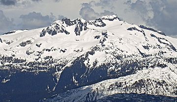
Mamquam Mountain facts for kids
Quick facts for kids Mamquam Mountain |
|
|---|---|

Mamquam Mountain
|
|
| Highest point | |
| Elevation | 2,588 m (8,491 ft) |
| Prominence | 1,138 m (3,734 ft) |
| Geography | |
| Parent range | Pacific Ranges |
| Topo map | NTS 92G/15 |
| Climbing | |
| First ascent | 1911 B. Gray, C. Chapman, H. Korten, F. Perry, F. Smith |
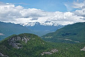
Mamquam Mountain is a tall mountain found in the Pacific Ranges. These ranges are part of the larger Coast Mountains in southwestern British Columbia, Canada.
This impressive peak is located about 6 kilometers (4 miles) southeast of Eanastick Meadows. It is also about 22 kilometers (14 miles) east of Brackendale. Mamquam Mountain is the highest point in the Mamquam Icefield. It sits at the southern edge of Garibaldi Provincial Park. The mountain got its name on September 2, 1930. It was named after the nearby Mamquam River.
Mountain Weather and Climate
Mamquam Mountain has a special kind of weather. It is called a marine west coast climate. This means it gets a lot of rain and snow. This climate zone is common in western North America.
Most of the weather comes from the Pacific Ocean. Big weather systems travel east towards the Coast Mountains. When they hit the mountains, the air is forced to rise. This process is called Orographic lift. As the air rises, it cools down and drops its moisture. This causes a lot of rain or snowfall in the Coast Mountains.
Because of this, the mountains get a lot of precipitation. This is especially true during the winter months. Temperatures can drop very low, sometimes below −20 °C (–4 °F). With the wind, it can feel even colder, below −30 °C (–22 °F).
If you want to climb Mamquam Mountain, the best time is usually from July to September. The weather is much better and safer during these months.
 | Emma Amos |
 | Edward Mitchell Bannister |
 | Larry D. Alexander |
 | Ernie Barnes |


