Manassas Park, Virginia facts for kids
Quick facts for kids
Manassas Park, Virginia
|
|||||
|---|---|---|---|---|---|
| City of Manassas Park | |||||
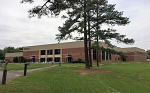
Manassas Park community center
|
|||||
|
|||||
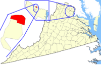
Location of Manassas Park in Virginia
|
|||||
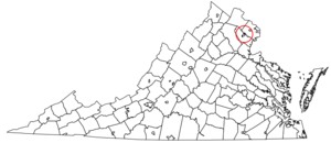
Manassas Park in Virginia
|
|||||
| Country | United States | ||||
| State | Virginia | ||||
| Pre-incorporation County | |||||
| Incorporated | 1975 | ||||
| Named for | Manassas, Virginia | ||||
| Area | |||||
| • Total | 3.03 sq mi (7.86 km2) | ||||
| • Land | 3.03 sq mi (7.86 km2) | ||||
| • Water | 0.00 sq mi (0.00 km2) | ||||
| Population
(2020)
|
|||||
| • Total | 17,219 | ||||
| • Density | 5,682.84/sq mi (2,194.16/km2) | ||||
| Time zone | UTC-5 | ||||
| • Summer (DST) | UTC-4 | ||||
| Zip Code |
20111
|
||||
| FIPS code | 51-48968 | ||||
| GNIS feature ID | 1495894 | ||||
| Website | City of Manassas Park | ||||
Manassas Park is a small, independent city in the state of Virginia, USA. An "independent city" means it's not part of a larger county. It is located near the city of Manassas and Prince William County. In 2020, about 17,219 people called Manassas Park home. This city is also part of the larger Washington, D.C. area.
Contents
History of Manassas Park
The area where Manassas Park now stands has a rich history. During the American Civil War, soldiers from the Confederate States Army used this land as a camp. This happened during two major battles nearby, known as the First and Second Battles of Bull Run.
How Manassas Park Grew
Manassas Park started as a neighborhood within Prince William County. The first houses were built here in 1955. Just two years later, in 1957, Manassas Park officially became a town.
The town grew bigger in 1974 when it added about 600 acres of land. The very next year, in 1975, Manassas Park became an independent city. This meant it was no longer part of Prince William County. Since then, it has been the newest city in Virginia.
Geography of Manassas Park
Manassas Park is located at coordinates 38°46′19″N 77°27′09″W. It has a unique shape, a bit like a dumbbell. The city lies south of a stream called Bull Run.
City Size and Shape
The longest part of the city stretches from the northwest to the southeast along Manassas Drive. Virginia State Route 28 cuts through the narrowest part of the city. According to the United States Census Bureau, Manassas Park covers about 2.5 square miles (6.5 square kilometers), and all of it is land.
Neighboring Areas
Manassas Park shares its borders with two other important areas:
- Prince William County, Virginia - to the north, east, and south
- Manassas, Virginia - to the west and southwest
Population and People
Manassas Park has grown quite a bit over the years. Here's how its population has changed:
| Historical population | |||
|---|---|---|---|
| Census | Pop. | %± | |
| 1960 | 5,342 | — | |
| 1970 | 6,844 | 28.1% | |
| 1980 | 6,524 | −4.7% | |
| 1990 | 6,734 | 3.2% | |
| 2000 | 10,290 | 52.8% | |
| 2010 | 14,273 | 38.7% | |
| 2020 | 17,219 | 20.6% | |
| U.S. Decennial Census 1790-1960 1900-1990 1990-2000 2020-2020 |
|||
Diversity in Manassas Park
The city is home to a diverse group of people from many backgrounds. The 2020 census showed that Manassas Park has a mix of different racial and ethnic groups living together. This makes the city a vibrant place with many cultures.
Education in Manassas Park
The city has its own school system called Manassas Park City Schools. There are four schools that serve the students in the city:
- Cougar Elementary
- Manassas Park Elementary
- Manassas Park Middle
- Manassas Park High School
There are also private schools available in the area.
Transportation in Manassas Park
Manassas Park has important roads that help people travel in and out of the city.
Main Roads
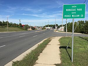
Virginia State Route 28 is the main highway that goes through Manassas Park. This road connects the city to major highways like Interstate 66 to the north and Virginia State Route 234 to the south. These connections make it easier to reach other big cities in the region.
Another important road is Virginia State Route 213, which follows Manassas Drive. Even though it's a main road within the city, its route number isn't usually shown on signs.
Train Service
The city also has a train station called Manassas Park station. This station is part of the Manassas Line of the Virginia Railway Express, which provides commuter train service.
Notable People from Manassas Park
- Johnny Micheal Spann (1969–2001): He worked for the Central Intelligence Agency (CIA). He was the first American soldier killed in combat after the U.S. invasion of Afghanistan.
See also
 In Spanish: Manassas Park para niños
 | Aurelia Browder |
 | Nannie Helen Burroughs |
 | Michelle Alexander |


