Maple Hill, Kansas facts for kids
Quick facts for kids
Maple Hill, Kansas
|
|
|---|---|

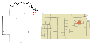
Location within Wabaunsee County and Kansas
|
|

|
|
| Country | United States |
| State | Kansas |
| County | Wabaunsee |
| Founded | 1882 |
| Incorporated | 1908 |
| Named for | Maple trees on a hill |
| Government | |
| • Type | Mayor–Council |
| Area | |
| • Total | 0.24 sq mi (0.63 km2) |
| • Land | 0.24 sq mi (0.63 km2) |
| • Water | 0.00 sq mi (0.00 km2) |
| Elevation | 968 ft (295 m) |
| Population
(2020)
|
|
| • Total | 631 |
| • Density | 2,630/sq mi (1,002/km2) |
| Time zone | UTC-6 (CST) |
| • Summer (DST) | UTC-5 (CDT) |
| ZIP code |
66507
|
| Area code | 785 |
| FIPS code | 20-44500 |
| GNIS ID | 2395839 |
Maple Hill is a small city in Wabaunsee County, Kansas, United States. In 2020, the city had a population of 631 people. It is known for its quiet, community feel.
Contents
History of Maple Hill
Maple Hill was founded around 1882. It got its name from a group of Maple trees growing on a nearby hill. The city was officially incorporated in 1908.
In 1887, a railroad called the Chicago, Kansas and Nebraska Railway built a main line through Maple Hill. This connected the city to Topeka and Herington. Over the years, this railroad changed hands many times. Today, it is part of the Union Pacific Railroad system. However, many local people still call it the "Rock Island" railroad.
Between 1900 and 1901, three fires happened in Maple Hill. These events were a challenge for the young community.
Geography and Location
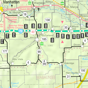
Maple Hill is located in Wabaunsee County. It is about 39 degrees North and 96 degrees West. The city covers a total area of about 0.25 square miles (0.63 square kilometers). All of this area is land, with no large bodies of water.
Maple Hill is part of the Topeka metropolitan area. This means it is near a larger city and shares some economic and social connections with it.
Population and People
The number of people living in Maple Hill has changed over the years. Here is a quick look at the population from different census years:
| Historical population | |||
|---|---|---|---|
| Census | Pop. | %± | |
| 1910 | 277 | — | |
| 1920 | 255 | −7.9% | |
| 1930 | 256 | 0.4% | |
| 1940 | 247 | −3.5% | |
| 1950 | 176 | −28.7% | |
| 1960 | 244 | 38.6% | |
| 1970 | 327 | 34.0% | |
| 1980 | 381 | 16.5% | |
| 1990 | 406 | 6.6% | |
| 2000 | 469 | 15.5% | |
| 2010 | 620 | 32.2% | |
| 2020 | 631 | 1.8% | |
| U.S. Decennial Census | |||
2020 Census Information
The 2020 United States census counted 631 people living in Maple Hill. There were 207 households and 145 families. The city had about 2,597 people per square mile.
Most people in Maple Hill were white or European American. A small number were black, Native American, or from two or more races. About 6% of the population was Hispanic or Latino.
Many households (42%) had children under 18 living there. Most households (about 60%) were married couples living together. The average household had about 2.9 people.
The median age in Maple Hill was 30.2 years. This means half the people were younger than 30.2 and half were older. About 36% of the population was under 18 years old.
The average income for a household was about $76,875 per year. A small percentage of families and people lived below the poverty line.
Education in Maple Hill
The public schools in Maple Hill are part of the Wabaunsee USD 329 school district. This district was formed by combining schools from several towns, including Alma, Maple Hill, McFarland, and Paxico.
Wabaunsee High School is located in Alma. The school's mascot is the Wabaunsee Chargers. Maple Hill used to have its own high school, but it closed when the school districts combined.
Notable People
- Joseph Norman Dolley: He was a banking commissioner in Kansas. He helped create the nation's first state "blue sky law" in 1911. This law was made to protect people from dishonest investments.
See also
 In Spanish: Maple Hill para niños
 | William M. Jackson |
 | Juan E. Gilbert |
 | Neil deGrasse Tyson |

