Northway, Oxford facts for kids
Quick facts for kids Northway |
|
|---|---|
| Housing Estate | |
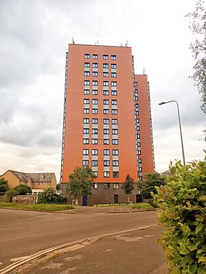
 Plowman Tower in Northway |
|
| Population | 6,500 (Includes Headington Hill) (2021 Census) |
| OS grid reference | SP538081 |
| District | |
| Shire county | |
| Region | |
| Country | England |
| Sovereign state | United Kingdom |
| Post town | Oxford |
| Postcode district | OX3 |
| Dialling code | 01865 |
| Police | Thames Valley |
| Fire | Oxfordshire |
| Ambulance | South Central |
| EU Parliament | South East England |
| UK Parliament | |
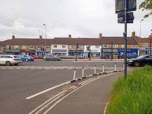
Northway is a suburb in northeast Oxford, England, just inside the Oxford ring road. It is near Marston and the John Radcliffe Hospital. It mainly consists of social housing built by Oxford City Council in the 1950s, though many houses and apartments are now in private ownership.
To the southwest is Headley Way and to the northwest is Marsh Lane.
History
Plowman Tower was built by Oxford City Council in 1965, it was the first tower block in Oxfordshire.
Amenities
There is a Community Centre in Dora Carr Close and a Sports Centre in Maltfield Road. There is a Northway Evangelical Church.

All content from Kiddle encyclopedia articles (including the article images and facts) can be freely used under Attribution-ShareAlike license, unless stated otherwise. Cite this article:
Northway, Oxford Facts for Kids. Kiddle Encyclopedia.

