Marshfield, Missouri facts for kids
Quick facts for kids
Marshfield, Missouri
|
|
|---|---|
| City of Marshfield | |

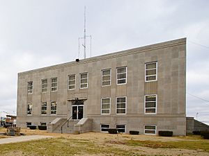
The Webster County Courthouse in Marshfield
|
|

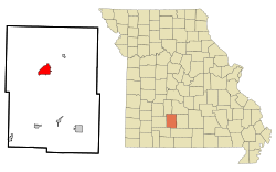
Location of Marshfield, Missouri
|
|
| Country | United States |
| State | Missouri |
| County | Webster |
| Founded | 1855 |
| Incorporated | 1856 |
| Named for | Marshfield, Massachusetts |
| Area | |
| • Total | 5.53 sq mi (14.33 km2) |
| • Land | 5.52 sq mi (14.30 km2) |
| • Water | 0.01 sq mi (0.03 km2) |
| Elevation | 1,493 ft (455 m) |
| Population
(2020)
|
|
| • Total | 7,458 |
| • Density | 1,350.84/sq mi (521.60/km2) |
| Time zone | UTC-6 (Central (CST)) |
| • Summer (DST) | UTC-5 (CDT) |
| ZIP code |
65706
|
| Area code(s) | 417 |
| FIPS code | 29-46388 |
| GNIS feature ID | 0721909 |
| Website | marshfieldmo.gov |
Marshfield is a friendly city in the state of Missouri, United States. It is the main city and county seat of Webster County, Missouri. In 2020, about 7,458 people called Marshfield home. This makes it a growing community within the larger Springfield, Missouri, area.
Contents
Discovering Marshfield's Past
Marshfield was officially planned out in 1855. It got its name from a town called Marshfield, Massachusetts. A post office opened here in 1856. The city is the center of Webster County. The land for the city was kindly given by William T. Burford and C.F. Dryden.
Some important historical places in Marshfield are listed on the National Register of Historic Places. These include the Hosmer Dairy Farm Historic District and the Rainey Funeral Home Building.
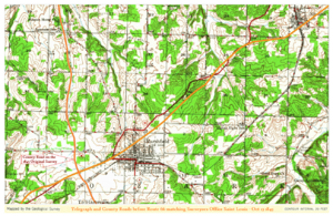
Marshfield is also special because it's where the TransAmerica Bicycle Trail crosses U.S. Route 66. This is a unique spot for cyclists and travelers!
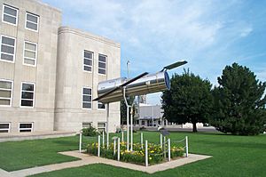
The famous astronomer Edwin Hubble grew up in Marshfield. You can even see a cool replica of the Hubble Space Telescope right in front of the Webster County Courthouse. It's located at 100 S Clay St.
Exploring Marshfield's Location
Marshfield is located in Missouri at coordinates 37.339599 degrees North and 92.907230 degrees West. The city covers a total area of about 5.03 square miles (13.03 square kilometers). All of this area is land.
Marshfield's Weather and Seasons
Marshfield has a climate with four clear seasons. Summers are warm and humid, meaning they can feel sticky. Winters are cool, and sometimes it gets quite cold. Rain falls most often in the late spring. Snowfall is usually light, with about 5.2 inches (13 cm) on average each year.
Population and Community Life
Marshfield has grown quite a bit over the years. Here's how its population has changed:
| Historical population | |||
|---|---|---|---|
| Census | Pop. | %± | |
| 1860 | 408 | — | |
| 1870 | 809 | 98.3% | |
| 1880 | 655 | −19.0% | |
| 1890 | 980 | 49.6% | |
| 1900 | 964 | −1.6% | |
| 1910 | 1,193 | 23.8% | |
| 1920 | 1,371 | 14.9% | |
| 1930 | 1,378 | 0.5% | |
| 1940 | 1,764 | 28.0% | |
| 1950 | 1,925 | 9.1% | |
| 1960 | 2,221 | 15.4% | |
| 1970 | 2,961 | 33.3% | |
| 1980 | 3,871 | 30.7% | |
| 1990 | 4,374 | 13.0% | |
| 2000 | 5,720 | 30.8% | |
| 2010 | 6,633 | 16.0% | |
| 2020 | 7,458 | 12.4% | |
| U.S. Decennial Census | |||
In 2010, there were 6,633 people living in Marshfield. There were 2,605 households, which are groups of people living together. The average household had about 2.47 people. The average family size was 3.04 people.
The average age of people in Marshfield was 36.4 years old. About 27.6% of the population was under 18 years old.
Learning and Education in Marshfield
Marshfield offers good educational opportunities for its young people.
- Public High School: Students attend Marshfield High School.
- Private School: There is also a private school called Marshfield Christian School.
The city also has a public library. It is a branch of the Webster County Library, where you can borrow books and other materials.
Famous People from Marshfield
Marshfield is the hometown of several notable individuals:

- Dan Hendrycks: He is known for directing the Center for AI Safety.
- Dan Clemens: A Republican who was a member of the Missouri State Senate.
- Joe Haymes: A well-known orchestra leader from the Swing Era.
- Edwin Hubble: A very famous American astronomer. A part of Interstate 44 that goes through Marshfield is named the Edwin Hubble Highway in his honor.
- Darren King: A member of the band Mutemath.
See also
 In Spanish: Marshfield (Misuri) para niños


