Marshfield, Massachusetts facts for kids
Quick facts for kids
Marshfield, Massachusetts
|
||
|---|---|---|

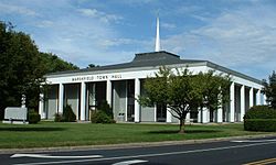
Marshfield Town Hall
|
||
|
||
| Motto(s):
"Home of Daniel Webster"
|
||

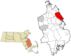
Location in Plymouth County in Massachusetts
|
||
| Country | United States | |
| State | Massachusetts | |
| County | Plymouth | |
| Settled | 1632 | |
| Incorporated | March 1, 1640 | |
| Government | ||
| • Type | Open town meeting | |
| Area | ||
| • Total | 31.7 sq mi (82.2 km2) | |
| • Land | 28.5 sq mi (73.7 km2) | |
| • Water | 3.3 sq mi (8.5 km2) | |
| Elevation | 17 ft (5 m) | |
| Population
(2020)
|
||
| • Total | 25,825 | |
| • Density | 906.1/sq mi (350.4/km2) | |
| Time zone | UTC−5 (Eastern) | |
| • Summer (DST) | UTC−4 (Eastern) | |
| ZIP Code |
02050
|
|
| Area code(s) | 339/781 | |
| FIPS code | 25-38855 | |
| GNIS feature ID | 0619470 | |
Marshfield is a town located in Plymouth County, Massachusetts, United States. It sits on the beautiful South Shore of Massachusetts. In 2020, about 25,825 people lived here.
Marshfield includes several smaller communities called CDPs. These are Marshfield, Marshfield Hills, Ocean Bluff-Brant Rock, and Cedar Crest. It also shares the Green Harbor CDP with the nearby town of Duxbury.
Contents
History of Marshfield
Marshfield was first settled by Europeans in 1632. It officially became a town on March 1, 1640. This makes it one of the older towns in Massachusetts.
Exploring Marshfield's Geography
Marshfield is found on the South Shore of Massachusetts. It's where Cape Cod Bay and Massachusetts Bay meet. The town covers about 31.74 square miles (82.2 square kilometers). Most of this area is land, with some water.
Marshfield is surrounded by other towns. To the south and southeast is Duxbury. To the west is Pembroke. Norwell is to the northwest, and Scituate is to the north. The Massachusetts Bay is to the east.
Rivers and Natural Areas
The town gets its name from the many salt marshes found along its coast. These are wetlands where salt and fresh water mix. Marshfield has three main rivers:
- The North River flows along the town's northern border.
- The South River goes through the town.
- The Green Harbor River flows near Brant Rock.
A part of the town, called the Rexhame-Humarock peninsula, is a special barrier beach. It has a unique hill formation called a moraine. Marshfield also has several forests and nature spots. These include the Daniel Webster Wildlife Sanctuary and the North River Wildlife Sanctuary.
Villages and Beaches
Marshfield has eight different villages. Each has its own feel:
- Marshfield Center
- Fieldston
- Ocean Bluff
- Rexhame
- Brant Rock
- Green Harbor
- Marshfield Hills
- North Marshfield
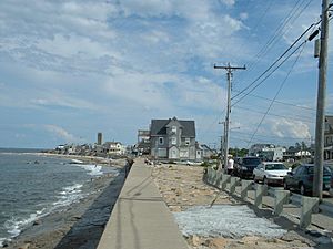
The town is famous for its beautiful public beaches. There are about 5 miles (8 kilometers) of coastline. Some popular beaches include Rexhame, Fieldston, Ocean Bluff, and Green Harbor. Marshfield is a very popular place for summer vacations. Its population almost doubles between Memorial Day and Labor Day!
Marshfield's Population and People
| Historical population | ||
|---|---|---|
| Year | Pop. | ±% |
| 1850 | 1,837 | — |
| 1860 | 1,870 | +1.8% |
| 1870 | 1,659 | −11.3% |
| 1880 | 1,781 | +7.4% |
| 1890 | 1,713 | −3.8% |
| 1900 | 1,810 | +5.7% |
| 1910 | 1,738 | −4.0% |
| 1920 | 1,379 | −20.7% |
| 1930 | 1,625 | +17.8% |
| 1940 | 2,419 | +48.9% |
| 1950 | 3,267 | +35.1% |
| 1960 | 6,748 | +106.6% |
| 1970 | 15,223 | +125.6% |
| 1980 | 20,916 | +37.4% |
| 1990 | 21,531 | +2.9% |
| 2000 | 24,324 | +13.0% |
| 2010 | 25,132 | +3.3% |
| 2020 | 25,825 | +2.8% |
| 2023* | 25,765 | −0.2% |
| * = population estimate. Source: United States Census records and Population Estimates Program data. |
||
In 2000, Marshfield had 24,324 people living there. About 37.4% of homes had children under 18. The average family size was about 3 people.
The population is spread out by age. About 27.4% of residents were under 18. About 9.5% were 65 or older. The average age in Marshfield was 37 years old.
Education in Marshfield
Marshfield has its own school system. It serves almost 4,700 students. The town has five elementary schools, one middle school, and one high school.
Elementary Schools (Grades K-5)
- Edward Winslow Elementary School
- Daniel Webster Elementary School
- Martinson Elementary School
- South River Elementary School
- Eames Way Elementary School
Middle School (Grades 6-8)
- Furnace Brook Middle School
High School (Grades 9-12)
- Marshfield High School
Transportation in Marshfield
Marshfield is connected by several important roads. Massachusetts Route 3, also known as the Pilgrims Highway, runs near the town. You can get onto it using the Route 139 exit. Route 139 also goes through the town, passing along the beaches. Route 3A also runs through Marshfield.
For public transport, there is bus service. These buses connect to train stations in Braintree and South Station in Boston. The closest train station is the Greenbush station in Scituate. You can also take a commuter ferry to Boston from Hingham.
The closest major airport is Logan International Airport in Boston. Marshfield also has its own municipal airport for smaller planes.
Famous People from Marshfield
Many interesting people have lived in Marshfield. Here are a few:
- Steve Carell and Nancy Carell: Famous comedians and actors.
- Joe Castiglione: A well-known baseball radio announcer for the Boston Red Sox.
- Jeff Corwin: A naturalist and host of The Jeff Corwin Experience on Animal Planet.
- Reginald Fessenden: A pioneer in radio technology.
- Joseph Patrick Kennedy II: A former U.S. congressman.
- Lou Merloni: A former Major League Baseball (MLB) player.
- Sean Morey: A former NFL wide receiver.
- Jeremy Roenick: A former National Hockey League (NHL) player.
- Steven Tyler: The lead singer for the famous band Aerosmith.
- Daniel Webster: A very important statesman, orator, and senator in U.S. history.
- Peregrine White: The first English child born in New England.
- Edward Winslow: A Pilgrim and Governor of the Plymouth Colony.
See also
 In Spanish: Marshfield (Massachusetts) para niños
 | Charles R. Drew |
 | Benjamin Banneker |
 | Jane C. Wright |
 | Roger Arliner Young |


