Duxbury, Massachusetts facts for kids
Quick facts for kids
Duxbury, Massachusetts
|
|||
|---|---|---|---|
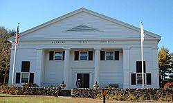
Duxbury Town Offices
|
|||
|
|||
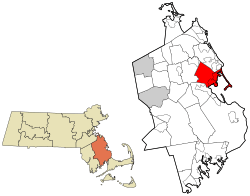
Location of Duxbury in Massachusetts (left) and in Plymouth County (right)
|
|||
| Country | United States | ||
| State | Massachusetts | ||
| County | Plymouth | ||
| Settled | 1624 | ||
| Incorporated | 1637 | ||
| Government | |||
| • Type | Open town meeting | ||
| Area | |||
| • Total | 37.6 sq mi (97.4 km2) | ||
| • Land | 23.8 sq mi (61.5 km2) | ||
| • Water | 13.9 sq mi (35.9 km2) | ||
| Elevation | 36 ft (11 m) | ||
| Population
(2020)
|
|||
| • Total | 16,090 | ||
| • Density | 676.1/sq mi (261.6/km2) | ||
| Time zone | UTC-5 (Eastern) | ||
| • Summer (DST) | UTC-4 (Eastern) | ||
| ZIP code |
02332
|
||
| Area code(s) | 339 / 781 | ||
| FIPS code | 25-17895 | ||
| GNIS feature ID | 0618338 | ||
Duxbury is a historic seaside town in Plymouth County, Massachusetts, United States. It's located on the South Shore, about 35 miles (56 km) southeast of Boston. In 2020, about 16,090 people lived here.
Contents
Duxbury's Past: A Look at History
The land where Duxbury now stands was first lived on by people as early as 12,000 to 9,000 BCE. When European settlers arrived, the Wampanoag people lived here. They called the area Mattakeesett, which means "place of many fish."
Early Settlers and the 17th Century
In 1620, English settlers, known as the Pilgrims, started their colony in nearby Plymouth. They were required to live closely together for seven years. After this time, in 1627, land along the coast was given to settlers for farming.
This land included Duxbury, which was likely named after Myles Standish's family home, Duxbury Hall in Chorley, England. Many settlers began to move away from Plymouth to their new farms.
At first, people only came to Duxbury to farm in the warmer months. They would return to Plymouth for the winter. But soon, they started building homes on their land. They asked the colony for permission to become their own community with a church. Duxbury was officially made a town in 1637. It originally included land that is now Pembroke.
Some of the most important leaders of the colony received land in Duxbury. They became the town's first leaders.
- Captain Myles Standish, the military leader, lived in an area called "the Nook," now known as Standish Shore.
- Elder William Brewster was the religious leader. He led services until Duxbury got its own minister in 1637.
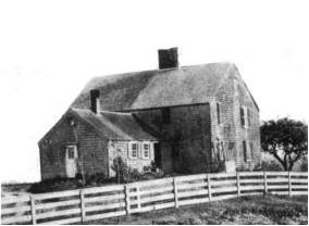
- John Alden was another important settler. His house, now a museum, was a place for many important meetings.
You can find the graves of some of Duxbury's first settlers at the Old Burying Ground on Chestnut Street. This cemetery is next to where the first church meetinghouse stood.
Duxbury was mainly a farming community throughout the 17th and 18th centuries.
Revolutionary Times and Shipbuilding (18th Century)
Duxbury's quiet history changed during the Revolutionary War. Before the war, people in Duxbury strongly opposed the British. Crowds often met to protest the Stamp Act.
In 1775, when news of the Battles of Lexington and Concord arrived, many volunteers from Duxbury joined the fight. They headed towards Marshfield to face the British.
After the Revolutionary War ended in 1783, Duxbury's shipbuilding era began. The new nation gained fishing rights, and families started building large fishing schooners. These schooners led to bigger brigs and then three-masted ships. As merchant families built large fleets, shipyards and other related businesses grew. Duxbury became very successful. By the 1840s, Duxbury had about 20 shipyards. They built around ten large sailing ships each year.
The biggest business in Duxbury was owned by Ezra Weston. He was known as "King Caesar" because of his success. His son, Ezra Weston II, continued to grow the business.
The 19th Century: From Ships to Summer Fun
Lloyd's of London recognized Ezra Weston II as owning the largest fleet in America. His business was huge and important to the town. The King Caesar House is now a museum. By 1837, there were nearly 40 shipyards along Duxbury Bay. These shipyards had support businesses like a foundry (for metal), a sail loft (for sails), and a ropewalk (for ropes).
However, by the 1850s, the demand for shallow-draft ships decreased. Duxbury Bay was too shallow for the new, larger clippers and steamships. Also, railroads started competing with ships for trade. While other Massachusetts towns grew, Duxbury faced a long period of economic decline.
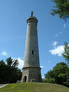
But there was a new opportunity! By the 1870s, Duxbury's quiet countryside and beautiful bay started to attract summer visitors. Duxbury became known as a lovely summer resort. When the Duxbury & Cohasset Railroad was completed in 1871, many city people from Boston could easily visit. Boarding houses opened everywhere. The Miles Standish Hotel became very popular. The Myles Standish monument, finished in 1898, was built because of this increase in tourism.
The 20th Century: Modern Growth

Duxbury continued as a summer destination into the 20th century. However, when Route 3 was built, it became much easier to travel to Boston. This led to thousands of people moving to Duxbury to live there year-round, and the town's population grew even more.
Duxbury's Location and Natural Features
Duxbury covers about 37.6 square miles (97.4 km²). About 23.8 square miles (61.5 km²) is land, and 13.9 square miles (35.9 km²) is water.
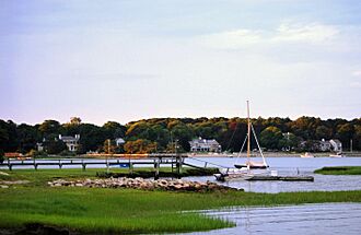
Duxbury is next to Cape Cod Bay to the east. It borders Duxbury Bay, Kingston Bay, and Plymouth to the southeast. To the southwest is Kingston, to the west and northwest is Pembroke, and to the north is Marshfield.
Duxbury is the sixth largest producer of cranberry in Massachusetts. It also has many oyster beds and other shellfish.
The town has many ponds and bogs. The Back River runs along the western edge of Saquish Neck. Many smaller rivers, brooks, and marshes flow into it. Duxbury also has several nature sanctuaries, a conservation area, and forests, especially in the western part of town.
Who Lives in Duxbury? (Demographics)
| Historical population | ||
|---|---|---|
| Year | Pop. | ±% |
| 1850 | 2,679 | — |
| 1860 | 2,597 | −3.1% |
| 1870 | 2,341 | −9.9% |
| 1880 | 2,196 | −6.2% |
| 1890 | 1,908 | −13.1% |
| 1900 | 2,075 | +8.8% |
| 1910 | 1,688 | −18.7% |
| 1920 | 1,553 | −8.0% |
| 1930 | 1,696 | +9.2% |
| 1940 | 2,359 | +39.1% |
| 1950 | 3,167 | +34.3% |
| 1960 | 4,727 | +49.3% |
| 1970 | 7,636 | +61.5% |
| 1980 | 11,807 | +54.6% |
| 1990 | 13,895 | +17.7% |
| 2000 | 14,248 | +2.5% |
| 2010 | 15,059 | +5.7% |
| 2020 | 16,090 | +6.8% |
| 2023* | 16,185 | +0.6% |
| * = population estimate. Source: United States Census records and Population Estimates Program data. |
||
In 2010, there were 15,059 people living in Duxbury. Most residents (98%) were White. About 1.2% of the population identified as Hispanic or Latino.
The average age in Duxbury was 44.8 years. About 22.6% of the population was under 15 years old.
The median income for a household in Duxbury was $117,124. This means that half of the households earned more than this amount, and half earned less.
Learning in Duxbury: Schools
Duxbury has its own public school system for about 3,400 students. It serves students from preschool through 12th grade.
- Chandler School teaches students from pre-kindergarten to second grade.
- Alden Elementary School serves grades 3–5.
- Duxbury Middle/High School is a combined building for grades 6–12.
Duxbury's sports teams are called the Dragons. Their colors are green and white. Their main rival is Marshfield High School.
Private Schools in Duxbury
There are two private schools in Duxbury:
- Bay Farm Montessori Academy is for Toddlers through grade 8.
- Good Shepherd Christian Academy serves students from kindergarten through eighth grade.
Getting Around Duxbury: Transportation
Bus Services
Several bus lines pass through Duxbury:
- The local Greater Attleboro Taunton Regional Transit Authority (GATRA) bus stops at Halls Corner, Island Creek, Millbrook Motors, and the Duxbury Free Library.
- The P&B Line (Plymouth & Brockton) also stops at Millbrook Motors.
- The Greyhound Bus Line, which offers national service, stops at Millbrook Motors too.
Roads and Highways
Route 3, also known as the Pilgrims Highway, goes through Duxbury. Exits 20 and 22 provide access to the town. Other routes that pass through Duxbury include 3A, 14, 53, and 139. Routes 14 and 139 end in Duxbury.
Other Transportation
Duxbury does not have train or air service. There are no special paths for bicycles, and only some roads have sidewalks.
Famous People from Duxbury
Many notable people have connections to Duxbury:
- Ichabod Alden, an officer in the American Revolutionary War.
- John Alden, a Mayflower immigrant and one of Duxbury's founders.
- Elder William Brewster, a Pilgrim leader and a founder of Duxbury.
- Juliana Hatfield, an indie rock singer.
- Joe Perry, the lead guitarist for the band Aerosmith.
- Myles Standish, a Mayflower settler and a Duxbury founder.
- Ezra Weston II, a famous 19th-century shipbuilding merchant.
Cool Places to Visit in Duxbury
- Art Complex Museum: This museum has the Carl A. Weyerhaeuser collection of art.
- Duxbury Beach: A popular spot for swimming and relaxing.
- Duxbury Free Library: The town's public library.
- First Parish Church, Unitarian Universalist: Founded in 1632 by the Pilgrims, it was the second church in the Plymouth Colony.
- John Alden House: Built in 1653, this was the home of Pilgrim John Alden.
- King Caesar House: A museum that was once the home of Ezra Weston II, the famous shipbuilder.
- Myles Standish Burial Ground: A historic cemetery where some of the first Pilgrims are buried.
- Myles Standish Monument State Reservation: A tall monument honoring Myles Standish.
- North Hill Marsh Pond: A nature sanctuary with a forest, bike trails, and a 90-acre (36 ha) pond.
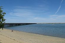
- Powder Point Bridge: A wooden bridge built in 1892. It was once in the Guinness World Records as the longest and oldest wooden bridge in the world. It was rebuilt in 1986 after a fire and is still standing today. The bridge has been featured in movies like The Equalizer 2.
- Tree of Knowledge Corner: A historic intersection where mail carriers used to leave mail in boxes nailed to a tree. An engraved stone now marks the spot.
Duxbury in the Media
Newspapers
- The Duxbury Clipper
- The Duxbury Reporter (online only)
Television
- Duxbury Community Television (Comcast; Channel 14-Verizon; Channel 38)
- Duxbury Government (Comcast; Channel 15-Verizon; Channel 39)
- Dragon TV (Comcast; Channel 14-Verizon; Channel 38)
Radio
- WDSU, an internet radio station.
See also
 In Spanish: Duxbury (Massachusetts) para niños
 | Percy Lavon Julian |
 | Katherine Johnson |
 | George Washington Carver |
 | Annie Easley |


