
Kingston, Massachusetts facts for kids
Quick facts for kids
Kingston, Massachusetts
|
|||||
|---|---|---|---|---|---|

Green street
|
|||||
|
|||||
| Nickname(s): | |||||

Location in Plymouth County in Massachusetts
|
|||||
| Country | United States | ||||
| State | Massachusetts | ||||
| County | Plymouth | ||||
| Settled | 1620 | ||||
| Incorporated | 1726 | ||||
| Government | |||||
| • Type | Open town meeting | ||||
| Area | |||||
| • Total | 20.5 sq mi (53.1 km2) | ||||
| • Land | 18.6 sq mi (48.3 km2) | ||||
| • Water | 1.9 sq mi (4.8 km2) | ||||
| Elevation | 105 ft (34 m) | ||||
| Population
(2020)
|
|||||
| • Total | 13,708 | ||||
| • Density | 668.6/sq mi (258.15/km2) | ||||
| Time zone | UTC-5 (Eastern) | ||||
| • Summer (DST) | UTC-4 (Eastern) | ||||
| ZIP code |
02364
|
||||
| Area code(s) | 339 / 781 | ||||
| FIPS code | 25-33220 | ||||
| GNIS feature ID | 0619469 | ||||
| Website | www.kingstonma.gov | ||||


.jpg)
Kingston is a town located on the coast in Plymouth County, Massachusetts, United States. In 2020, about 13,708 people lived there.
Contents
History of Kingston
Before European settlers arrived, the land that is now Kingston was home to the Wampanoag people. Sadly, many Wampanoag people became very sick from a rapidly spreading illness between 1616 and 1619. This happened because they had met Europeans earlier. Several old Native American burial sites have been found in Kingston.
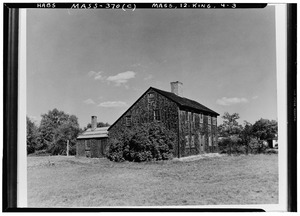
Kingston was first settled by Europeans shortly after the Pilgrims landed at Plymouth Rock in 1620. It was settled again in 1635. In 1675, some fierce battles during King Philip's War are thought to have happened in Kingston. The home of Governor Bradford, which is now in Kingston, was attacked by Wampanoag warriors.
In 1685, the area became part of Plymouth County. For a short time, from 1686 to 1689, Kingston was part of the Dominion of New England.
Kingston officially became a separate town on June 16, 1726. Before that, it was known as Plymouth's northern area. This change happened after a disagreement about taxes between the people living in the north and south parts of Plymouth. Kingston's boundaries were created from parts of nearby towns like Plymouth, Duxbury, Plympton, and Pembroke.
Kingston is home to the longest continuously running boat yard in North America, now called the Jones River Landing. An American Revolutionary War ship, the USS Independence, was built by Kingston shipbuilders on the Jones River. This ship is now a symbol of the town and is shown on the Kingston town seal. However, the Independence was captured in battle off the coast of Nova Scotia by two British ships, HMS Hope and HMS Nancy.

In the early to mid-1800s, Kingston was a busy center for shipbuilding and ice harvesting. Silver Lake, the largest freshwater body in town, was used to collect ice during the long New England winters. This ice was then shipped all over the world. The lake was even renamed Silver Lake for marketing during the peak of the ice export business. Kingston also had the first co-op store in North America, which closed in 1954.
On April 14, 1857, Kingston added a small part of Duxbury to its land. This was the last time the town's borders changed.
In the 1950s, Kingston changed from a small rural town to a part of the Boston area. This happened when Massachusetts Route 3 was built, connecting Boston to Cape Cod. This highway has two exits in Kingston.
Kingston's population grew the most in the 1990s. This was when the Old Colony Railroad reopened as a commuter rail line, connecting Kingston to Boston. This made Kingston a good place for people who work in Boston to live. More recently, four large wind turbines have been built in Kingston, near Route 3.
Geography and Natural Features
Kingston covers about 53.1 square kilometers (20.5 square miles). About 48.3 square kilometers (18.6 square miles) is land, and 4.8 square kilometers (1.9 square miles) is water. Kingston is next to Pembroke to the north, Duxbury to the northeast, Plymouth to the south, Carver to the southwest, and Plympton to the west. Kingston is about 56 kilometers (35 miles) south-southeast of Boston.
Kingston is on Kingston Bay, which is part of the larger Plymouth Bay. The Jones River flows through the town, starting from Silver Lake and emptying into the bay. There are also several smaller streams and ponds in town, like Muddy Pond. A state forest in the southern part of town is popular for biking, off-roading, and hunting. Kingston also has Gray's Beach, located in a neighborhood called Rocky Nook.
The highest natural point in Kingston is Monk's Hill, which is 95 meters (313 feet) high.
Transportation in Kingston
.jpg)
Massachusetts Route 3, also known as the Pilgrims Highway, runs through the eastern part of town. There are three exits for Kingston on this highway. The new highway part of U.S. Route 44 also goes through the southern part of town. Other state routes like 27, 53, 80, and 106 all end in Kingston.
Kingston is the last stop on the Kingston line of the MBTA's Commuter Rail system. This train connects Kingston to Boston. Local transportation is provided by GATRA. You can also find regional flights at Plymouth Municipal Airport. For national and international flights, the closest airport is Logan International Airport in Boston.
The Claire Saltonstall Bikeway, also called Bike Route 1, runs through the southern part of town. It is 217 kilometers (135 miles) long and goes from Boston to Cape Cod, with about 4.8 kilometers (3 miles) passing through Kingston.
Population of Kingston
| Historical population | ||
|---|---|---|
| Year | Pop. | ±% |
| 1850 | 1,591 | — |
| 1860 | 1,655 | +4.0% |
| 1870 | 1,604 | −3.1% |
| 1880 | 1,524 | −5.0% |
| 1890 | 1,659 | +8.9% |
| 1900 | 1,955 | +17.8% |
| 1910 | 2,445 | +25.1% |
| 1920 | 2,505 | +2.5% |
| 1930 | 2,672 | +6.7% |
| 1940 | 2,783 | +4.2% |
| 1950 | 3,461 | +24.4% |
| 1960 | 4,302 | +24.3% |
| 1970 | 5,999 | +39.4% |
| 1980 | 7,362 | +22.7% |
| 1990 | 9,045 | +22.9% |
| 2000 | 11,780 | +30.2% |
| 2010 | 12,629 | +7.2% |
| 2020 | 13,708 | +8.5% |
| 2023* | 13,948 | +1.8% |
| * = population estimate. Source: United States Census records and Population Estimates Program data. |
||
In 2020, the population of Kingston was 13,708 people.
Education in Kingston
Kingston is part of the Silver Lake Regional School District, along with the towns of Halifax and Plympton. While these towns share a middle school and a high school, each town has its own elementary schools. Kingston has the Kingston Elementary School and Kingston Intermediate School for students from kindergarten through sixth grade.
After sixth grade, students go to Silver Lake Regional Middle School. Then, from ninth grade, they attend Silver Lake Regional High School. Both of these schools are located in Kingston. The sports teams at Silver Lake are called the Lakers, and their colors are red and silver. Their main rival is Pembroke High School. A new Silver Lake High School building was finished in January 2006.
Kingston is also home to the private Roman Catholic Sacred Heart School. It serves students from kindergarten through eighth grade.
Media in Kingston
Television
Kingston receives TV news from both the Boston and Providence, Rhode Island areas. This includes channels like WCVB (ABC), WBZ (CBS), WBTS (NBC), and WFXT (Fox) from Boston.
Newspapers
Kingston has had many different newspapers over the years. The Kingston Reporter covered local news from 1984 until it stopped printing in August 2022. Today, Kingston news is still covered by larger newspapers like the Boston Globe, Boston Herald, The Patriot Ledger, and the Brockton Enterprise.
Notable People from Kingston

Many interesting people have connections to Kingston:
- Isaac Allerton (Plymouth Colony assistant governor), an early trader and diplomat in colonial America.
- William Bradford, who was the Governor of Plymouth Colony several times.
- William Bradford, son of Governor William Bradford and Deputy Governor of Plymouth County.
- John Howland, a passenger on the Mayflower ship.
- John Thomas, a Major General in the Continental Army during the American Revolution.
- Thomas Willett, the first and third Mayor of New York City.
- Chris Cooper, an actor.
- Marianne Leone Cooper, an actress.
- Neil Cicierega, an internet personality and musician.
- Rich Cronin, a singer and songwriter from the group LFO.
- Matt Hawrilenko, a professional poker player.
- Tim Murphy, the head coach for Harvard Football.
See also
 In Spanish: Kingston (Massachusetts) para niños
