Plymouth Bay facts for kids
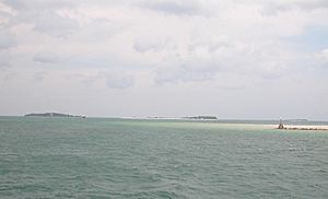
Plymouth Bay is a small, safe bay located on the western coast of Cape Cod Bay in Massachusetts. This bay is very important in history because the Pilgrims landed here at Plymouth Rock in 1620. They arrived on their ship, the Mayflower, and started the first lasting European settlement in North America at Plymouth Colony.
Contents
What is Plymouth Bay?
Plymouth Bay is a part of the bigger Cape Cod Bay. It's also sometimes seen as part of Massachusetts Bay, which stretches between Cape Ann in the north and Cape Cod in the south. This bay is in the southern part of the Gulf of Maine, which is in the northern Atlantic Ocean.
Three towns in Massachusetts share the waters of Plymouth Bay:
- Plymouth is in the southern part of the bay.
- Duxbury is in the northern part.
- Kingston is in the westernmost area.
Natural Features of Plymouth Bay
Plymouth Bay has some key natural features that make it special:
- Plymouth Beach: This is a three-mile long barrier beach. It protects Plymouth Harbor from the rough waves of Cape Cod Bay.
- Saquish Neck: To the north, this is another barrier beach, nearly seven miles long. It also helps protect the bay.
Plymouth Beach and Saquish Neck create an opening about a mile wide. This opening connects the bay to the open sea, allowing boats to easily pass through.
Smaller Bays and Coves
Inside Plymouth Bay, there are two smaller bays and one cove:
- Kingston Bay: Located in the northern part of Plymouth Bay.
- Duxbury Bay: Also in the northern part of Plymouth Bay.
- Warren Cove: Found in the southern part of Plymouth Bay, between Plymouth Beach and Rocky Point.
Peninsulas and Rivers
Several land areas stick out into Plymouth Bay, forming peninsulas:
- Rocky Nook: A busy coastal area in Kingston.
- Powder Point: Located in Duxbury.
Plymouth Bay also has one island where people live all year round:
- Clark's Island: This island is in the northern part of the bay and is managed by Plymouth.
The bay is also where several important rivers flow into the sea, like the Jones River in Kingston and the Eel River in Plymouth.
Water Depth and Mud Flats
Even though many boats use Plymouth Bay, it's not very deep. The deepest parts, west of Fort Standish, are about 35 feet deep. However, most of the bay has rolling mud flats that are only 6 to 42 inches deep.
Most of these mud flats are in Kingston Bay and Duxbury Bay. They often become completely exposed (you can see the mud) when the tide is low. The biggest mud flat is Ichabod's Flat in Kingston Bay.
These mud flats in Kingston Bay are used for collecting shellfish and clamming. They are a good place for this because Plymouth Bay can protect itself from red tide, which sometimes affects other parts of the Massachusetts coast.
See also
 In Spanish: Bahía de Plymouth para niños
 | Jackie Robinson |
 | Jack Johnson |
 | Althea Gibson |
 | Arthur Ashe |
 | Muhammad Ali |


