Springfield metropolitan area, Missouri facts for kids
Quick facts for kids
Springfield metropolitan area, Missouri
|
|
|---|---|
| Springfield, Missouri Metropolitan Statistical Area | |
| Country | |
| State | |
| Principal city | Springfield |
| Other cities | Battlefield Nixa Ozark Republic Marshfield Bolivar Willard |
| Area | |
| • Total | 3,021 sq mi (7,820 km2) |
| Population
(2020 census)
|
|
| • Total | 475,432 |
| • Rank | 117th in the U.S. |
| Time zone | UTC−7 (CST) |
| • Summer (DST) | UTC−6 (CDT) |
| Historical population | |||
|---|---|---|---|
| Census | Pop. | %± | |
| 1960 | 126,274 | — | |
| 1970 | 152,929 | 21.1% | |
| 1980 | 207,704 | 35.8% | |
| 1990 | 240,593 | 15.8% | |
| 2000 | 368,374 | 53.1% | |
| 2010 | 436,712 | 18.6% | |
| 2020 | 475,432 | 8.9% | |
| [1] | |||
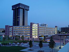
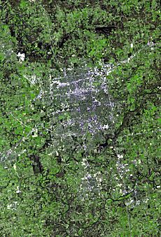
The Springfield, Missouri, metropolitan area is a large region in southwestern Missouri. It includes five counties and has the city of Springfield as its main center. Springfield is the third-largest city in Missouri. Other important towns in this area are Nixa, Ozark, Republic, Bolivar, Marshfield, and Willard.
As of 2020, over 475,000 people lived in this metropolitan area. It was the fastest-growing metro area in Missouri at that time. The region is home to several colleges and universities, like Missouri State University and Drury University. Many big companies also have their main offices here, such as Bass Pro Shops and O'Reilly Auto Parts. In 2019, the Springfield area produced about $20.8 billion in goods and services, making it the third-largest economy in Missouri.
Contents
Understanding the Springfield Metro Area
The Springfield metropolitan area is officially called a Metropolitan Statistical Area (MSA) by the United States government. This means it's a region with a large population center and nearby areas that are closely connected. People often live in one part of the MSA and work in another.
Counties that Make Up the Metro Area
The Springfield metropolitan area includes five counties. These counties work together to form the larger region.
| County | 2023 Census Estimate | 2020 Census | 2010 Census | Change |
|---|---|---|---|---|
| Greene County | 304,611 | 298,915 | 275,174 | +8.63% |
| Christian County | 94,422 | 88,842 | 77,422 | +14.75% |
| Webster County | 41,472 | 39,085 | 36,202 | +7.96% |
| Polk County | 32,780 | 31,519 | 31,137 | +1.23% |
| Dallas County | 17,768 | 17,071 | 16,777 | +1.75% |
| Total | 491,053 | 475,432 | 436,712 | +8.87% |
Cities and Towns in the Area
The Springfield metro area has several cities and many smaller towns.
Main Cities in the Metro Area
- Springfield (Population: 169,176)
- Nixa (Population: 23,257)
- Ozark (Population: 21,284)
Larger Towns (5,000 to 20,000 people)
- Republic (Population: 18,750)
- Bolivar (Population: 10,679)
- Marshfield (Population: 7,458)
- Willard (Population: 6,344)
- Battlefield (Population: 5,990)
Smaller Communities
There are also many other smaller towns and villages in the Springfield metropolitan area. These include places like Rogersville, Buffalo, Clever, Strafford, and Seymour. Many even smaller communities and unincorporated areas also exist throughout the five counties.
Education in the Springfield Area
The Springfield metropolitan area offers many educational opportunities, from public schools to large universities.
Local School Districts
Many school districts serve the children and teens living in the Springfield metro area. Some of the larger districts include:
- Ash Grove R-IV School District
- Billings R-IV School District
- Bolivar R-1 School District
- Chadwick School District
- Clever R-V School District
- Dallas Co. R-1 School District
- Fair Grove R-10 School District
- Fordland R-III School District
- Greenwood Laboratory School
- Logan-Rogersville R-VIII School District
- Marion C Early R-V (Morrisville) School District
- Marshfield R-I School District
- Niangua R-V School District
- Nixa R-II School District
- Ozark R-VI School District
- Pleasant Hope R-VI School District
- Republic R-III School District
- Seymour R-II School District
- Spokane R-VII School District
- Springfield Catholic Schools
- Springfield R-12 School District
- Strafford R-VI School District
- Walnut Grove R-V School District
- Willard R-2 School District
High Schools and Their Achievements
Springfield Public Schools is the biggest school district in Missouri. It has almost 25,000 students. Nixa Public Schools, just south of Springfield, is also growing fast. Nixa schools often have high scores on the ACT test. They have also received the highest state award for academic success for many years. Other growing school districts are found in Ozark, Republic, Strafford, and Marshfield.
There are also private schools like the Greenwood Laboratory School in Springfield. This school is located on the Missouri State campus. Other private religious schools include Springfield Catholic and Springfield Lutheran.
Colleges and Universities for Higher Learning
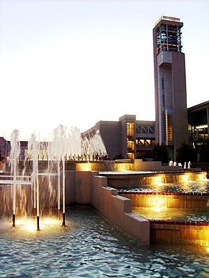
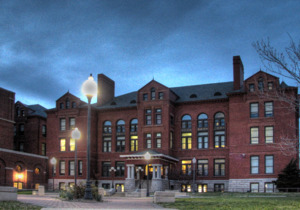
Missouri State University in Springfield is the second-largest university in Missouri. It had about 23,697 students in 2019. Other universities in Springfield include Drury University, a private college with over 1,000 students. OTC is also in Springfield, with about 11,000 students. At OTC, students can earn a one-year certificate or a two-year associate degree. Evangel University is another private Christian university in the city.
Economy and Jobs
Springfield is an important center for business and jobs in the region.
Major Companies and Industries
Springfield is home to the main offices of several large companies. These include O'Reilly Auto Parts, which is a Fortune 500 company. Other major companies with headquarters here are Bass Pro Shops, CoxHealth, Andy's Frozen Custard, and Jack Henry & Associates.
The Springfield–Branson National Airport is a base for American Airlines and Envoy Air. They use the airport for airplane maintenance. Springfield is also a key location for call centers. Companies like Expedia, Chase, and AT&T have call centers in the city.
Media and News
Springfield is the center of its own media market. This means it's where many TV, radio, and newspaper companies are based for the surrounding area. It's the 75th largest media market in the United States.
Newspapers in the Area
The main newspaper for the Springfield area is the Springfield News-Leader. There are also business journals and magazines like 417 magazine. Smaller towns in the area have their own local newspapers, such as Headliner News for Christian County and The Marshfield Mail for Marshfield.
Television Stations
Here are some of the television stations you can watch in the Springfield metro area:
- KYTV channel 3 (NBC)
- KOLR channel 10 (CBS)
- KYCW channel 15 (The CW)
- KOZK channel 21 (PBS)
- KOZL channel 27 (MyNetworkTV)
- KSPR channel 33 (ABC)
- KRBK channel 49 (Fox)
Getting Around: Transportation
The Springfield area has different ways to travel, from major highways to public buses and walking trails.
Main Highways for Travel
Several important highways pass through the Springfield metropolitan area:
 I-44 – This highway goes east to St. Louis and west to Tulsa.
 US 60 – This road goes east towards Louisville and west to Monett.
 US 65 – This highway heads south to Little Rock and north to Des Moines.
 US 160 – This route goes west to Wichita.
 Route 13 – This road goes north to Kansas City.
 Route 14 – This route connects Nixa and Ozark.
 Route 125 – This road runs between Strafford and Rogersville.
Airports for Flying
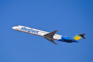
The main airport is Springfield-Branson National Airport. You can fly directly from here to many cities across the United States. Before the COVID-19 pandemic, over one million passengers used this airport each year. It's one of the fastest-growing airports of its size. A new terminal opened in 2007 with 10 gates. The runways are big enough for large planes like the Boeing 747.
Springfield also has a smaller airport called Downtown Airport. This airport is mostly used by smaller private planes and does not have passenger flights.
Public Transportation Options
In Springfield, City Utilities of Springfield runs the public bus system, called Springfield Transit Services. Buses travel on many different routes throughout the city. Bus service is available every day of the year, though less often on weekends, holidays, and evenings.
Greenway Trails for Outdoor Fun
The Springfield area has a growing network of Greenway trails. These trails are paths for walking, running, and biking. About 70 miles (112 km) of trails run through parks and green spaces. Another 81 miles (130 km) are located on city streets. Some popular routes include The Link, which goes through Springfield, and the Frisco Link, which connects Springfield with Bolivar to the north.
See also
 In Spanish: Área metropolitana de Springfield (Misuri) para niños
 | Tommie Smith |
 | Simone Manuel |
 | Shani Davis |
 | Simone Biles |
 | Alice Coachman |


