
Martin Creek (Chestatee River tributary) facts for kids
Martin Creek is a small stream located in Georgia. It flows into the Chestatee River, which is like a smaller river that joins a bigger one. Martin Creek is about 1.24 miles (2.00 km) long.
Where Martin Creek Flows
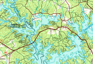
Martin Creek starts in western Hall County. It begins in the middle of a piece of land almost surrounded by water, called a peninsula. This peninsula is created by parts of Lake Lanier. To the west is the Chestatee River part of the lake. To the east is the Chattahoochee River part of the lake. State Route 53 is to the north.
This area has only Martin Creek. There are no other named or unnamed streams here. The creek flows south, then turns southwest. It travels for about 1.2 miles. Finally, it flows into the Chestatee River and Lake Lanier. This happens just north of where the Chestatee and Chattahoochee parts of the lake meet. Here, Martin Creek joins the Chestatee River, which is now under the lake's water.
Martin Creek's Watery Home
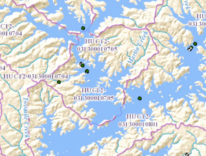
A watershed is an area of land where all the water drains into a single stream, river, or lake. The land around Martin Creek is part of a special watershed. The United States Geological Survey (USGS) gives this area a special code: HUC 031300010705. It is called the Martin Creek-Lake Sidney Lanier sub-watershed.
This watershed covers about 8 square miles. It is located west of Gainesville and northeast of Chestatee. The watershed stretches south to where the two rivers meet underwater. It goes west to the crossing of State Route 306 and State Route 53 in Forsyth County. It also extends east to Fork Road, which is west of State Route 53 in Hall County.
