Marysville, Kansas facts for kids
Quick facts for kids
Marysville, Kansas
|
|
|---|---|
|
City and County seat
|
|
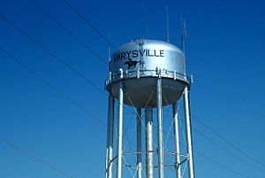
Marysville water tower (2009)
|
|
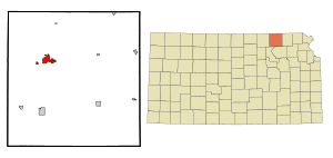
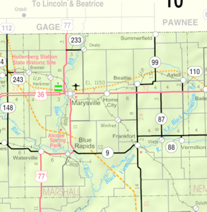
Location within Marshall County and Kansas
|
|
|
|
| Country | United States |
| State | Kansas |
| County | Marshall |
| Platted | 1855 |
| Incorporated | 1861 |
| Area | |
| • Total | 4.61 sq mi (11.94 km2) |
| • Land | 4.58 sq mi (11.86 km2) |
| • Water | 0.03 sq mi (0.08 km2) |
| Elevation | 1,234 ft (376 m) |
| Population
(2020)
|
|
| • Total | 3,447 |
| • Density | 747.7/sq mi (288.69/km2) |
| Time zone | UTC-6 (CST) |
| • Summer (DST) | UTC-5 (CDT) |
| ZIP codes |
66508, 66555
|
| Area code | 785 |
| FIPS code | 20-45050 |
| GNIS ID | 485620 |
Marysville is a city in Kansas, United States. It is also the county seat of Marshall County. This means it is the main town where the county government offices are located.
In 2020, about 3,447 people lived in Marysville.
Contents
History of Marysville
Marysville was founded in 1855 by Francis J. Marshall. In the same year, it was chosen as the county seat. The city officially became an incorporated city in 1861.
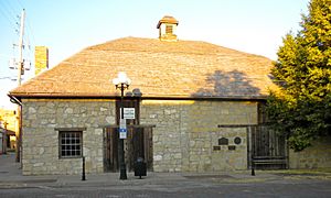
Marysville was an important stop on several historic routes. These included the famous Oregon Trail and the Pony Express route. The Pony Express was a fast mail service that used horse riders. The old Pony Express Station building can still be seen in downtown Marysville today.
The city's growth was greatly helped by the Union Pacific Railroad. The railroad became a major employer for many people in Marysville. Over time, the train tracks caused traffic delays in the city center. To solve this, the main rail line was moved outside the town in 2006.
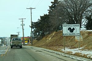
Marysville is also known as the "Black Squirrel City." This is because a special group of all-black squirrels lives in the town. People say these squirrels might have escaped from a traveling circus long ago.
Geography and Climate
Marysville is located in the northeast part of Kansas. It is close to the border with Nebraska. The city is about 75 miles (120 km) northwest of Topeka, the capital of Kansas. It is also about 67 miles (108 km) south of Lincoln, Nebraska.
City Area and Water
The total area of Marysville is about 4.62 square miles (11.94 square kilometers). Most of this area, about 4.58 square miles (11.86 square kilometers), is land. A very small part, about 0.04 square miles (0.08 square kilometers), is water.
Marysville's Weather
| Climate data for Marysville, Kansas (1991–2020 normals, extremes 1950–present) | |||||||||||||
|---|---|---|---|---|---|---|---|---|---|---|---|---|---|
| Month | Jan | Feb | Mar | Apr | May | Jun | Jul | Aug | Sep | Oct | Nov | Dec | Year |
| Record high °F (°C) | 71 (22) |
84 (29) |
92 (33) |
97 (36) |
102 (39) |
108 (42) |
112 (44) |
110 (43) |
109 (43) |
97 (36) |
87 (31) |
74 (23) |
112 (44) |
| Mean maximum °F (°C) | 60.4 (15.8) |
67.4 (19.7) |
79.2 (26.2) |
86.6 (30.3) |
91.5 (33.1) |
96.0 (35.6) |
100.4 (38.0) |
99.4 (37.4) |
94.8 (34.9) |
88.8 (31.6) |
74.0 (23.3) |
63.6 (17.6) |
102.1 (38.9) |
| Mean daily maximum °F (°C) | 38.2 (3.4) |
43.3 (6.3) |
55.3 (12.9) |
65.7 (18.7) |
75.7 (24.3) |
85.6 (29.8) |
90.2 (32.3) |
88.6 (31.4) |
81.2 (27.3) |
69.2 (20.7) |
54.2 (12.3) |
42.2 (5.7) |
65.8 (18.8) |
| Daily mean °F (°C) | 26.7 (−2.9) |
31.3 (−0.4) |
42.5 (5.8) |
52.8 (11.6) |
63.7 (17.6) |
73.9 (23.3) |
78.5 (25.8) |
76.3 (24.6) |
67.9 (19.9) |
55.3 (12.9) |
41.9 (5.5) |
30.9 (−0.6) |
53.5 (11.9) |
| Mean daily minimum °F (°C) | 15.3 (−9.3) |
19.3 (−7.1) |
29.6 (−1.3) |
40.0 (4.4) |
51.6 (10.9) |
62.1 (16.7) |
66.8 (19.3) |
64.1 (17.8) |
54.5 (12.5) |
41.4 (5.2) |
29.5 (−1.4) |
19.5 (−6.9) |
41.1 (5.1) |
| Mean minimum °F (°C) | −5.8 (−21.0) |
−0.4 (−18.0) |
9.9 (−12.3) |
23.3 (−4.8) |
35.3 (1.8) |
48.3 (9.1) |
54.5 (12.5) |
52.0 (11.1) |
37.5 (3.1) |
24.0 (−4.4) |
13.2 (−10.4) |
0.8 (−17.3) |
−9.6 (−23.1) |
| Record low °F (°C) | −21 (−29) |
−28 (−33) |
−18 (−28) |
6 (−14) |
15 (−9) |
35 (2) |
42 (6) |
44 (7) |
27 (−3) |
11 (−12) |
−3 (−19) |
−27 (−33) |
−28 (−33) |
| Average precipitation inches (mm) | 0.83 (21) |
1.07 (27) |
2.11 (54) |
3.09 (78) |
4.86 (123) |
4.91 (125) |
4.65 (118) |
3.61 (92) |
3.28 (83) |
2.52 (64) |
1.50 (38) |
1.17 (30) |
33.60 (853) |
| Average snowfall inches (cm) | 4.9 (12) |
4.3 (11) |
1.5 (3.8) |
0.7 (1.8) |
0.0 (0.0) |
0.0 (0.0) |
0.0 (0.0) |
0.0 (0.0) |
0.0 (0.0) |
0.1 (0.25) |
1.0 (2.5) |
3.3 (8.4) |
15.8 (40) |
| Average precipitation days (≥ 0.01 in) | 4.7 | 5.2 | 6.8 | 9.3 | 11.3 | 11.1 | 10.5 | 10.1 | 8.9 | 7.7 | 5.8 | 5.0 | 96.4 |
| Average snowy days (≥ 0.1 in) | 2.1 | 2.1 | 0.9 | 0.2 | 0.0 | 0.0 | 0.0 | 0.0 | 0.0 | 0.2 | 0.6 | 1.3 | 7.4 |
| Source: NOAA | |||||||||||||
Population and People
| Historical population | |||
|---|---|---|---|
| Census | Pop. | %± | |
| 1860 | 171 | — | |
| 1870 | 300 | 75.4% | |
| 1880 | 1,249 | 316.3% | |
| 1890 | 1,913 | 53.2% | |
| 1900 | 2,006 | 4.9% | |
| 1910 | 2,260 | 12.7% | |
| 1920 | 3,048 | 34.9% | |
| 1930 | 4,013 | 31.7% | |
| 1940 | 4,055 | 1.0% | |
| 1950 | 3,866 | −4.7% | |
| 1960 | 4,143 | 7.2% | |
| 1970 | 3,588 | −13.4% | |
| 1980 | 3,670 | 2.3% | |
| 1990 | 3,359 | −8.5% | |
| 2000 | 3,271 | −2.6% | |
| 2010 | 3,294 | 0.7% | |
| 2020 | 3,447 | 4.6% | |
| U.S. Decennial Census | |||
Marysville's Population in 2020
According to the 2020 United States census, Marysville had 3,447 people. There were 1,458 households, which are groups of people living together. The population density was about 755.6 people per square mile.
Most of the people living in Marysville were white (91.21%). About 6.18% of the population identified as being from two or more races. About 3.95% of the population was Hispanic or Latino.
About 25.4% of the people were under 18 years old. The median age in the city was 40.0 years. This means half the people were younger than 40 and half were older.
Marysville's Population in 2010
In the census of 2010, Marysville had 3,294 people. There were 1,468 households. The population density was about 719.2 people per square mile.
Most of the people were White (96.7%). About 2.6% of the population was Hispanic or Latino.
About 24% of the residents were under 18 years old. The median age in the city was 41.8 years.
Education in Marysville
The public schools in Marysville are part of the Marysville USD 364 school district. This district serves the community's students.
Famous People from Marysville
Many notable people have come from Marysville, including:
- Helen Arnold, who was a legislator in the Oklahoma House of Representatives.
- Kenneth Dam, who served as the Deputy Secretary of State.
- Brian Duensing, a professional baseball player.
- Ralph Elliott, an accountant famous for his Elliott Wave Theory.
- Louis Hardin, also known as Moondog, a talented composer, musician, and poet.
- Michael McClure, a well-known poet and playwright.
- Kendra Wecker, a collegiate and professional basketball player.
See also
 In Spanish: Marysville (Kansas) para niños
 | Kyle Baker |
 | Joseph Yoakum |
 | Laura Wheeler Waring |
 | Henry Ossawa Tanner |


