Masaya Volcano facts for kids
Quick facts for kids Masaya Volcano |
|
|---|---|
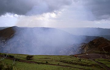
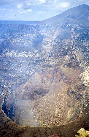
View of the crater.
|
|
| Highest point | |
| Elevation | 635 m (2,083 ft) |
| Geography | |
| Location | Masaya, Nicaragua |
| Parent range | Central American Volcanic Belt |
| Geology | |
| Age of rock | ~9,000 years |
| Mountain type | Caldera |
| Volcanic arc/belt | Central American Volcanic Belt |
| Last eruption | 2015-present |
Masaya (which means Spanish: Volcán Masaya in Spanish) is a large caldera in Nicaragua. It is located about 20 kilometers (12 miles) south of the capital city, Managua.
Masaya is special because it was Nicaragua's very first and largest national park. It is one of 78 protected natural areas in the country. This volcano is actually a group of connected craters and larger bowl-shaped areas called calderas. The biggest one is called Las Sierras.
Inside this large caldera, there's a smaller volcano, which is the Masaya Volcano itself. This part is a shield volcano, which means it's wide and gently sloped, like a warrior's shield. It's made from lava and volcanic ash. It also has a crater at its top.
The main Masaya caldera formed about 2,500 years ago. This happened after a huge eruption that sent out a lot of volcanic material. Since then, new volcanic cones have grown inside this caldera. These include the Masaya and Nindiri cones.
Masaya is always active, letting out large amounts of sulfur dioxide gas from its Santiago crater. Scientists study this gas to understand how the volcano behaves. They also check for things like acid rain and possible health risks.
Volcano's Past and Activity
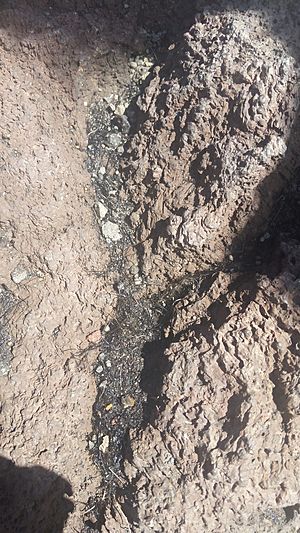
The ground inside Masaya caldera is mostly covered by rough ʻaʻā lava. This shows that new lava flows have happened in the last 1,000 years. However, only two major lava flows have occurred since the 1500s.
One flow happened in 1670. It came from the Nindiri crater, which at that time had a wide lake of lava. The other flow was in 1772. It came from a crack on the side of the Masaya cone.
Since 1772, lava has only appeared in the Santiago pit crater. This crater is active today and constantly releases gas. Lava might have also appeared in Nindiri crater in 1852. A lake now sits at the far eastern end of the caldera.
Even though Masaya mostly releases gas, it has had some sudden explosions in the last 50 years. On November 22, 1999, satellites detected a hot spot, suggesting a possible explosion.
On April 23, 2001, the crater exploded. This created a new opening at the bottom of the crater. The explosion threw rocks up to 60 centimeters (2 feet) wide. These rocks flew as far as 500 meters (1,640 feet) from the crater. Some cars in the visitor area were damaged, and one person was hurt.
Another eruption cloud was seen on October 4, 2003. The cloud rose about 4.6 kilometers (2.8 miles) high. In 2008, the volcano erupted, sending out ash and steam.
Scientists keep a close eye on Masaya. They use special equipment to measure the gases coming from the volcano. This helps them predict when the volcano might become more active.
On March 4, 2020, a famous tightrope walker named Nik Wallenda walked across a steel cable over the caldera.
Masaya Volcano National Park
In 1979, Masaya became Nicaragua's first national park. It is officially called Masaya Volcano National Park (Parque Nacional Volcán Masaya). The park covers an area of 54 square kilometers (21 square miles).
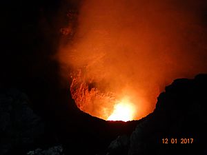
The park includes two volcanoes and five craters. Its elevation ranges from 100 to 630 meters (328 to 2,067 feet) above sea level. Inside the park, you can find lava tubes. These are tunnels formed by old lava flows. You might even see bats living in them. It's also possible to see the glowing lava inside the dark crater of the volcano.
How the Volcano Formed
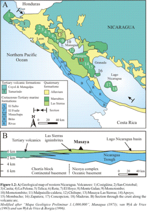
Masaya is one of 18 different volcanoes that make up the Nicaraguan part of the Central American Volcanic Belt (CAVF). This volcanic belt formed because the Cocos Plate is slowly sliding under the Caribbean Plate. This process is called subduction.
The Central American Volcanic Belt stretches from Guatemala to Costa Rica. In western Nicaragua, this belt cuts through an area called the Nicaraguan Depression. It starts with the Cosigüina volcano in the northwest and ends with the Maderas volcano in Lake Nicaragua.
The western part of Nicaragua has four main geological areas. These include very old rocks, areas formed by sediments, older volcanic rocks, and the active volcanoes we see today.
The active volcanoes are mostly found in the Nicaraguan Depression. They form two main groups. One group, the Marrabios Cordillera, includes volcanoes like San Cristobal and Telica. The other group includes volcanoes like Masaya, Apoyo, and Mombacho. These volcanoes sit on top of volcanic ash deposits from the Sierras Caldera, which surrounds Masaya volcano.
See also
 In Spanish: Volcán Masaya para niños
- List of volcanoes in Nicaragua
 | Claudette Colvin |
 | Myrlie Evers-Williams |
 | Alberta Odell Jones |


