Mascardi Lake facts for kids
Quick facts for kids Mascardi Lake |
|
|---|---|
 |
|
| Location | Bariloche Department, Río Negro Province, Argentina, in Patagonia |
| Coordinates | 41°20′54″S 71°33′49″W / 41.34833°S 71.56361°W |
| Primary inflows | Manso River |
| Primary outflows | Manso River |
| Basin countries | Argentina |
| Max. length | 15 kilometres (9.3 mi) |
| Max. width | 2.5 kilometres (1.6 mi) |
| Surface area | 39.2 square kilometres (15.1 sq mi) |
| Average depth | 111 metres (364 ft) |
| Max. depth | 218 metres (715 ft) |
| Water volume | 4.35 cubic kilometres (3,530,000 acre⋅ft) |
| Residence time | 3.72 years |
| Surface elevation | 750 metres (2,460 ft) |
| Settlements | Villa Mascardi |
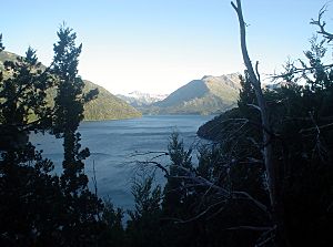
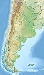
Mascardi Lake (called Lago Mascardi in Spanish) is a beautiful lake in the northern part of Patagonia, Argentina. It is located in Río Negro Province, close to the popular city of Bariloche. This lake is part of the amazing Nahuel Huapi National Park.
Mascardi Lake was formed by glaciers long ago. It was named after Nicolás Mascardi, a Jesuit missionary who explored this area in the 1600s.
Contents
Exploring Mascardi Lake
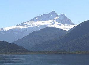
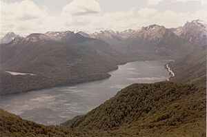
Mascardi Lake has a unique V-shape. It has two main sections, or "arms," that are similar in size. The eastern arm is known as the Catedral (Cathedral) arm. The western arm is called the Tronador arm. This arm gets its name from the Tronador volcano, which is the tallest and most famous mountain nearby.

High mountains surround the lake, rising steeply from its shores. These mountains reach over 1,800 metres (5,900 ft) high and are covered in snow for most of the year. The lake itself is very deep, reaching up to 218 metres (715 ft) at its deepest point. Its surface covers about 39.2 square kilometres (9,700 acres).
Water Flow and Connections
The main river flowing into Mascardi Lake is the Manso River. This river starts from a small lake fed by a glacier called Ventisquero Negro. This "black snowfield" is on the slopes of Tronador mountain, about 20 kilometres (12 mi) west of the lake.
The Manso River then flows out of Mascardi Lake from its southwestern corner. It goes through a short, fast-moving section called "Los Rapidos" (The Rapids). This leads to Las Moscas Lake, which is the next lake in a series along the Manso River.
Mascardi Lake is also very close to Gutiérrez Lake. A flat, gravel area separates them. This area is important because it marks the continental divide. This means Mascardi Lake's water eventually flows to the Pacific Ocean, while Gutiérrez Lake's water flows to the Atlantic Ocean.
Roads and Communities
A paved road, National Route 40, runs along the eastern arm of the lake. It goes all the way to the southern shore, where a small town called Villa Mascardi is located. From Villa Mascardi, another road (Route 82) follows the western arm of the lake northward. This road continues towards the Ventisquero Negro glacier.
Fun Activities at the Lake
Mascardi Lake is a great place for outdoor activities. Many people enjoy kayaking and fishing here. Tourist companies in Bariloche offer guided trips for visitors.
Fishing at Mascardi Lake
Fishermen often try to catch different types of trout in the lake. These include rainbow, brown, and brook trout. It's interesting to know that none of these fish are originally from Argentina.
Camping and Hiking
You can find several campgrounds and places to stay along the roads that go around half of the lake. One of the campgrounds on the northern part of the Catedral arm belongs to a Mapuche community. The Mapuche people were the main inhabitants of this area from the 1600s until the late 1800s.
There is also a hiking trail that leads south from the lake to Lake Steffen. This trail is part of the longer Huella Andina trail and is about 19.5 kilometres (12.1 mi) long. It's considered a moderately difficult hike.
See also
 In Spanish: Lago Mascardi para niños
 | Madam C. J. Walker |
 | Janet Emerson Bashen |
 | Annie Turnbo Malone |
 | Maggie L. Walker |


