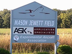
Mason Jewett Field Airport facts for kids
Quick facts for kids
Mason Jewett Field Airport
|
|||||||||||
|---|---|---|---|---|---|---|---|---|---|---|---|
 |
|||||||||||
| Summary | |||||||||||
| Airport type | Public | ||||||||||
| Owner/Operator | Capital Region Airport Authority | ||||||||||
| Serves | Mason, Michigan | ||||||||||
| Elevation AMSL | 920 ft / 280 m | ||||||||||
| Coordinates | 42°33′57″N 084°25′24″W / 42.56583°N 84.42333°W | ||||||||||
| Website | www.flylansing.com/... | ||||||||||
| Runway | |||||||||||
|
|||||||||||
| Statistics (2009) | |||||||||||
|
|||||||||||
|
Source: Federal Aviation Administration
|
|||||||||||
Mason Jewett Field (ICAO: KTEW, FAA LID: TEW) is a public airport in Michigan, a state in the United States. It is located about one mile (1.85 km) southeast of the town of Mason. This airport is in Ingham County.
The Capital Region Airport Authority owns and runs the airport. Mason Jewett Field covers about 275 acres (111 hectares). The airport is 920 feet (280 meters) above sea level. It has one runway made of asphalt. No big commercial airlines fly from here.
A Look Back in Time
The story of Mason Jewett Field began in 1943. On December 16, Arthur Jewett bought 180 acres (73 hectares) of land. He wanted to build an airport there.
In 1944, the first runway was built. A few years later, in 1949, lights were added to the runway. This made it possible for planes to land and take off at night.
In March 1977, the Capital Region Airport Authority bought the airport from Arthur Jewett. They have owned and operated it ever since.
Images for kids
Related Pages
 | Delilah Pierce |
 | Gordon Parks |
 | Augusta Savage |
 | Charles Ethan Porter |


