Mattawa, Washington facts for kids
Quick facts for kids
Mattawa
|
|
|---|---|

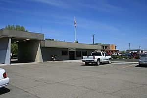
Mattawa City Hall (2008)
|
|

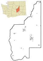
Location of Mattawa, Washington
|
|
| Country | United States |
| State | Washington |
| County | Grant |
| Government | |
| • Type | Mayor–council |
| Area | |
| • Total | 0.92 sq mi (2.39 km2) |
| • Land | 0.92 sq mi (2.39 km2) |
| • Water | 0.00 sq mi (0.00 km2) |
| Elevation | 768 ft (234 m) |
| Population
(2020)
|
|
| • Total | 3,335 |
| • Estimate
(2021)
|
3,627 |
| • Density | 5,160.52/sq mi (1,992.03/km2) |
| Time zone | UTC-8 (PST) |
| • Summer (DST) | UTC-7 (PDT) |
| ZIP code |
99349
|
| Area code(s) | 509 |
| FIPS code | 53-44165 |
| GNIS feature ID | 1506518 |
Mattawa is a city located in Grant County, Washington, in the United States. As of the 2020 census, the city had a population of 3,335 people. Mattawa is known for its interesting history and its unique straw bale library.
Contents
History of Mattawa
The area where Mattawa is located was first planned out as a town in 1909 by E. and Eva Campbell. However, it wasn't officially a city back then.
The town grew quickly when Priest Rapids Dam and Wanapum Dam were being built nearby. Many construction workers moved to Mattawa. On June 3, 1958, Mattawa officially became an incorporated city. The Port of Mattawa, which helps with trade and shipping, was also started in 1958.
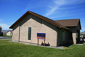
Mattawa is also special because it has the first library in the United States built using straw bales. This unique building was completed in 2002. In 2009, Mattawa changed its government type to become a "non-charter code city." This means it follows general state laws for cities.
Geography and Climate
Mattawa is found at these coordinates: 46°44′10″N 119°54′7″W / 46.73611°N 119.90194°W.
Land Area
The city covers a total area of about 0.92 square miles (2.39 square kilometers). All of this area is land, meaning there are no large lakes or rivers within the city limits.
Local Climate
Mattawa has a semi-arid climate. This means it gets very little rain and has dry weather, similar to a desert but not quite as extreme. It often has hot summers and cold winters.
People and Community
| Historical population | |||
|---|---|---|---|
| Census | Pop. | %± | |
| 1960 | 394 | — | |
| 1970 | 180 | −54.3% | |
| 1980 | 299 | 66.1% | |
| 1990 | 941 | 214.7% | |
| 2000 | 2,609 | 177.3% | |
| 2010 | 4,437 | 70.1% | |
| 2020 | 3,335 | −24.8% | |
| 2021 (est.) | 3,627 | −18.3% | |
| U.S. Decennial Census 2020 Census |
|||
The Mattawa Police Department (MAPD) works to keep the community safe. It includes a police chief and four full-time police officers.
Students in Mattawa attend schools in the Wahluke School District.
Population in 2010
According to the 2010 census, there were 4,437 people living in Mattawa.
- Diversity: About 45% of the people were White, and nearly 50% were from other racial backgrounds. A large part of the population, about 95.7%, identified as Hispanic or Latino.
- Households: There were 791 households in the city. Most of these, about 82.8%, had children under 18 living in them. Many households were married couples living together.
- Age Groups: The average age in Mattawa was 22 years old. This shows that Mattawa has a very young population. About 42% of residents were under 18, and 14.3% were between 18 and 24 years old.
See also
 In Spanish: Mattawa (Washington) para niños


