McDonough, New York facts for kids
Quick facts for kids
McDonough, New York
|
|
|---|---|
| Motto(s):
"The hills o' McDonough are calling you home"
|
|
 |
|
| Country | United States |
| State | New York |
| County | Chenango |
| Government | |
| • Type | Town Council |
| Area | |
| • Total | 39.63 sq mi (102.64 km2) |
| • Land | 39.04 sq mi (101.11 km2) |
| • Water | 0.59 sq mi (1.53 km2) |
| Elevation | 1,726 ft (526 m) |
| Population
(2010)
|
|
| • Total | 886 |
| • Estimate
(2019)
|
847 |
| • Density | 22.05/sq mi (8.52/km2) |
| Time zone | UTC-5 (Eastern (EST)) |
| • Summer (DST) | UTC-4 (EDT) |
| ZIP code |
13801
|
| Area code(s) | 607 |
| FIPS code | 36-017-44127 |
| GNIS feature ID | 0979178 |
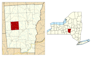
McDonough is a small town located in Chenango County, New York, United States. In 2010, about 886 people lived there. The town is named after Thomas Macdonough, a brave naval officer. He was famous for his service on Lake Champlain. McDonough is found in the western part of Chenango County, just west of Norwich.
Contents
Town History and Heritage
The area where McDonough is now was first settled around 1795. A person named Sylvanius Moore was one of the early settlers. The town of McDonough was officially created in 1816. It was formed from a part of the nearby town of Preston.
A special building in the town, the Calvary Episcopal Church, is quite old. It was added to the National Register of Historic Places in 1998. This means it's an important historical site.
Geography and Natural Features
McDonough covers a total area of about 102.6 square kilometers (39.6 square miles). Most of this area, about 101.1 square kilometers (39.0 square miles), is land. The rest, about 1.5 square kilometers (0.59 square miles), is water.
The water in McDonough comes from several small lakes. These include Genegantslet Lake, Bowman Lake, and Lake Ludlow.
New York State Route 220 is a main road that winds through the town. It connects McDonough to other places like Oxford to the southeast and Smithville Flats to the southwest.
Population Over the Years
| Historical population | |||
|---|---|---|---|
| Census | Pop. | %± | |
| 1820 | 789 | — | |
| 1830 | 1,232 | 56.1% | |
| 1840 | 1,369 | 11.1% | |
| 1850 | 1,522 | 11.2% | |
| 1860 | 1,483 | −2.6% | |
| 1870 | 1,280 | −13.7% | |
| 1880 | 1,298 | 1.4% | |
| 1890 | 1,025 | −21.0% | |
| 1900 | 907 | −11.5% | |
| 1910 | 813 | −10.4% | |
| 1920 | 765 | −5.9% | |
| 1930 | 598 | −21.8% | |
| 1940 | 675 | 12.9% | |
| 1950 | 709 | 5.0% | |
| 1960 | 639 | −9.9% | |
| 1970 | 703 | 10.0% | |
| 1980 | 796 | 13.2% | |
| 1990 | 809 | 1.6% | |
| 2000 | 870 | 7.5% | |
| 2010 | 886 | 1.8% | |
| 2019 (est.) | 847 | −4.4% | |
| U.S. Decennial Census | |||
In the year 2000, there were 870 people living in McDonough. These people lived in 349 households. About 28% of these households had children under 18 living there. The average age of people in the town was 40 years old.
Communities and Places in McDonough
- Bowman Lake State Park – This is a state park located north of East McDonough. It's a great place for outdoor activities.
- East McDonough – This is a small community, also called a hamlet. It's located on NY-220 in the eastern part of the town.
- Genegantslet Lake – This lake is in the northwestern part of the town. It is privately owned and maintained.
- Lake Ludlow – Another lake found in the southern part of the town.
- McDonough – This is the main community or hamlet of McDonough. It's located on NY-220 where several county roads meet.
See also
 In Spanish: McDonough (Nueva York) para niños


