
McHugh Peak facts for kids
Quick facts for kids McHugh Peak |
|
|---|---|
.jpg)
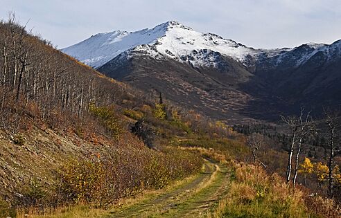
West aspect of McHugh Peak summit tor
(South Suicide Peak in the distance) |
|
| Highest point | |
| Elevation | 4,308 ft (1,313 m) |
| Prominence | 1,184 ft (361 m) |
| Isolation | 2.22 mi (3.57 km) |
| Parent peak | North Suicide Peak |
| Geography | |

McHugh Peak
Location in Alaska
|
|
| Location | Chugach State Park Anchorage Municipality, Alaska United States |
| Parent range | Chugach Mountains |
| Topo map | USGS Anchorage A-8 |
| Climbing | |
| Easiest route | Scrambling |
McHugh Peak is a cool mountain in Alaska, standing tall at 4,308 feet (1,313 meters). It's part of the Chugach Mountains and is located inside Chugach State Park. You can find it about 14 miles (23 km) southeast of downtown Anchorage. Getting to the very top means hiking a trail and then doing some easy climbing on the final rocky part. Many popular guidebooks tell you how to hike to McHugh Peak.
About McHugh Peak
McHugh Peak is a big mountain in the western Chugach Mountains of Alaska. It's 4,308 feet (1,313 meters) high. The mountain is located within Chugach State Park, near Anchorage. The very top of the mountain is a rocky formation called a tor. To reach the summit, hikers follow a ridge trail and then do some light climbing on this final rocky section.
How McHugh Peak Got Its Name
The name "McHugh Peak" comes from McHugh Creek. This creek flows down the south side of the mountain. The creek's name was first written down in 1912 by the United States Coast and Geodetic Survey. The mountain's local name was reported in 1942 by the Army Map Service. It was officially named McHugh Peak in 1969 by the U.S. Board on Geographic Names.
The mountain also has a special name in the Denaʼina language. They call it Q'isqa Dghelaya. This means "Banjo Snowshoe Mountain." "Q'isqa" are temporary snowshoes that people make from branches tied together.
Weather at McHugh Peak
McHugh Peak is in a subarctic climate zone. This means it has long, cold, and snowy winters. Summers are usually mild. Temperatures can drop very low, sometimes below -20 °C. With the wind, it can feel even colder, below -30 °C. Rain and melted snow from the peak flow into McHugh, Potter, and Rabbit Creeks. These creeks then empty into Turnagain Arm, which is about three miles from the mountain's top.
Gallery
-
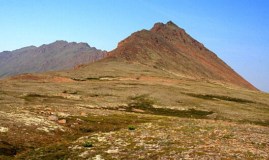
West aspect, summit to left
-

.jpg)
