McMahons Point facts for kids
Quick facts for kids McMahons PointSydney, New South Wales |
|||||||||||||||
|---|---|---|---|---|---|---|---|---|---|---|---|---|---|---|---|

McMahons Point, New South Wales
|
|||||||||||||||
| Postcode(s) | 2060 | ||||||||||||||
| Elevation | 41 m (135 ft) | ||||||||||||||
| Area | 0.3 km2 (0.1 sq mi) | ||||||||||||||
| Location | 3 km (2 mi) N of Sydney CBD | ||||||||||||||
| LGA(s) | North Sydney Council | ||||||||||||||
| State electorate(s) | North Shore | ||||||||||||||
| Federal Division(s) | North Sydney | ||||||||||||||
|
|||||||||||||||
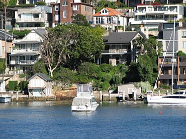
McMahons Point is a cool neighbourhood right by the water in Sydney, New South Wales, Australia. It's on the northern side of Sydney Harbour. This area is about 3 kilometres north of Sydney's city centre. It's part of the North Sydney Council area.
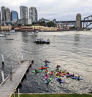
McMahons Point sits on a piece of land that sticks out into the water. Berrys Bay is on one side, and Lavender Bay is on the other. The very tip of this land is called Blues Point. From here, you get amazing views of Port Jackson (Sydney Harbour). The postcode for McMahons Point is 2060.
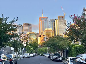
This area used to be home to many working-class families. Now, it's one of Sydney's most fancy places to live. McMahons Point has lots of apartments and homes. It is surrounded by the suburbs of Waverton, North Sydney, and Lavender Bay. Homes here are very popular because the area is safe. It also has many cafes, restaurants, pubs, and parks. It's easy to get around using buses, trains, and ferries. Plus, the views of Sydney's city centre are fantastic!
Contents
The Story of McMahons Point
Who was Michael McMahon?
McMahons Point is named after a man called Michael McMahon. He was an Irish farm worker who came to Sydney in 1848 when he was 19. Two years later, he married Angelina Faning. They had several children together.
Michael McMahon became very successful. He made brushes and combs. In 1864, he built his family home on the headland. He even became the mayor of the local area (which was then called Victoria) in 1890. Michael and Angelina, along with many of their family, are buried in Gore's Hill Cemetery. The McMahon family name is now a famous part of Sydney Harbour.
Early People and Land Use
The first people to live in this area were the Cammeraygal. They lived along the water's edge, in the bush, and in rock shelters. This was long before Europeans arrived.
In 1806, a man named James Milson (1785-1872) started farming land here. He was a soldier who fought in the Napoleonic War. Later, in 1817, more land was given to Billy Blue. He was a Jamaican convict who became a boatman on Sydney Harbour. His family owned the land until the 1850s.
Over time, the land was divided up into smaller pieces. The first buildings appeared on the northern end. Blues Point Road was made a proper road in 1839. It connected the ferry wharf to the St Leonards town. By the 1870s, most of the middle and southern parts of the land were divided. A tram line was built to McMahons Point in 1909. This helped the area grow even more.
Ferries and Transport Changes
Around the early 1900s, many ferries carried people and cars between Blues Point/McMahons Point and the city. These ferries were very busy. They carried six million passengers each year!
When the Sydney Harbour Bridge opened in 1932, most of these ferries were no longer needed. By 1935, smaller ferries took over the routes. The tram service was also replaced by buses in 1933.
Protecting the Waterfront
In July 1890, several local areas, including McMahons Point, joined together. They formed the borough of North Sydney. For a long time, the waterfront was used for building boats and other water activities.
In 1957, the North Sydney Council wanted to change much of McMahons Point to 'waterfront industrial' land. This would mean more factories and businesses by the water. But local residents and architects, led by Harry Seidler, wanted to keep it residential. They wanted more homes and gardens. Seidler suggested building 29 apartment buildings with gardens. However, a new council and other residents disagreed. Only two tall apartment buildings were built: Blues Point Tower and Harbour Master.
There is an old railway line from 1893 that runs through the north-west of the suburb. It comes out of a tunnel near Lavender Bay. This line no longer carries passengers. A newer line, called the North Shore railway line, was built in 1932. This line goes through the North Sydney and Milsons Point stations.
Special Places in McMahons Point
McMahons Point has some places that are important to its history. These are called heritage-listed sites. One of them is:
- 11-11a Bayview Point: Ildemere
Who Lives in McMahons Point?
In the 2021 Census, there were 2,315 people living in McMahons Point.
- Most people (60.9%) were born in Australia.
- Other common birthplaces included England (7.7%), New Zealand (2.7%), United States of America (2.3%), China (2.0%), and South Africa (2.0%).
- Most people (79.6%) spoke only English at home.
- Other languages spoken included Mandarin (2.4%), French (1.6%), Cantonese (1.4%), Spanish (1.1%), and Italian (1.0%).
- When asked about religion, many people said they had No Religion (48.3%). Others were Catholic (19.4%) or Anglican (12.7%).
Shops and Businesses
At the northern end of Blues Point Road, close to the North Sydney city centre, you'll find many businesses. These include companies that work in advertising, publishing, media, computers, and design. This area also has lots of outdoor cafes and restaurants. You can also find some special shops here.
Getting Around McMahons Point
It's easy to get around McMahons Point!
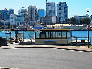
- You can take Cross Harbour ferry services and Parramatta River ferry services from the ferry wharf.
- Trains are available from nearby stations like Waverton, North Sydney, and Milsons Point. These are on the North Shore & Western Line and Northern Line of the Sydney Trains network.
- Bus routes 254 and 291 stop at the McMahons Point ferry wharf. Other bus routes pass through North Sydney Station and Victoria Cross, which are close by.
 | James B. Knighten |
 | Azellia White |
 | Willa Brown |


