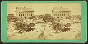
Medomak River facts for kids
Quick facts for kids Medomak River |
|
|---|---|
| Country | United States |
| Physical characteristics | |
| Main source | Maine 600 feet (180 m) |
| River mouth | Muscongus Bay sea level 44°00′32″N 69°23′20″W / 44.009°N 69.389°W |
| Length | 40 miles (64 km) |
| Basin features | |
| Tributaries |
|
The Medomak River is a 40-mile long river in Maine. It used to be called the Muscongus River. It starts in Liberty and flows south for about 32 miles to Waldoboro. This is where its tidal estuary begins. A tidal estuary is where fresh river water mixes with salty ocean water. Then it flows another 8 miles south to Bremen. The river eventually reaches Muscongus Bay. The name Medomak comes from the Abenaki language. It means 'place (river) of many alewives'.
History of the Medomak River
The Medomak River was once a border between two large land claims. Early European settlers came from Germany to live here. They did not know about the land claims and settled on both sides of the river. Later, some settlers had to buy the land they were living on from its legal owners.
People arrived by ship and traveled by foot or boat. Roads started to be built in the 1780s. Two ferries helped people cross the river in Waldoboro. One was Light's ferry, and the other was Waterman's ferry. The first bridge was built on Main Street.
In the 1800s, Waldoboro became an important place for building ships. It was also a customs port, where ships checked in and out. Many dams were built on the river during the 1700s and 1800s. These dams helped power water mills, like sawmills and grist mills. Sawmills cut wood, and grist mills ground grain into flour.
However, these dams stopped fish like alewives from moving up and down the river. In 1896, people caught about 41,512 alewives. By 1956, these fish were almost gone from the river.
Freshwater Life in the Medomak River
The freshwater part of the Medomak River collects water from an area of about 74 square miles. This area is called the Medomak River Watershed. It includes about 1,077 acres of lake area.
Seven large ponds are part of this system. They are Crystal, Washington, Johnson, Iron, Medomak, Little Medomak, and Kalers Ponds. Smaller streams like Pettingill Brook, Little Medomak Brook, Kalers Pond Outlet, and Hope Brook also feed into the Medomak River.
Many types of fish live in the freshwater section. These include brook trout, white sucker, brown trout, and various minnows. You can also find smallmouth bass, lake chub, white perch, and yellow perch. Other fish include golden shiner, chain pickerel, hornpout (also called bullhead), and smelt. Alewives, eels, and pumpkinseed sunfish also live here.
Saltwater Life in the Medomak River
The saltwater part of the Medomak River is a very important place for catching clams. Many people fish for clams here.
Several types of fish that migrate, or move from one place to another, live in this river. These include alewives and blueback herring. These two are often called river herring. American eels also live here; their young are called elvers or glass eels. Other migrating fish are rainbow smelt and striped bass.
Two other interesting animals found in the river are the horseshoe crab and the quahog clam.
 | Roy Wilkins |
 | John Lewis |
 | Linda Carol Brown |


