Mentz, New York facts for kids
Quick facts for kids
Mentz, New York
|
|
|---|---|

Village of Port Byron
|
|

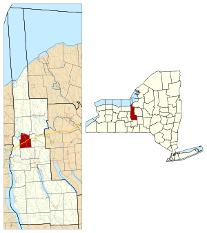
Location within Cayuga County and New York
|
|
| Country | United States |
| State | New York |
| County | Cayuga |
| Government | |
| • Type | Town Council |
| Area | |
| • Total | 17.18 sq mi (44.50 km2) |
| • Land | 16.92 sq mi (43.83 km2) |
| • Water | 0.26 sq mi (0.67 km2) |
| Elevation | 489 ft (149 m) |
| Population
(2020)
|
|
| • Total | 2,114 |
| Time zone | UTC-5 (Eastern (EST)) |
| • Summer (DST) | UTC-4 (EDT) |
| ZIP code |
13140 (Port Byron)
|
| FIPS code | 36-011-46602 |
| GNIS feature ID | 0979209 |
Mentz is a town in Cayuga County, New York, United States. In 2020, about 2,114 people lived there. The town is in the central part of the county, about 7 miles north of Auburn. People think the town's name might come from a city in Germany called Mainz.
Contents
History of Mentz
Mentz started as the "Town of Jefferson" in 1802. It was formed from the town of Aurelius. In 1808, its name was changed to Mentz. This was because too many places were already named Jefferson.
The town is part of a special area called the Military Tract. Much of this land was given to soldiers who fought in the American Revolutionary War. The first settlers built their homes near the Owasco Outlet. This is a river that flows out of Owasco Lake, one of the smaller Finger Lakes. The Owasco Outlet flows into the Seneca River, which forms the northern border of Mentz. Early settlers used the Outlet for travel and for running mills.
The Erie Canal and Port Byron
The Erie Canal was built through Mentz in 1819 and opened in 1820. This new canal helped the area grow quickly. A settlement near the Outlet, first called Bucksville, became very busy. Its post office was named Port Byron to honor the poet Lord Byron. Soon, the whole settlement was renamed Port Byron. In 1837, Port Byron officially became a separate village.
Over time, Mentz also had other smaller communities. In 1859, parts of Mentz were separated to form the towns of Montezuma and Throop. Today, Mentz is mostly a "bedroom community." This means many people who live there travel to work in nearby cities like Auburn, Syracuse, and Rochester.
Getting Around Mentz
Mentz has seen many changes in how people travel over the years.
Railroads
In 1853, the New York Central Railroad was built through the northern part of the town. A train station and a hotel were built there, and the area was called North Port Byron. Later, in 1884, another railroad, the New York, West Shore and Buffalo Railway, was built nearby. This "West Shore" line stopped service in the 1950s.
An electric train line, the Rochester, Syracuse and Eastern Interurban, was built in 1907. However, this company closed down in 1931.
Canals and Roads
The Erie Canal was made larger in 1857 and again in 1896. In 1917, the Erie Canal was moved to the Seneca River. It still uses the Seneca River today.
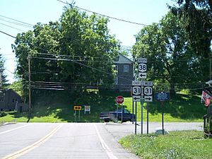
Two main roads pass through Mentz. NY Route 31 goes east-west through the center of the town and Port Byron village. NY Route 38 goes north-south through the town and village.
The New York State Thruway was built in the 1950s. It also goes east-west through Mentz, close to the old Erie Canal route. The closest exit for the Thruway is Exit 40, about 4 miles east in Weedsport. There's also a service area called the Port Byron Service Plaza near the western edge of Mentz. The Old Erie Canal Heritage Park is an attraction on the Thruway, located near the village's western border.
Famous People from Mentz
Mentz has been home to several notable people:
- John W. DeGroff – A politician from Wisconsin, who was born in Mentz.
- Isaac Singer – Famous for making sewing machines.
- Henry Wells – A partner in the well-known company Wells-Fargo.
- Brigham Young – An important leader of the Mormon faith. He lived in Mentz for a short time between 1825 and 1829. The house he rented is still standing and is owned by his family. He also built another house in the village that is still used today.
Geography of Mentz
Mentz covers a total area of about 17.18 square miles (44.5 square kilometers). Most of this area, about 16.92 square miles (43.8 square kilometers), is land. The rest, about 0.26 square miles (0.7 square kilometers), is water.
The northern border of the town is formed by the Seneca River.
Population Facts
| Historical population | |||
|---|---|---|---|
| Census | Pop. | %± | |
| 1820 | 3,010 | — | |
| 1830 | 4,144 | 37.7% | |
| 1840 | 4,215 | 1.7% | |
| 1850 | 5,239 | 24.3% | |
| 1860 | 2,232 | −57.4% | |
| 1870 | 2,278 | 2.1% | |
| 1880 | 2,288 | 0.4% | |
| 1890 | 1,952 | −14.7% | |
| 1900 | 1,914 | −1.9% | |
| 1910 | 1,909 | −0.3% | |
| 1920 | 1,758 | −7.9% | |
| 1930 | 1,553 | −11.7% | |
| 1940 | 1,677 | 8.0% | |
| 1950 | 1,783 | 6.3% | |
| 1960 | 2,105 | 18.1% | |
| 1970 | 2,338 | 11.1% | |
| 1980 | 2,441 | 4.4% | |
| 1990 | 2,453 | 0.5% | |
| 2000 | 2,446 | −0.3% | |
| 2010 | 2,378 | −2.8% | |
| U.S. Decennial Census | |||
In the year 2000, there were 2,446 people living in Mentz. These people lived in 932 households, and 676 of these were families. The town had about 143.5 people per square mile.
Most people in Mentz were White (96.52%). A smaller number were African American (0.94%), Native American (0.41%), or Asian (0.16%). Some people were from other races (0.65%) or from two or more races (1.31%). About 1.64% of the population was Hispanic or Latino.
About 32.6% of households had children under 18 living with them. About 52.7% were married couples. The average household had 2.61 people, and the average family had 2.99 people.
The population was spread out by age. About 25.8% were under 18, and 14.1% were 65 or older. The average age was 37 years.
Communities and Places in Mentz
- Haydenville – This community was built about 2 miles south of Port Byron. It was located on the bank of the Owasco Outlet. Haydenville grew around a large woolen mill that used the river for power.
- Throopsville – Another place where mills were built along the Owasco Outlet. It is about 5 miles south of Port Byron.
- Centerport – Located on the east side of the town, along the Erie Canal. Its name came from being in the center between Weedsport and Port Byron. The main industry here was making grain cradles, which are tools used for harvesting crops. Centerport also served as a shipping point on the canal.
- Montezuma – This community was about 3 miles west of Port Byron, on the bank of the Seneca River. Early on, it was a shipping center on the Seneca River, which was a main travel route before the Erie Canal. Montezuma was also known for making salt from its brine wells.
- High Bridge / Fox Ridge – An area located along the New York Central Railroad.
- North Port Byron – A small community north of Port Byron village. It is located on NY Route 38.
- Port Byron – This village is where NY-31 and NY-38 meet, just south of the Thruway. Port Byron became important as a port on the Erie Canal. However, the canal route was moved to the Seneca River in 1917.
See also
 In Spanish: Mentz (Nueva York) para niños


