Mexico Beach, Florida facts for kids
Quick facts for kids
Mexico Beach, Florida
|
|
|---|---|
| City of Mexico Beach | |

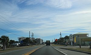
US 98 through Mexico Beach in January 2018
|
|

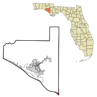
Location within Bay County and Florida
|
|
| Country | |
| State | |
| County | Bay |
| Incorporated | 1967 |
| Government | |
| • Type | Council-Manager |
| Area | |
| • Total | 2.34 sq mi (6.06 km2) |
| • Land | 2.28 sq mi (5.89 km2) |
| • Water | 0.06 sq mi (0.16 km2) |
| Elevation | 13 ft (4 m) |
| Population
(2020)
|
|
| • Total | 916 |
| • Density | 402.46/sq mi (155.39/km2) |
| Time zone | UTC−06:00 (Central (CST)) |
| • Summer (DST) | UTC−05:00 (CDT) |
| ZIP Code |
32456
|
| Area code(s) | 850 |
| FIPS code | 12-44300 |
| GNIS ID | 0286747 |
Mexico Beach is a small city in Bay County, Florida, United States. It is located about 25 miles (40 km) southeast of Panama City. This city is part of the larger Panama City-Panama City Beach area in North Florida. In 2020, 916 people lived there. This was a decrease from 1,072 people in 2010.
Mexico Beach faced huge damage from Hurricane Michael on October 10, 2018. The Federal Emergency Management Agency (FEMA) said the community was "wiped out." This shows how much the hurricane affected the area.
Contents
History of Mexico Beach
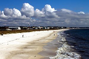
The City of Mexico Beach officially became a city in 1967. Before Hurricane Michael, it was known as "old Florida." It had many 50-year-old bungalows and newer vacation homes built on stilts. Tourists enjoyed walking on its beautiful white sand beaches.
In 1985, Hurricane Kate hit Mexico Beach. Its eye passed right over the city on November 22. This Category 2 storm brought strong winds and high tides. Many beachfront homes and businesses were destroyed.
Hurricane Michael's Impact
Hurricane Michael hit near Mexico Beach on October 10, 2018. It made landfall just before 1 p.m. local time. The hurricane had very strong winds of 160 miles per hour (257 km/h). This made it the first Category 5 hurricane to hit the United States since Hurricane Andrew in 1992.
Michael was one of the strongest storms ever to hit the continental United States. It caused massive damage to Mexico Beach and the nearby Tyndall Air Force Base. Almost all homes in the city were completely destroyed. Brock Long, who was in charge of FEMA, called Mexico Beach "ground zero." He said the community was "wiped out."
The elementary school and city hall were among the buildings ruined. The city's pier was washed away, and the water tower fell down. A report showed that about 285 people in Mexico Beach did not leave the area. However, some might have left before the storm was at its worst. Three people from Mexico Beach died because of the hurricane. The Mayor, Al Cathey, told residents that it could take months to get electricity, water, and plumbing back.
Geography and Location
Mexico Beach is located at coordinates 29°56′29″N 85°24′23″W. The city covers a total area of about 2.34 square miles (6.06 km²). Most of this area is land, about 2.28 square miles (5.89 km²). A small part, about 0.06 square miles (0.16 km²), is water.
The city is found in the Florida Panhandle. It sits right along the coast of the Gulf of Mexico.
Climate in Mexico Beach
The weather in Mexico Beach has hot and humid summers. The winters are usually mild. This type of weather is called a humid subtropical climate (Cfa) by the Köppen climate classification system.
Population and People
The population of Mexico Beach has changed over the years:
- 1970: 588 people
- 1980: 632 people
- 1990: 992 people
- 2000: 1,017 people
- 2010: 1,072 people
- 2020: 916 people
In 2020, there were 916 people living in Mexico Beach. There were 745 households and 415 families. In 2010, the city had 1,072 people and 599 households. About 11.4% of households had children under 18. The average household size was 1.90 people. The average family size was 2.43 people.
In 2010, the population was spread out by age. About 11.3% were under 18. About 31.2% were 65 years or older. The average age was 55.1 years.
Education Services
Mexico Beach is located in Bay County. However, its schools are managed by Gulf County Schools. This is different from most places in Bay County, which use Bay District Schools. The Bay District Schools pay Gulf County for the students from Mexico Beach to attend their schools.
Images for kids
See also
 In Spanish: Mexico Beach para niños
 | Isaac Myers |
 | D. Hamilton Jackson |
 | A. Philip Randolph |


