Mid Severn Sandstone Plateau facts for kids

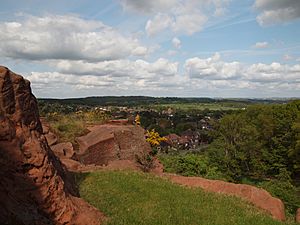
The Mid Severn Sandstone Plateau is a beautiful countryside area in central England. It's like a natural region that sits right on the edge of two counties: Shropshire and Staffordshire. This area stretches from the edge of the big city of Birmingham all the way to Telford in the north and Kidderminster in the south.
A really important part of this plateau is the River Severn valley. The river cuts right through the middle of the plateau, flowing from north to south. The ground here is mostly made of very old rock called New Red Sandstone. This sandstone was formed millions of years ago, during the Permian and Triassic periods. As you travel west, you'll find even older rocks, like siltstones and coals, from the Silurian and Carboniferous periods.
Geography of the Plateau
The Mid Severn Sandstone Plateau is officially known as National Character Area 66. This name is given by Natural England, which is the UK government's main advisor on the natural environment. This special area covers about 888 square kilometers (or 343 square miles). It measures roughly 25 kilometers (15 miles) from west to east and 50 kilometers (31 miles) from north to south.
To the west and southwest, the land gently rises from the Severn Valley. It then meets the Shropshire Hills and the Herefordshire Plateau. To the east, the land goes up from the Stour Valley towards the Black Country and Arden. In the south, the rolling hills slowly go down into the Severn and Avon Vales. In the north, the plateau changes into the clay lands of the Shropshire and Staffordshire Plain.
This region is home to a national nature reserve called the Wye Forest NNR. A small part (13 hectares) of the Shropshire Hills AONB (Area of Outstanding Natural Beauty) is also found here. The main rivers flowing through the plateau are the Severn, the Stour, and the Worfe. The average height of the plateau is about 97 meters (318 feet) above sea level. The highest point on the plateau reaches 233 meters (764 feet).
 | James Van Der Zee |
 | Alma Thomas |
 | Ellis Wilson |
 | Margaret Taylor-Burroughs |

