
Middle Fork Stanislaus River facts for kids
Quick facts for kids Middle Fork Stanislaus River |
|
|---|---|
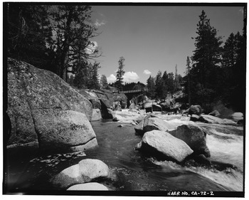
Middle Fork below Highway 108
|
|
| Physical characteristics | |
| Main source | Confluence of Kennedy and Summit Creeks 6,644 ft (2,025 m) 38°17′39″N 119°43′49″W / 38.29417°N 119.73028°W |
| River mouth | Stanislaus River 1,230 ft (370 m) 38°09′15″N 120°21′27″W / 38.15417°N 120.35750°W |
| Length | 45.7 mi (73.5 km) |
| Basin features | |
| Progression | Stanislaus–San Joaquin |
| Basin size | 332 sq mi (860 km2) |
The Middle Fork Stanislaus River is a river in California. It flows for about 45.7 miles (73.5 km). This river is an important part of the Stanislaus River system. It flows through the beautiful Sierra Nevada mountains and the Stanislaus National Forest.
Where the River Flows
The Middle Fork Stanislaus River starts in a wild area called the Emigrant Wilderness. It begins where two smaller streams, Kennedy Creek and Summit Creek, join together.
The river first flows towards the northwest. Along the way, another stream called Clark Fork joins it. Then, the river turns southwest and flows through a deep canyon. It eventually meets the North Fork Stanislaus River. When these two rivers join, they form the main Stanislaus River.
The area that this river drains is called a watershed. The Middle Fork Stanislaus River's watershed covers about 332 square miles (860 km²). Most of this area is in Tuolumne County, California. Much of the river's path is inside the Stanislaus National Forest.
Dams and Power
The Middle Fork Stanislaus River has several dams built on it. These dams help control the water. They also help create electricity.
There are four main dams on the river:
- Donnells Dam
- Beardsley Dam
- Beardsley Forebay
- Sand Bar Flat
One important dam on a smaller stream that feeds the Middle Fork is Relief Dam. It forms Relief Reservoir on Summit Creek.
Making Electricity
The water in the Middle Fork is used to make hydroelectricity. This is electricity made from the power of moving water. The Spring Gap–Stanislaus hydroelectric project manages this. It is owned by Pacific Gas and Electric Company. The Oakdale and South San Joaquin irrigation districts also help manage the water.
How Tunnels Help
Long tunnels connect the four main reservoirs on the river. These tunnels help move water from higher places to lower places. This creates a strong flow of water. This strong flow is used to spin turbines and make electricity.
The last tunnel from Sand Bar Flat empties into the main Stanislaus River. This happens about 2 miles (3.2 km) below where the Middle Fork joins it. This spot is at the start of the New Melones Lake reservoir. Because of these tunnels and dams, parts of the Middle Fork River can have less water during dry months. This is called being "dewatered."
