North Fork Stanislaus River facts for kids
Quick facts for kids North Fork Stanislaus River |
|
|---|---|

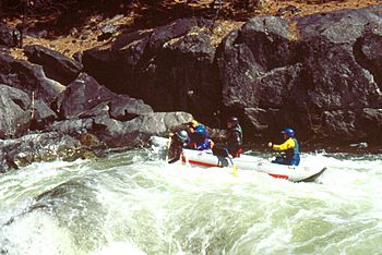
Rafters on the North Fork
|
|
| Country | United States |
| State | California |
| Physical characteristics | |
| Main source | Confluence of Silver Creek and Duck Creek 6,716 ft (2,047 m) 38°30′54″N 119°54′52″W / 38.51500°N 119.91444°W |
| River mouth | Stanislaus River 1,230 ft (370 m) 38°09′15″N 120°21′27″W / 38.15417°N 120.35750°W |
| Length | 31.2 mi (50.2 km) |
| Basin features | |
| Progression | Stanislaus—San Joaquin |
| Basin size | 196 sq mi (510 km2) |
The North Fork Stanislaus River is a river in eastern California. It is about 31.2-mile (50.2 km) long. This river flows into the Stanislaus River. You can find it in the central Sierra Nevada mountains and the Stanislaus National Forest.
Contents
River's Path and Location
The North Fork Stanislaus River starts in Alpine County. It then flows through Calaveras County. Finally, it reaches Tuolumne County.
Where the River Begins
The river begins where two smaller streams meet. These are Silver Creek and Duck Creek. This meeting point is near the western edge of the Carson-Iceberg Wilderness. This wilderness area is part of the Sierra Nevada mountains.
Journey to the Main River
From its start, the river flows southwest. It travels through a deep canyon. It eventually joins with the Middle Fork Stanislaus River. This meeting happens near Forest Meadows. When these two forks join, they form the larger Stanislaus River. The area of land that drains water into this river is called its watershed. This watershed is a rugged, mountainous area. It covers about 196 square miles (510 km2).
Making Electricity from the River
Since the 1980s, people have used the North Fork Stanislaus River to make hydroelectricity. Hydropower uses the force of moving water to create electricity.
How Hydropower Works Here
Water from the North Fork is collected in several reservoirs. These include Alpine, Utica, Union, and New Spicer Meadows Reservoirs. These big lakes help control the water flow. The water then goes to the McKays Point Diversion Dam. This dam is located further down the North Fork.
From McKays Point, the water is sent to the Collierville Powerhouse. This powerhouse is a special building where electricity is made. It can create up to 253 megawatts of power. A megawatt is a very large unit of electricity. This power helps provide electricity for many homes and businesses.
 | Jewel Prestage |
 | Ella Baker |
 | Fannie Lou Hamer |

