Mildred Island facts for kids

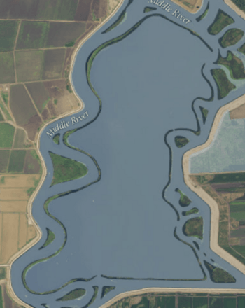
USGS aerial imagery of Mildred Island; the only part that remains above water is its levees.
|
|
| Geography | |
|---|---|
| Location | Northern California |
| Coordinates | 37°59′11″N 121°31′23″W / 37.9863117°N 121.5230069°W |
| Adjacent bodies of water | Sacramento–San Joaquin River Delta |
| Administration | |
| State | |
| County | San Joaquin |

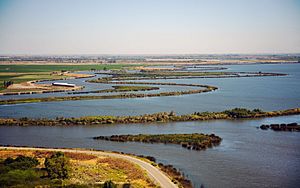
Mildred Island is a unique island in the San Joaquin River Delta in California. Unlike most islands, Mildred Island is almost completely underwater. Only its levees, which are like protective walls, remain above the water.
It is located in San Joaquin County, in the northern part of California. Its exact location can be found using these coordinates: 37°59′11″N 121°31′23″W / 37.9863117°N 121.5230069°W.
What is the San Joaquin River Delta?
The San Joaquin River Delta is a large area where the San Joaquin River and the Sacramento River meet. This area is a mix of rivers, channels, and islands. It is very important for California's water supply and for wildlife.
Many islands in the delta were once wetlands. Over time, people built levees around them. This allowed the land to be drained and used for farming.
Why is Mildred Island Submerged?
Mildred Island became submerged due to a levee break. Levees are built to hold back water. If a levee breaks, water can rush in and flood the land.
When Mildred Island's levee broke, the island filled with water. Now, only the tops of the levees can be seen. This makes it look like a ring of land around a large lake.
Life in the Delta
Even though Mildred Island is mostly underwater, the San Joaquin River Delta is full of life. It is home to many kinds of fish, birds, and other animals. The delta is a vital habitat for migrating birds. It also supports important fisheries.
The delta's islands, whether submerged or not, are a key part of California's natural environment.
 | May Edward Chinn |
 | Rebecca Cole |
 | Alexa Canady |
 | Dorothy Lavinia Brown |


