Millicoma River facts for kids
Quick facts for kids Millicoma River |
|
|---|---|

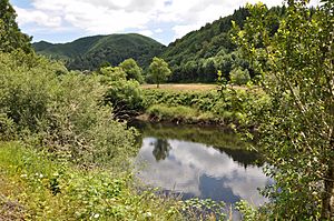
Millicoma River from Oregon Route 241
|
|
|
Location of the mouth of the Millicoma River in Oregon
|
|
| Other name(s) | North Fork Coos River |
| Country | United States |
| State | Oregon |
| County | Coos |
| Physical characteristics | |
| Main source | confluence of the river's east and west forks Allegany 25 ft (7.6 m) 43°25′28″N 124°01′44″W / 43.42444°N 124.02889°W |
| River mouth | Coos River 16 ft (4.9 m) 43°22′48″N 124°05′53″W / 43.38000°N 124.09806°W |
| Length | 8.5 mi (13.7 km) |
| Basin features | |
| Basin size | 149 sq mi (390 km2) |
The Millicoma River is a short river in Oregon, USA. It is about 8.5 miles (13.7 km) long. You can find it east of Coos Bay. The river starts when two smaller rivers, the East Fork Millicoma River and the West Fork Millicoma River, join together near a town called Allegany. From there, the Millicoma River flows across flat land until it meets the South Fork Coos River. When these two rivers meet, they form the larger Coos River.
Where Does the Millicoma River Flow?
The Millicoma River generally flows towards the southwest. A road called Oregon Route 241 (also known as Coos River Highway) follows along the right side of the river. This road goes from Allegany all the way to where the Millicoma River joins another river.
River's Journey and Tributaries
After leaving Allegany, the Millicoma River receives water from a stream called Woodruff Creek. This creek flows into the river from its left side. Further downstream, Deton Creek joins the river from the right side. You can find this spot near Rooke Higgins County Park. About half a mile after that, Hendrickson Creek adds its water to the Millicoma from the left. Finally, Matt Davis Creek flows in from the right side. This happens just before the Millicoma River meets the South Fork Coos River. Together, they create the Coos River, which then flows about 5 miles (8 km) more before reaching Coos Bay.
Fish and Fishing in the Millicoma River
The Millicoma River is home to many different types of fish. It's a great place for fishing!
What Fish Can You Catch?
The river has a large number of shad. These fish are popular for fishing. You can also find Chinook salmon and steelhead in the river. Fishing for these types of fish is allowed.
Fish You Cannot Catch
The Millicoma River also has Coho salmon. However, it is not allowed to fish for Coho salmon in this river. This rule helps protect the fish population.
Places to Launch a Boat
If you want to go fishing from a boat, there are places to launch your boat. Rooke Higgins County Park has a boat launch. There is also another boat launch called Doras Ramp, which is located closer to where the river meets the Coos River.
 | Jewel Prestage |
 | Ella Baker |
 | Fannie Lou Hamer |


