Mine La Motte, Missouri facts for kids
Quick facts for kids
Mine La Motte, Missouri
|
|
|---|---|

Location in Missouri
|
|
| Country | United States |
| State | Missouri |
| County | Madison |
| Area | |
| • Total | 3.37 sq mi (8.73 km2) |
| • Land | 3.27 sq mi (8.47 km2) |
| • Water | 0.10 sq mi (0.25 km2) |
| Elevation | 774 ft (236 m) |
| Population
(2020)
|
|
| • Total | 364 |
| • Density | 111.28/sq mi (42.97/km2) |
| ZIP code |
63645
|
| Area code(s) | 573 |
| FIPS code | 29-48602 |
| GNIS feature ID | 2587090 |
Mine La Motte is a small community in Madison County, Missouri, United States. It is an unincorporated community, which means it does not have its own local government. It is also a census-designated place (CDP), a special area defined by the U.S. Census Bureau for counting people. In 2020, about 364 people lived here.
History of Mine La Motte
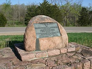
Mine La Motte is one of the oldest settlements west of the Mississippi River. Europeans first found lead here a long time ago. They also hoped to discover silver, but they did not find any.
In 1717, a French governor named Antoine de la Mothe Cadillac helped start a company to develop mines. About 200 French settlers came to the area. They were led by Philip François Renault. These settlers brought workers, including enslaved people, from Santo Domingo. This made Mine La Motte an important early mining spot.
Lead was very important because it was used to make ammunition. This attracted French colonists to this remote part of North America. Much later, during the American Civil War, lead was still needed for ammunition. This led to the Battle of Fredericktown, where soldiers fought for control of lead smelters (places where lead is melted) nearby.
La Mothe named the mine after himself. The town that grew around it was named after the mine too. In 1804, about 150 people lived in the village. Most of these early settlers were French Canadians. They started farming because the soil was very rich. They grew extra grain, which was important for the survival of the French colony further south in Louisiana. The farmers shipped tons of grain down the Mississippi River to places like New Orleans. La Mothe later became the Governor-General of Louisiana.
Geography of Mine La Motte
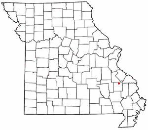
Mine La Motte is located in the northern part of Madison County. It is about 4 miles (6.4 km) north of Fredericktown, which is the main town of the county.
The U.S. Census Bureau says that the community covers a total area of 3.37 square miles (8.73 km²). A small part of this area, about 0.10 square miles (0.25 km²), is water. Sweetwater Branch is a stream that flows west through the middle of the community. It joins the Little St. Francis River. The Little St. Francis River also flows through the west side of Mine La Motte before joining the St. Francis River.
Population and Demographics
The word "demographics" refers to information about the people who live in a place, like their numbers. Here is how the population of Mine La Motte has changed over time:
| Historical population | |||
|---|---|---|---|
| Census | Pop. | %± | |
| 2010 | 348 | — | |
| 2020 | 364 | 4.6% | |
| U.S. Decennial Census | |||
As of the 2020 census, the population of Mine La Motte was 364 people.
See also
 In Spanish: Mine La Motte para niños
 | Laphonza Butler |
 | Daisy Bates |
 | Elizabeth Piper Ensley |


