Misema River facts for kids
Quick facts for kids Misema River |
|
|---|---|

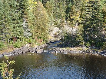
Banks of the Misema
|
|
|
Location of the mouth of the Misema River in Ontario
|
|
| Country | Canada |
| Province | Ontario |
| Region | Northeastern Ontario |
| Districts |
|
| Physical characteristics | |
| Main source | Sullivan Lake Ben Nevis Township, Cochrane District 375 m (1,230 ft) 48°16′50″N 79°42′03″W / 48.28056°N 79.70083°W |
| River mouth | Blanche River Marter Township, Timiskaming District 183 m (600 ft) 47°54′03″N 79°52′38″W / 47.90083°N 79.87722°W |
| Basin features | |
| River system | Saint Lawrence River drainage basin |
| Tributaries |
|
The Misema River is a cool river located in Northeastern Ontario, Canada. It flows through two different areas called Timiskaming District and Cochrane District. This river is part of a much bigger water system, the Saint Lawrence River drainage basin, and it's a branch that flows into the Blanche River.
Contents
Journey of the Misema River
Where the River Starts
The Misema River starts its journey at Sullivan Lake. This lake is found in a specific area known as Ben Nevis Township in the Cochrane District. From the lake, the river flows out towards the northeast.
The River's Path
As the river begins its adventure, it curves around some hills called the Pushkin Hills. These hills are part of a very old and large volcanic area known as the Blake River Megacaldera Complex. Imagine a huge ancient volcano that collapsed, forming a big basin!
After circling the hills, the Misema River turns south. It then enters the Timiskaming District and flows into Misema Lake. Here, another smaller river, the Little Misema River, joins it from the left side. This happens in an area called Katrine Township.
The river continues heading south. It flows under an old transcontinental railroad line, which used to be a main railway connecting different parts of the country. It also passes under Ontario Highway 66, a busy road.
Reaching the End
Further along its path, the Misema River creates a beautiful spot called the Eighty Foot Falls. This is where the river drops about 80 feet! At these falls, there's a special place called the Misema Dam. This dam helps create electricity using the power of the flowing water. It's a hydroelectric powerplant that can generate 3.2 megawatts of power.
Finally, the Misema River reaches its end, or "mouth," where it flows into the Blanche River. This meeting point is in Marter Township, right on the edge of an area called Chamberlain. The Blanche River then carries the water even further, eventually joining the Ottawa River, which then flows into the mighty Saint Lawrence River.
What Feeds the River?
Many smaller streams and creeks join the Misema River along its way, adding more water to its flow. These are called tributaries.
Here are some of the streams that feed the Misema River:
- Spring Creek (joins from the left side)
- McElroy Creek (joins from the right side)
- Estrangement Creek (joins from the left side)
- Victoria Creek (joins from the right side)
- Kinabik Creek (joins from the left side)
- Little Misema River (a larger tributary that joins from the left side)
 | May Edward Chinn |
 | Rebecca Cole |
 | Alexa Canady |
 | Dorothy Lavinia Brown |


