Mississagi River facts for kids
Quick facts for kids Mississagi River |
|
|---|---|
 |
|
|
Location of the mouth of the Mississagi River in Ontario
|
|
| Country | Canada |
| Province | Ontario |
| Districts |
|
| Physical characteristics | |
| Main source | Unnamed lake Unorganized, North Part, Sudbury District 520 m (1,710 ft) 47°17′57″N 82°39′34″W / 47.29917°N 82.65944°W |
| River mouth | Lake Huron Blind River, Algoma District 176 m (577 ft) 46°10′29″N 83°0′58″W / 46.17472°N 83.01611°W |
| Length | 266 km (165 mi) |
| Basin features | |
| River system | Great Lakes Basin |
| Basin size | 9,250 km2 (3,570 sq mi) |
| Tributaries |
|
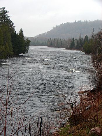
The Mississagi River is a long river in Ontario, Canada. It starts in the Sudbury District and flows for about 266 kilometers (165 miles). The river ends by emptying into Lake Huron at a town called Blind River.
Contents
What's in a Name?
The name Mississagi comes from the Ojibwe people. In their language, misi-zaagi means "river with a wide mouth." This name perfectly describes how the river looks where it meets Lake Huron.
The River's Journey
The Mississagi River begins in a small, unnamed lake in the Sudbury District. It flows south, then southeast, moving between the Sudbury and Algoma districts.
The river passes through several lakes, like Mississagi Lake and Rocky Island Lake. It also flows through Mississagi River Provincial Park. Along its way, the river creates beautiful features like the Aubrey Falls. Some of the river's water is used to make electricity at power stations.
The Mississagi River also has many smaller rivers and creeks that join it. These are called tributaries. Some of its main tributaries include the Abinette River, Cypress River, and Little White River.
Where the River Meets the Lake
When the Mississagi River reaches Lake Huron, it forms a special shape called a "bird's foot" delta. This means the river splits into several smaller channels that look like a bird's foot before flowing into the lake. This type of delta is not very common in the Great Lakes.
Towns Along the River
Several communities are located along the Mississagi River. These include:
- Mississauga First Nation
- Blind River
- Iron Bridge
- Wharncliffe, Ontario
A Look Back in Time
For a long time, the Ojibwe people used the Mississagi River as a travel route. They moved between the forests and Lake Huron using the river.
Later, in 1799, a company built a trading post at the river's mouth. This was a place where people traded furs. The post closed in 1900. In the late 1800s, the river was important for transporting logs. These logs were floated down the river to sawmills in Blind River.
How the River Helps People
The Mississagi River plays a role in the local economy. Between 1950 and 1970, several dams and power stations were built on the river. These stations use the river's water to create hydroelectric power, which is electricity made from moving water.
In the past, mining and cutting down trees (forestry) were big industries here. Today, tourism is very important. Many people visit the river for its natural beauty and outdoor activities.
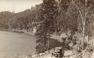
Part of Highway 129 also follows the river, making it easy for people to explore the area.
Nature and Parks
The Mississagi River is home to different kinds of wildlife. The lower part of the river is a very important place for lake sturgeon to lay their eggs.
Several parks protect different parts of the river and its surroundings:
- Aubrey Falls Provincial Park is located at Aubrey Falls.
- Mississagi River Provincial Park covers the upper parts of the river, including Mississagi Lake.
- Mississagi Delta Provincial Nature Reserve Park protects the river's mouth where it meets Lake Huron.
- The Voyageur Hiking Trail also follows a section of the river near Iron Bridge.
River Branches
Here are some of the rivers and creeks that flow into the Mississagi River:
- Abinette River (joins from the right)
- Cypress River (joins from the right)
- Wenebegon River (joins from the right)
- Aubinadong River (joins from the right)
- Sharpsand River (joins from the left)
- Rapid River (joins from the left)
- Grindstone Creek (joins from the left)
- Little White River (joins from the left)
- Bolton River (joins from the right)
 | Jessica Watkins |
 | Robert Henry Lawrence Jr. |
 | Mae Jemison |
 | Sian Proctor |
 | Guion Bluford |


