Monacillo Urbano, San Juan, Puerto Rico facts for kids
Quick facts for kids
Monacillo Urbano
|
|
|---|---|

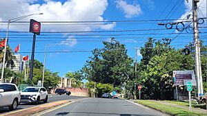
Puerto Rico Highway 841 between Frailes and Monacillo Urbano
|
|

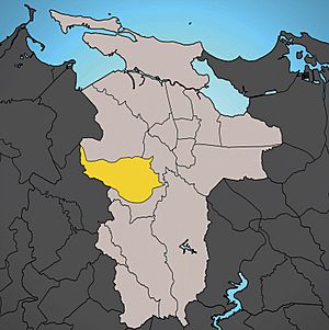
Location of Monacillo Urbano shown in yellow.
|
|
| Commonwealth | |
| Municipality | |
| Area | |
| • Total | 3.23 sq mi (8.4 km2) |
| • Land | 3.23 sq mi (8.4 km2) |
| • Water | 0 sq mi (0 km2) |
| Elevation | 141 ft (43 m) |
| Population
(2010)
|
|
| • Total | 22,342 |
| • Density | 6,917.0/sq mi (2,670.7/km2) |
| 2010 census | |
| Time zone | UTC−4 (AST) |
Monacillo Urbano is a busy neighborhood, also known as a barrio, located in the city of San Juan, Puerto Rico. It was once part of a larger area called Monacillo.
In 2010, about 22,342 people lived in Monacillo Urbano. This area covers about 3.23 square miles (8.68 square kilometers) of land. Monacillo Urbano is surrounded by other neighborhoods. To its north is Gobernador Piñero. To the east, you'll find El Cinco. To the south is Monacillo, and to the west is the town of Guaynabo.
Population Changes Over Time
This section shows how the number of people living in Monacillo Urbano has changed over the years. This information comes from the U.S. Census, which counts everyone in the country every ten years.
| Historical population | |||
|---|---|---|---|
| Census | Pop. | %± | |
| 1950 | 7,210 | — | |
| 1960 | 18,058 | 150.5% | |
| 1970 | 0 | −100.0% | |
| 1980 | 28,417 | — | |
| 1990 | 28,707 | 1.0% | |
| 2000 | 29,309 | 2.1% | |
| 2010 | 22,342 | −23.8% | |
| Data from the U.S. Decennial Census. | |||
Explore More
 In Spanish: Monacillo Urbano para niños
Black History Month on Kiddle
Influential African-American Artists:
 | James Van Der Zee |
 | Alma Thomas |
 | Ellis Wilson |
 | Margaret Taylor-Burroughs |

All content from Kiddle encyclopedia articles (including the article images and facts) can be freely used under Attribution-ShareAlike license, unless stated otherwise. Cite this article:
Monacillo Urbano, San Juan, Puerto Rico Facts for Kids. Kiddle Encyclopedia.
