Moonie River facts for kids
Quick facts for kids Moonie River |
|
|---|---|

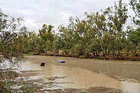
Moonie River at Nindigully
|
|
|
Location of the Moonie River mouth in New South Wales
|
|
| Country | Australia |
| States | Queensland, New South Wales |
| Region | Southern Downs, Orana |
| Physical characteristics | |
| Main source | Braemar State Forest, near Tara, Queensland 347 m (1,138 ft) 27°19′59″S 150°43′32″E / 27.33306°S 150.72556°E |
| River mouth | confluence with the Barwon River near Mogil Mogil, north of Collarenebri New South Wales 149 m (489 ft) 29°18′46″S 148°42′43″E / 29.31278°S 148.71194°E |
| Length | 542 km (337 mi) |
| Basin features | |
| River system | Barwon River catchment, Murray–Darling basin |
| Basin size | 14,812 km2 (5,719 sq mi) |
| Reservoir | Thallon Weir |
The Moonie River is a river in Australia. It flows through parts of Queensland and New South Wales. This river is always flowing, making it a perennial river. It is an important part of the Barwon River system, which then joins the huge Murray–Darling basin.
Contents
What's in a Name? The Moonie River's Story
The explorer and surveyor Thomas Mitchell gave the river its name, "Mooni," on November 9, 1846. We don't know exactly where the name came from.
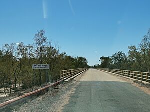
Even though it's officially called "Mooni River" in New South Wales, most people call it "Moonie River." This is the same spelling used in Queensland, where most of the river is located. Even a sign put up by the Walgett Shire Council uses the common spelling, "Moonie River."
History of the Moonie River Region
The land around the Moonie River has a rich history. It is the traditional country of the Yuwaalaraay people. This is an Aboriginal language spoken in this area.
The Yuwaalaraay language region covers a large area. This includes places like Dirranbandi and Hebel in Queensland. It also stretches into New South Wales, reaching Walgett and Collarenebri.
The Moonie River's Journey and Features
The Moonie River starts in Queensland, southwest of Dalby. Its source is near Braemar State Forest, close to Tara. From there, it flows mostly towards the southwest.
Along its journey, the river is joined by thirteen smaller streams, called tributaries. It eventually meets the Barwon River near Mogil Mogil farm, north of Collarenebri, New South Wales. The river drops about 198 meters (650 feet) over its 542-kilometer (337-mile) path.
River Landscape and Water Flow
The area around the Moonie River is very flat. There are no big towns directly on its banks. The river's water is held back by a structure called Thallon Weir. This weir can hold a lot of water, about 185 megalitres.
The Moonie River flows through or near several towns. These include Nindigully, Flinton, and Thallon. Two main roads, the Moonie Highway and the Carnarvon Highway, cross the river. In New South Wales, only one public road, Gundabloui Road, crosses the river. It crosses near Goondoobluie farm in Collarenebri.
 | Delilah Pierce |
 | Gordon Parks |
 | Augusta Savage |
 | Charles Ethan Porter |


