Morotai Island Regency facts for kids
Quick facts for kids
Morotai Island Regency
Kabupaten Pulau Morotai
|
||
|---|---|---|
|
||
| Motto(s):
Podiki De Porigaho
(Let's Unite) |
||

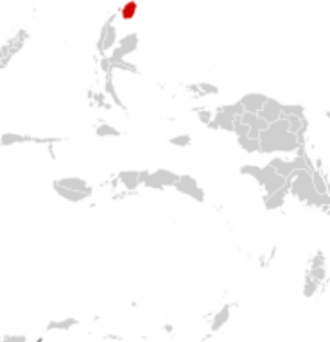
Location within Maluku Islands
|
||
| Country | ||
| Province | ||
| Incorporated | 26 November 2008 | |
| Capital | Daruba | |
| Area | ||
| • Total | 2,336.6 km2 (902.2 sq mi) | |
| Population
(mid 2023 estimate)
|
||
| • Total | 80,566 | |
| • Density | 34.4800/km2 (89.3028/sq mi) | |
| Time zone | UTC+9 (IEST) | |
| Area code | (+62) 921 | |
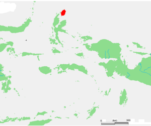
Morotai Island Regency is a special administrative area, called a regency, in the North Maluku province of Indonesia. It is located on Morotai Island, one of Indonesia's northernmost islands. The regency also includes the smaller Rao Island.
The island is part of the Halmahera group in the Maluku Islands. It is a rugged, forested island with a long history. In 2023, about 80,566 people lived there. The largest town is Daruba, which is on the south coast.
Morotai is famous for its role in World War II. It is also known as the place where a Japanese soldier named Teruo Nakamura was found in 1974. He had been hiding for almost 30 years after the war ended.
Contents
Geography and Climate
Morotai is a large island covered in forests. It is about 80 kilometers long from north to south. The island's villages are mostly along the coast. A road connects the villages on the east coast, starting from the main town of Daruba.
The weather in Morotai is tropical. This means it is warm all year round. It has a tropical rainforest climate, with heavy rainfall for most of the year and slightly less rain from August to October.
| Climate data for Daruba | |||||||||||||
|---|---|---|---|---|---|---|---|---|---|---|---|---|---|
| Month | Jan | Feb | Mar | Apr | May | Jun | Jul | Aug | Sep | Oct | Nov | Dec | Year |
| Mean daily maximum °C (°F) | 30.0 (86.0) |
30.0 (86.0) |
29.9 (85.8) |
31.1 (88.0) |
30.6 (87.1) |
30.3 (86.5) |
29.8 (85.6) |
30.8 (87.4) |
31.1 (88.0) |
31.5 (88.7) |
31.4 (88.5) |
30.5 (86.9) |
30.6 (87.0) |
| Daily mean °C (°F) | 26.3 (79.3) |
26.3 (79.3) |
26.2 (79.2) |
27.2 (81.0) |
26.8 (80.2) |
26.6 (79.9) |
26.1 (79.0) |
26.9 (80.4) |
27.1 (80.8) |
27.4 (81.3) |
27.5 (81.5) |
26.8 (80.2) |
26.8 (80.2) |
| Mean daily minimum °C (°F) | 22.7 (72.9) |
22.7 (72.9) |
22.5 (72.5) |
23.3 (73.9) |
23.1 (73.6) |
23.0 (73.4) |
22.5 (72.5) |
23.1 (73.6) |
23.1 (73.6) |
23.3 (73.9) |
23.6 (74.5) |
23.2 (73.8) |
23.0 (73.4) |
| Average rainfall mm (inches) | 207 (8.1) |
182 (7.2) |
208 (8.2) |
205 (8.1) |
217 (8.5) |
202 (8.0) |
138 (5.4) |
122 (4.8) |
113 (4.4) |
104 (4.1) |
168 (6.6) |
177 (7.0) |
2,043 (80.4) |
| Source: Climate-Data.org | |||||||||||||
History of Morotai
For hundreds of years, Morotai was influenced by the powerful sultanate of Ternate. In the 1500s, Portuguese missionaries came to the island. However, they were driven out in 1571 by the local Muslim rulers. Later, the Dutch East India Company took control of the region.
World War II
During World War II, the island became very important. Japanese forces captured it in 1942. In September 1944, American forces took the island in the Battle of Morotai.
The Allies used Morotai as a base to prepare for attacks on the Philippines and Borneo. Over 60,000 soldiers, mostly engineers, landed on the island. They quickly built harbors, two airstrips, and fuel storage areas. Japanese forces on the island fought until 1945 but could not defeat the Allies.
After the War
After Indonesia became independent, Morotai saw more conflict. During the Permesta rebellion in 1958, rebel forces with outside help briefly took control of the island. But the Indonesian army quickly took it back.
Morotai officially became its own regency on October 29, 2008. It was separated from the North Halmahera Regency.
Future Plans for a Spaceport
The Indonesian space agency, LAPAN, chose Morotai as a future site for a spaceport. The island was selected for several reasons:
- It is near the equator, which makes launching rockets cheaper.
- It has long runways left over from World War II that can be improved.
- Not many people live on the island, so building a spaceport is easier.
- Its east coast faces the open Pacific Ocean, which is safer for rocket launches.
The spaceport was planned to be finished around 2025.
Life on the Island
The main industries on Morotai are fishing and forestry. People on the island get wood and resin from the forests. They also rely on fishing to make a living.
The island's airport is called Leo Wattimena Airport. It was built during World War II and is now used for commercial flights to help bring tourists to the island.
Administration
The regency is divided into six areas called districts (kecamatan). The table below shows information about each district.
| Kode Wilayah |
Name of District (kecamatan) |
English name |
Actual location |
Area in km2 |
Pop'n census 2010 |
Pop'n census 2020 |
Pop'n Estimate mid 2023 |
Admin centre |
No. of villages |
Post codes |
|---|---|---|---|---|---|---|---|---|---|---|
| 82.07.01 | Morotai Selatan | South Morotai | South Morotai | 379.25 | 17,547 | 28,579 | 31,738 | Daruba | 25 | 97771 |
| 82.07.05 | Morotai Timur | East Morotai | Southeast Morotai | 342.01 | 7,779 | 10,846 | 11,837 | Sangowa | 15 | 97771 - 97777 |
| 82.07.02 | Morotai Selatan Barat | Southwest Morotai | West Morotai | 557.12 | 11,078 | 9,053 | 9,630 | Wayabula | 15 | 97770 |
| 82.07.04 | Morotai Utara | North Morotai | Northeast Morotai | 478.31 | 9,226 | 11,560 | 12,064 | Bere-Bere | 14 | 97773 |
| 82.07.03 | Morotai Jaya | Great Morotai | North Morotai | 519.85 | 7,067 | 9,588 | 10,370 | Sopi | 14 | 97772 |
| 82.07.06 | Pulau Rao | Rao Island | off west coast | 60.06 | (a) | 4,810 | 4,927 | Leo-Leo Rao | 5 | 97770 |
| Totals | 2,336.60 | 52,860 | 74,436 | 80,566 | Gotalamo | 88 |
Note: (a) The population of Rao Island in 2010 is included in the number for Morotai Selatan Barat District.
Notable people
- Melky Goeslaw, a famous singer and the father of another singer, Melly Goeslaw.
See also
- Battle of Morotai
- List of islands of Indonesia
 | Frances Mary Albrier |
 | Whitney Young |
 | Muhammad Ali |


