Morrison, Iowa facts for kids
Quick facts for kids
Morrison, Iowa
|
|
|---|---|

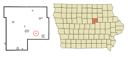
Location of Morrison, Iowa
|
|
| Country | |
| State | |
| County | Grundy |
| Area | |
| • Total | 0.10 sq mi (0.25 km2) |
| • Land | 0.10 sq mi (0.25 km2) |
| • Water | 0.00 sq mi (0.00 km2) |
| Elevation | 951 ft (290 m) |
| Population
(2020)
|
|
| • Total | 98 |
| • Density | 1,031.58/sq mi (398.69/km2) |
| Time zone | UTC-6 (Central (CST)) |
| • Summer (DST) | UTC-5 (CDT) |
| ZIP code |
50657
|
| Area code(s) | 319 |
| FIPS code | 19-54165 |
| GNIS feature ID | 0459246 |
Morrison is a small city in Grundy County, Iowa, United States. In 2020, 98 people lived there. It's part of the larger Waterloo–Cedar Falls area.
The city of Morrison has a mayor who helps lead the community. As of November 2023, David Hach was the mayor. He has worked to improve the city, including paving roads and managing floodwaters. In 2020, a strong storm called a derecho hit Morrison. Mayor Hach helped the city rebuild after many homes and trees were damaged.
Contents
Where is Morrison Located?
Morrison is in Iowa. You can find it at these coordinates: 42.343390 degrees North and -92.674434 degrees West.
The United States Census Bureau says the city covers about 0.10 square miles (0.25 square kilometers) of land. There is no water area within the city limits.
The Black Hawk Creek river flows just north of Morrison.
How Many People Live in Morrison?
Morrison has always been a small community. Here's how its population has changed over the years:
| Historical populations | ||
|---|---|---|
| Year | Pop. | ±% |
| 1880 | 116 | — |
| 1890 | 165 | +42.2% |
| 1900 | 176 | +6.7% |
| 1910 | 173 | −1.7% |
| 1920 | 207 | +19.7% |
| 1930 | 173 | −16.4% |
| 1940 | 161 | −6.9% |
| 1950 | 169 | +5.0% |
| 1960 | 139 | −17.8% |
| 1970 | 136 | −2.2% |
| 1980 | 146 | +7.4% |
| 1990 | 125 | −14.4% |
| 2000 | 97 | −22.4% |
| 2010 | 94 | −3.1% |
| 2020 | 98 | +4.3% |
| Source: and Iowa Data Center Source: |
||
Morrison's Population in 2020
In 2020, the census counted 98 people living in Morrison. There were 38 households and 26 families. This means there were about 1,032 people per square mile (398.7 per square kilometer).
Most residents (94.9%) were White. About 3.1% of the population identified as Hispanic or Latino.
- About 36.8% of households had children under 18.
- Most households (60.5%) were married couples living together.
- About 31.6% of all households were not families.
The average age in Morrison was 43.5 years old.
- About 31.6% of residents were under 20.
- About 16.3% were 65 or older.
- The population was almost evenly split between males (52.0%) and females (48.0%).
Morrison's Population in 2010
In 2010, the census counted 94 people in Morrison. There were 40 households and 26 families. The population density was about 940 people per square mile (363 per square kilometer).
Most residents (92.6%) were White.
- About 30.0% of households had children under 18.
- Most households (60.0%) were married couples living together.
- About 30.0% of all households were made up of single individuals.
The average age was 40.5 years old.
- About 24.5% of residents were under 18.
- About 18.1% were 65 or older.
- The population was 52.1% male and 47.9% female.
See also
 In Spanish: Morrison (Iowa) para niños
 | Emma Amos |
 | Edward Mitchell Bannister |
 | Larry D. Alexander |
 | Ernie Barnes |

