Moundville, Alabama facts for kids
Quick facts for kids
Town of Moundville
|
|
|---|---|

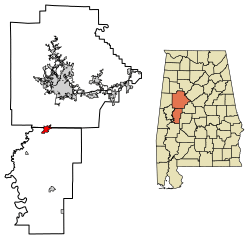
Location of Moundville in Hale County and Tuscaloosa County, Alabama.
|
|
| Country | United States |
| State | Alabama |
| Counties | Hale, Tuscaloosa |
| Area | |
| • Total | 4.67 sq mi (12.08 km2) |
| • Land | 4.61 sq mi (11.94 km2) |
| • Water | 0.06 sq mi (0.14 km2) |
| Elevation | 161 ft (49 m) |
| Population
(2020)
|
|
| • Total | 3,024 |
| • Density | 655.82/sq mi (253.24/km2) |
| Time zone | UTC-6 (Central (CST)) |
| • Summer (DST) | UTC-5 (CDT) |
| ZIP code |
35474
|
| Area code(s) | 205, 659 |
| FIPS code | 01-51648 |
| GNIS feature ID | 0160145 |

Moundville is a town in Alabama, a state in the United States. It is located in Hale and Tuscaloosa counties. In 2020, about 3,024 people lived there. Moundville is also part of the larger Tuscaloosa Metropolitan Area.
A very important place in Moundville is the Moundville Archaeological Site. This site was once a major center for the ancient Mississippian culture. It was a place where people lived, held ceremonies, and made important decisions long ago.
Contents
History of Moundville
Moundville officially became a town on December 22, 1908. For many years, it was only in Hale County. Later, its borders expanded into Tuscaloosa County.
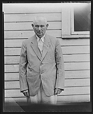
In the 1930s, a photographer named Walker Evans and a writer named James Agee visited the Moundville area. They documented the lives of tenant farmers. These were farmers who rented land and paid their rent with a share of their crops. Their work helped show what life was like during that time.
Geography and Climate
Moundville is in northern Hale County. It sits on the south side of the Black Warrior River. Part of the town also reaches north into Tuscaloosa County.
Alabama State Route 69 goes through the eastern part of Moundville. This road leads north about 16 miles (26 km) to Tuscaloosa. It also goes south about 22 miles (35 km) to Greensboro, which is the main town in Hale County.
The town covers a total area of about 4.67 square miles (12.08 square kilometers). Most of this area is land, with a small part being water.
Moundville's Weather
Moundville has a humid subtropical climate. This means it has hot, humid summers and mild winters. It gets a good amount of rain throughout the year.
| Climate data for Moundville, 1991–2020 simulated normals (174 ft elevation) | |||||||||||||
|---|---|---|---|---|---|---|---|---|---|---|---|---|---|
| Month | Jan | Feb | Mar | Apr | May | Jun | Jul | Aug | Sep | Oct | Nov | Dec | Year |
| Mean daily maximum °F (°C) | 55.9 (13.3) |
60.3 (15.7) |
68.7 (20.4) |
75.9 (24.4) |
83.1 (28.4) |
89.4 (31.9) |
91.9 (33.3) |
91.6 (33.1) |
87.4 (30.8) |
77.7 (25.4) |
66.4 (19.1) |
58.3 (14.6) |
75.6 (24.2) |
| Daily mean °F (°C) | 45.1 (7.3) |
48.9 (9.4) |
56.3 (13.5) |
63.7 (17.6) |
71.8 (22.1) |
78.8 (26.0) |
81.5 (27.5) |
81.1 (27.3) |
76.1 (24.5) |
65.3 (18.5) |
54.1 (12.3) |
47.7 (8.7) |
64.2 (17.9) |
| Mean daily minimum °F (°C) | 34.5 (1.4) |
37.4 (3.0) |
43.9 (6.6) |
51.3 (10.7) |
60.4 (15.8) |
68.0 (20.0) |
71.2 (21.8) |
70.7 (21.5) |
64.9 (18.3) |
52.9 (11.6) |
41.9 (5.5) |
37.0 (2.8) |
52.8 (11.6) |
| Average precipitation inches (mm) | 5.46 (138.73) |
5.52 (140.31) |
5.24 (133.00) |
5.12 (130.11) |
3.53 (89.58) |
4.76 (120.78) |
4.85 (123.25) |
4.57 (116.19) |
3.53 (89.73) |
3.49 (88.70) |
4.57 (115.96) |
5.24 (133.13) |
55.88 (1,419.47) |
| Average dew point °F (°C) | 36.0 (2.2) |
38.8 (3.8) |
44.1 (6.7) |
51.8 (11.0) |
60.8 (16.0) |
68.2 (20.1) |
71.2 (21.8) |
70.5 (21.4) |
65.3 (18.5) |
54.9 (12.7) |
44.6 (7.0) |
39.6 (4.2) |
53.8 (12.1) |
| Source: PRISM Climate Group | |||||||||||||
People in Moundville
The number of people living in Moundville has grown over the years.
| Historical population | |||
|---|---|---|---|
| Census | Pop. | %± | |
| 1910 | 253 | — | |
| 1920 | 328 | 29.6% | |
| 1930 | 757 | 130.8% | |
| 1940 | 812 | 7.3% | |
| 1950 | 901 | 11.0% | |
| 1960 | 922 | 2.3% | |
| 1970 | 996 | 8.0% | |
| 1980 | 1,310 | 31.5% | |
| 1990 | 1,348 | 2.9% | |
| 2000 | 1,809 | 34.2% | |
| 2010 | 2,427 | 34.2% | |
| 2020 | 3,024 | 24.6% | |
| U.S. Decennial Census 2013 Estimate |
|||
2020 Census Information
In 2020, the town had 3,024 residents. There were 1,072 households and 803 families living in Moundville. The population was made up of different groups. About 47.3% of the people were White (not Hispanic). About 47.8% were Black or African American (not Hispanic). Other groups included Native American, Asian, and people of mixed races. About 1.65% of the population was Hispanic or Latino.
Fun Places to Visit
Moundville Archaeological Park
The Moundville Archaeological Park is a very important historical site. It is recognized as a National Historic Landmark. The park covers about 320 acres (1.3 square kilometers). It contains 26 ancient Mississippian culture earthwork mounds. These mounds were built by Native Americans long ago. The park also has burial sites and many artifacts from that time.
The biggest mounds are found closer to the Black Warrior River. Mounds get smaller as you move away from the river. This might show that people who lived closer to the river were more important.
A large fence, called a palisade, once surrounded the main part of the Moundville site. This fence protected the mounds, a central open area (plaza), and homes. This palisade was rebuilt at least six times while people lived there.
Getting Around Moundville
Airport Access
Moundville has a small airport called Moundville Airport. It is a private airport but is open for public use. It is located about 2.3 miles (3.7 kilometers) south of the town's center.
Education for Students
Students living in Moundville attend different school districts. If they live in Hale County, they go to schools in the Hale County School District. If they live in Tuscaloosa County, they attend schools in the Tuscaloosa County School District.
Famous People from Moundville
- Rufus Deal was a professional football player. He also played football for Auburn University.
See also
 In Spanish: Moundville (Alabama) para niños
 | Janet Taylor Pickett |
 | Synthia Saint James |
 | Howardena Pindell |
 | Faith Ringgold |


