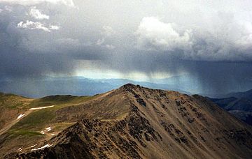
Mount Columbia (Colorado) facts for kids
Quick facts for kids Mount Columbia |
|
|---|---|

Mount Columbia as seen from Mount Harvard
|
|
| Highest point | |
| Elevation | 14,077 ft (4,291 m) |
| Prominence | 893 ft (272 m) |
| Isolation | 1.90 mi (3.06 km) |
| Parent peak | Mount Harvard |
| Listing | Colorado Fourteener 35th |
| Geography | |
| Location | Chaffee County, Colorado, U.S. |
| Parent range | Sawatch Range, Collegiate Peaks |
| Topo map | USGS 7.5' topographic map Mount Columbia, Colorado |
| Climbing | |
| First ascent | 1916 by Roger Toll |
| Easiest route | Scramble |
- For other mountains by this name, see Mount Columbia.
Mount Columbia is a very tall mountain peak in the Rocky Mountains of North America. It is part of the Collegiate Peaks in the Sawatch Range of Colorado, United States. This mountain is known as a "fourteener" because it stands at 14,077 feet (4,291 meters) high!
Mount Columbia is located in the Collegiate Peaks Wilderness. This is a protected natural area within the San Isabel National Forest. The mountain was named to honor Columbia University in New York City. It celebrates the university's rowing team winning a big race in 1878.
Exploring Mount Columbia
Mount Columbia is one of five special mountains in Colorado. These mountains are called the Collegiate Peaks. They are all named after famous universities. The other peaks are Mount Harvard, Mount Yale, Mount Princeton, and Mount Oxford.
Hiking Challenges
Climbing Mount Columbia can be quite a challenge. The usual path has a difficult area called a "scree field." A scree field is a slope covered in loose, broken rocks. Walking on it can be tricky because the rocks can slide.
Because of this tough section, many people who climb Mount Columbia are trying to hike all of Colorado's fourteeners. This means they are working to reach the top of every mountain in the state that is over 14,000 feet tall!
Recommended Trail
The forest service suggests a specific path for hikers. It is called the Horn Fork Basin Route. This trail is about 11 miles long (17.7 kilometers) roundtrip. Hikers gain about 5,800 feet (1,768 meters) in height from the start to the summit.
The area around the scree field has been worn down a lot by hikers. People are working to build a new, official trail. This new trail will help protect the mountain and make hiking safer. However, the new trail is not finished yet.
 | Percy Lavon Julian |
 | Katherine Johnson |
 | George Washington Carver |
 | Annie Easley |


