Mount Cumnock facts for kids
Quick facts for kids Mount Cumnock |
|
|---|---|
| Highest point | |
| Elevation | 2,438 m (7,999 ft) |
| Prominence | 624 m (2,047 ft) |
| Listing | Mountains of Alberta |
| Geography | |
| Location | Jasper National Park Alberta, Canada |
| Parent range | De Smet Range Canadian Rockies |
| Topo map | NTS 83E/01 |
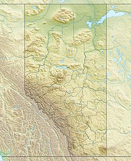
Mount Cumnock is a tall mountain peak located in Jasper National Park in Alberta, Canada. It stands at 2,438 m (7,999 ft) high! This impressive mountain is part of the De Smet Range, which is a section of the huge Canadian Rockies mountain chain. The very top of a mountain is called its summit.
Naming Mount Cumnock
Mount Cumnock got its name in 1916. It was named by a surveyor named Morrison P. Bridgland. He named it after a town called Cumnock in Scotland.
Morrison P. Bridgland (1878-1948) was a special kind of explorer. He was a Dominion Land Surveyor. This meant he helped map out and name many mountains in Jasper Park and the Canadian Rockies. The name "Mount Cumnock" was officially accepted in 1956. This was done by the Geographical Names Board of Canada. This board helps make sure all places have official names.
Mount Cumnock's closest taller neighbor is Mount Haultain. Mount Haultain is about 7.5 km (4.7 mi) to the west.
Mountain Climate
Mount Cumnock is in a place with a "subarctic climate." This means it has very cold, snowy winters. The summers are usually mild, not too hot.
Temperatures can drop below -20 °C (which is -4 °F). With the wind blowing, it can feel even colder, sometimes below -30 °C (-22 °F). This is called the wind chill factor.
All the rain and melting snow from Mount Cumnock flows into the Snake Indian River. This river is a "tributary" of the Athabasca River. A tributary is a smaller river or stream that flows into a larger one.
 | Misty Copeland |
 | Raven Wilkinson |
 | Debra Austin |
 | Aesha Ash |


