Mount Maclure facts for kids
Quick facts for kids Mount Maclure |
|
|---|---|

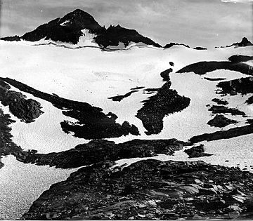
Mount Maclure and Maclure Glacier
|
|
| Highest point | |
| Elevation | 12,886+ ft (3,928+ m) NAVD 88 |
| Prominence | 440 ft (134 m) |
| Listing |
|
| Naming | |
| Etymology | William Maclure |
| Geography | |
| Location | Madera and Tuolumne counties, California, U.S. |
| Parent range | Cathedral Range, Sierra Nevada |
| Topo map | USGS Mount Lyell |
| Climbing | |
| First ascent | 1883 by Hillard Johnson |
| Easiest route | Southeast ridge, Exposed scramble (class 3-4) |
Mount Maclure is a tall mountain located in Yosemite National Park. It stands very close to Mount Lyell, which is the highest point in the park. Mount Maclure itself is the fifth-highest mountain in Yosemite.
About Mount Maclure
Mount Maclure is found at the southeastern end of the Cathedral Range. This mountain's top, or summit, sits right on the border between Madera and Tuolumne counties. This boundary also marks the edge between Yosemite National Park and the Ansel Adams Wilderness.
Who Was William Maclure?
The mountain was named to honor William Maclure. He was an important person in American geology. Geology is the study of Earth's physical structure and history. William Maclure was a pioneer because he created the very first geological maps of the United States.
The Maclure Glacier
On the northern side of Mount Maclure, you can find the Maclure Glacier. A glacier is a huge, slow-moving river of ice. The Maclure Glacier is one of the last remaining glaciers in Yosemite National Park.
Climbing and Exploring
People can climb Mount Maclure. The easiest way to reach the top starts from the John Muir Trail. This trail is about 8.5 miles south of an area called Tuolumne Meadows. From there, climbers cross the Maclure Glacier to get to the mountain's summit.
 | Audre Lorde |
 | John Berry Meachum |
 | Ferdinand Lee Barnett |

