Mount Lyell (California) facts for kids
Quick facts for kids Mount Lyell |
|
|---|---|

Mount Lyell from Donahue shoulder
|
|
| Highest point | |
| Elevation | 13,120 ft (3,999 m) NAVD 88 |
| Prominence | 1,927 ft (587 m) |
| Parent peak | Mount Ritter |
| Listing |
|
| Geography | |
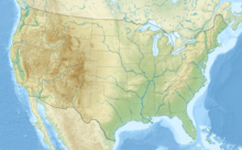
| Location | Madera and Tuolumne counties, California, U.S. |
| Parent range | Cathedral Range, Sierra Nevada |
| Topo map | USGS Mount Lyell |
| Climbing | |
| First ascent | August 29, 1871 by John Boies Tileston |
| Easiest route | Exposed scramble, class 3 |
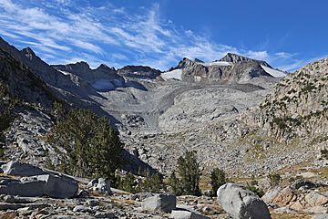
Mount Lyell is the tallest point in Yosemite National Park. It stands at 13,114 feet (3,997 meters) high. This impressive peak is found at the southeast end of the Cathedral Range. It is about 1.2 miles (1.9 km) northwest of Rodgers Peak.
The mountain and a nearby area called Lyell Canyon are named after Charles Lyell. He was a very famous geologist from the 1800s. Mount Lyell once had one of the last true glaciers in Yosemite, called Lyell Glacier. Today, this "glacier" is mostly a permanent field of ice and snow.
Mount Lyell is important because it helps divide different river systems. To the north, water flows into the Tuolumne River. To the west, it goes to the Merced River. To the southeast, water flows into Rush Creek, which leads to Mono Lake.
Climbing Mount Lyell
Most people who want to climb Mount Lyell start their journey from Tuolumne Meadows. They follow a popular part of the John Muir Trail. The entire trip to the top and back is about 25 miles (40 km) long. Climbers also gain about 4,500 feet (1,372 meters) in height.
The first part of the hike from Tuolumne Meadows is quite easy. You follow the Tuolumne River through Lyell Canyon. As you get closer to Donohue Pass, the hike becomes more challenging. Before reaching the pass, climbers leave the main trail. They then head south towards Mount Lyell itself.
Routes to the Summit
Most climbers reach the summit by going over or around the Lyell Glacier. The conditions on the glacier can change a lot. This means climbers need to check how much snow and ice there is before choosing their path.
One common way to climb is along the northwest ridge. This route starts from the saddle, which is a low point between Mount Lyell and nearby Mount Maclure. If there's a lot of snow on the glacier, this climb is moderately difficult. If there's not much snow, the path can become harder. It might involve climbing on exposed granite rocks. In these cases, it can be easier to go straight up the glacier to the top.
The Summit Rocks
The very top part of Mount Lyell is made of dark, volcanic granite. This type of rock is similar to what you find on nearby peaks like Rodgers Peak and Mount Ritter. This rock can be loose and unstable for climbing. This makes the climb to the summit plateau more dangerous when the glacier has less snow. When there's less snow, more of the loose rock is exposed.
Some climbers even think that Mount Lyell and Mount Maclure are geologically part of the Ritter Range. This is because of the type of rock they are made of.
Another climbing path is the East Arete. This route also gets harder when there's less snow. The rock under the glacier on this route can be quite loose. This makes it a bit dangerous when there's not much snow. There are other routes on the south and west sides of the mountain. However, these are usually more difficult and take longer to reach.
See also
 In Spanish: Monte Lyell para niños
 | John T. Biggers |
 | Thomas Blackshear |
 | Mark Bradford |
 | Beverly Buchanan |


